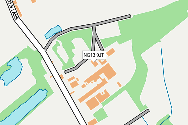
NG13 9JT is located in the Nevile & Langar electoral ward, within the local authority district of Rushcliffe and the English Parliamentary constituency of Rushcliffe. The Sub Integrated Care Board (ICB) Location is NHS Nottingham and Nottinghamshire ICB - 52R and the police force is Nottinghamshire. This postcode has been in use since January 1980.


GetTheData
Source: OS OpenMap – Local (Ordnance Survey)
Source: OS VectorMap District (Ordnance Survey)
Licence: Open Government Licence (requires attribution)
| Easting | 473703 |
| Northing | 335075 |
| Latitude | 52.908062 |
| Longitude | -0.905550 |
GetTheData
Source: Open Postcode Geo
Licence: Open Government Licence
| Country | England |
| Postcode District | NG13 |
➜ See where NG13 is on a map | |
GetTheData
Source: Land Registry Price Paid Data
Licence: Open Government Licence
Elevation or altitude of NG13 9JT as distance above sea level:
| Metres | Feet | |
|---|---|---|
| Elevation | 40m | 131ft |
Elevation is measured from the approximate centre of the postcode, to the nearest point on an OS contour line from OS Terrain 50, which has contour spacing of ten vertical metres.
➜ How high above sea level am I? Find the elevation of your current position using your device's GPS.
GetTheData
Source: Open Postcode Elevation
Licence: Open Government Licence
| Ward | Nevile & Langar |
| Constituency | Rushcliffe |
GetTheData
Source: ONS Postcode Database
Licence: Open Government Licence
| Works Lane (Main Road) | Barnstone | 470m |
| Works Lane (Main Road) | Barnstone | 479m |
| Main Road | Barnstone | 624m |
| Main Road | Barnstone | 627m |
| Main Road | Barnstone | 746m |
| Aslockton Station | 4.9km |
| Elton & Orston Station | 5.9km |
GetTheData
Source: NaPTAN
Licence: Open Government Licence
GetTheData
Source: ONS Postcode Database
Licence: Open Government Licence


➜ Get more ratings from the Food Standards Agency
GetTheData
Source: Food Standards Agency
Licence: FSA terms & conditions
| Last Collection | |||
|---|---|---|---|
| Location | Mon-Fri | Sat | Distance |
| Barnstone | 17:00 | 09:00 | 479m |
| Langar Post Office | 16:30 | 09:00 | 1,401m |
| Granby | 16:30 | 09:30 | 1,693m |
GetTheData
Source: Dracos
Licence: Creative Commons Attribution-ShareAlike
The below table lists the International Territorial Level (ITL) codes (formerly Nomenclature of Territorial Units for Statistics (NUTS) codes) and Local Administrative Units (LAU) codes for NG13 9JT:
| ITL 1 Code | Name |
|---|---|
| TLF | East Midlands (England) |
| ITL 2 Code | Name |
| TLF1 | Derbyshire and Nottinghamshire |
| ITL 3 Code | Name |
| TLF16 | South Nottinghamshire |
| LAU 1 Code | Name |
| E07000176 | Rushcliffe |
GetTheData
Source: ONS Postcode Directory
Licence: Open Government Licence
The below table lists the Census Output Area (OA), Lower Layer Super Output Area (LSOA), and Middle Layer Super Output Area (MSOA) for NG13 9JT:
| Code | Name | |
|---|---|---|
| OA | E00144824 | |
| LSOA | E01028420 | Rushcliffe 010C |
| MSOA | E02005915 | Rushcliffe 010 |
GetTheData
Source: ONS Postcode Directory
Licence: Open Government Licence
| NG13 9JJ | Works Lane | 286m |
| NG13 9JL | Manor Gardens | 421m |
| NG13 9JQ | Main Road | 423m |
| NG13 9JE | Orchard Close | 433m |
| NG13 9JU | The Brambles | 462m |
| NG13 9JG | Park Road | 464m |
| NG13 9JF | Park Road | 502m |
| NG13 9JP | Main Road | 510m |
| NG13 9JH | Langar Road | 715m |
| NG13 9HP | Coachgap Lane | 1042m |
GetTheData
Source: Open Postcode Geo; Land Registry Price Paid Data
Licence: Open Government Licence