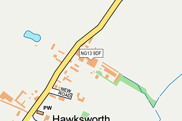
NG13 9DF is located in the East Bridgford electoral ward, within the local authority district of Rushcliffe and the English Parliamentary constituency of Newark. The Sub Integrated Care Board (ICB) Location is NHS Nottingham and Nottinghamshire ICB - 52R and the police force is Nottinghamshire. This postcode has been in use since January 1980.


GetTheData
Source: OS OpenMap – Local (Ordnance Survey)
Source: OS VectorMap District (Ordnance Survey)
Licence: Open Government Licence (requires attribution)
| Easting | 475458 |
| Northing | 343629 |
| Latitude | 52.984698 |
| Longitude | -0.877473 |
GetTheData
Source: Open Postcode Geo
Licence: Open Government Licence
| Country | England |
| Postcode District | NG13 |
➜ See where NG13 is on a map ➜ Where is Hawksworth? | |
GetTheData
Source: Land Registry Price Paid Data
Licence: Open Government Licence
Elevation or altitude of NG13 9DF as distance above sea level:
| Metres | Feet | |
|---|---|---|
| Elevation | 20m | 66ft |
Elevation is measured from the approximate centre of the postcode, to the nearest point on an OS contour line from OS Terrain 50, which has contour spacing of ten vertical metres.
➜ How high above sea level am I? Find the elevation of your current position using your device's GPS.
GetTheData
Source: Open Postcode Elevation
Licence: Open Government Licence
| Ward | East Bridgford |
| Constituency | Newark |
GetTheData
Source: ONS Postcode Database
Licence: Open Government Licence
| Main Road | Hawksworth | 221m |
| Main Road | Hawksworth | 223m |
| Hall Farm (Cliffhill Lane) | Thoroton | 1,521m |
| Hall Farm (Cliffhill Lane) | Thoroton | 1,532m |
| Newfield Lane | Sibthorpe | 1,827m |
| Elton & Orston Station | 3.9km |
| Aslockton Station | 3.9km |
| Bingham Station | 6km |
GetTheData
Source: NaPTAN
Licence: Open Government Licence
GetTheData
Source: ONS Postcode Database
Licence: Open Government Licence
| Last Collection | |||
|---|---|---|---|
| Location | Mon-Fri | Sat | Distance |
| Sibthorpe | 16:00 | 11:00 | 2,114m |
| Screveton | 16:00 | 09:00 | 2,207m |
| Flintham | 16:00 | 09:30 | 2,725m |
GetTheData
Source: Dracos
Licence: Creative Commons Attribution-ShareAlike
The below table lists the International Territorial Level (ITL) codes (formerly Nomenclature of Territorial Units for Statistics (NUTS) codes) and Local Administrative Units (LAU) codes for NG13 9DF:
| ITL 1 Code | Name |
|---|---|
| TLF | East Midlands (England) |
| ITL 2 Code | Name |
| TLF1 | Derbyshire and Nottinghamshire |
| ITL 3 Code | Name |
| TLF16 | South Nottinghamshire |
| LAU 1 Code | Name |
| E07000176 | Rushcliffe |
GetTheData
Source: ONS Postcode Directory
Licence: Open Government Licence
The below table lists the Census Output Area (OA), Lower Layer Super Output Area (LSOA), and Middle Layer Super Output Area (MSOA) for NG13 9DF:
| Code | Name | |
|---|---|---|
| OA | E00144771 | |
| LSOA | E01028411 | Rushcliffe 001C |
| MSOA | E02005906 | Rushcliffe 001 |
GetTheData
Source: ONS Postcode Directory
Licence: Open Government Licence
| NG13 9DE | New Road | 157m |
| NG13 9DD | Main Road | 224m |
| NG13 9DB | Town Street | 271m |
| NG13 9DA | Main Road | 463m |
| NG13 9BU | Hawksworth Road | 1178m |
| NG13 9DS | 1472m | |
| NG23 5PN | 1860m | |
| NG13 9DT | Thoroton Road | 1890m |
| NG23 5JL | 1957m | |
| NG13 8JP | Hawksworth Road | 2013m |
GetTheData
Source: Open Postcode Geo; Land Registry Price Paid Data
Licence: Open Government Licence