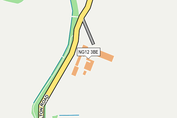
NG12 3BE lies on Canalside Industrial Park in Cropwell Bishop, Nottingham. NG12 3BE is located in the Cropwell electoral ward, within the local authority district of Rushcliffe and the English Parliamentary constituency of Rushcliffe. The Sub Integrated Care Board (ICB) Location is NHS Nottingham and Nottinghamshire ICB - 52R and the police force is Nottinghamshire. This postcode has been in use since January 1980.


GetTheData
Source: OS OpenMap – Local (Ordnance Survey)
Source: OS VectorMap District (Ordnance Survey)
Licence: Open Government Licence (requires attribution)
| Easting | 467994 |
| Northing | 334946 |
| Latitude | 52.907654 |
| Longitude | -0.990450 |
GetTheData
Source: Open Postcode Geo
Licence: Open Government Licence
| Street | Canalside Industrial Park |
| Locality | Cropwell Bishop |
| Town/City | Nottingham |
| Country | England |
| Postcode District | NG12 |
➜ See where NG12 is on a map ➜ Where is Cropwell Bishop? | |
GetTheData
Source: Land Registry Price Paid Data
Licence: Open Government Licence
Elevation or altitude of NG12 3BE as distance above sea level:
| Metres | Feet | |
|---|---|---|
| Elevation | 40m | 131ft |
Elevation is measured from the approximate centre of the postcode, to the nearest point on an OS contour line from OS Terrain 50, which has contour spacing of ten vertical metres.
➜ How high above sea level am I? Find the elevation of your current position using your device's GPS.
GetTheData
Source: Open Postcode Elevation
Licence: Open Government Licence
| Ward | Cropwell |
| Constituency | Rushcliffe |
GetTheData
Source: ONS Postcode Database
Licence: Open Government Licence
UNIT 8, CANALSIDE INDUSTRIAL PARK, CROPWELL BISHOP, NOTTINGHAM, NG12 3BE 1997 11 APR £49,500 |
➜ Cropwell Bishop house prices
GetTheData
Source: HM Land Registry Price Paid Data
Licence: Contains HM Land Registry data © Crown copyright and database right 2025. This data is licensed under the Open Government Licence v3.0.
| Kinoulton Road (Colston Road) | Colston Bridge | 494m |
| Kinoulton Road (Colston Road) | Colston Bridge | 503m |
| Kinoulton Road (Nottingham Road) | Cropwell Bishop | 545m |
| Kinoulton Road (Nottingham Road) | Cropwell Bishop | 561m |
| Hoe Nook (Hoe View Road) | Cropwell Bishop | 589m |
| Radcliffe (Notts) Station | 5.6km |
GetTheData
Source: NaPTAN
Licence: Open Government Licence
Estimated total energy consumption in NG12 3BE by fuel type, 2015.
| Consumption (kWh) | 117,757 |
|---|---|
| Meter count | 8 |
| Mean (kWh/meter) | 14,720 |
| Median (kWh/meter) | 9,159 |
GetTheData
Source: Postcode level gas estimates: 2015 (experimental)
Source: Postcode level electricity estimates: 2015 (experimental)
Licence: Open Government Licence
GetTheData
Source: ONS Postcode Database
Licence: Open Government Licence


➜ Get more ratings from the Food Standards Agency
GetTheData
Source: Food Standards Agency
Licence: FSA terms & conditions
| Last Collection | |||
|---|---|---|---|
| Location | Mon-Fri | Sat | Distance |
| Lime Kiln Public House | 17:00 | 11:15 | 470m |
| Cropwell Bishop Post Office | 17:00 | 11:30 | 783m |
| Hoeview Road | 17:00 | 11:30 | 1,071m |
GetTheData
Source: Dracos
Licence: Creative Commons Attribution-ShareAlike
The below table lists the International Territorial Level (ITL) codes (formerly Nomenclature of Territorial Units for Statistics (NUTS) codes) and Local Administrative Units (LAU) codes for NG12 3BE:
| ITL 1 Code | Name |
|---|---|
| TLF | East Midlands (England) |
| ITL 2 Code | Name |
| TLF1 | Derbyshire and Nottinghamshire |
| ITL 3 Code | Name |
| TLF16 | South Nottinghamshire |
| LAU 1 Code | Name |
| E07000176 | Rushcliffe |
GetTheData
Source: ONS Postcode Directory
Licence: Open Government Licence
The below table lists the Census Output Area (OA), Lower Layer Super Output Area (LSOA), and Middle Layer Super Output Area (MSOA) for NG12 3BE:
| Code | Name | |
|---|---|---|
| OA | E00144817 | |
| LSOA | E01028419 | Rushcliffe 010B |
| MSOA | E02005915 | Rushcliffe 010 |
GetTheData
Source: ONS Postcode Directory
Licence: Open Government Licence
| NG12 3BH | Kinoulton Road | 331m |
| NG12 3BD | Kinoulton Road | 485m |
| NG12 3BG | Skylark Hill | 523m |
| NG12 3BJ | Colston Road | 567m |
| NG12 3GN | Richards Close | 568m |
| NG12 3BP | Nottingham Road | 582m |
| NG12 3GP | Old Lenton Close | 589m |
| NG12 3BQ | Nottingham Road | 595m |
| NG12 3BS | Field Lane | 607m |
| NG12 3DR | Clarke Close | 613m |
GetTheData
Source: Open Postcode Geo; Land Registry Price Paid Data
Licence: Open Government Licence