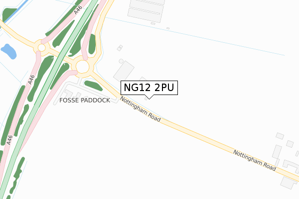
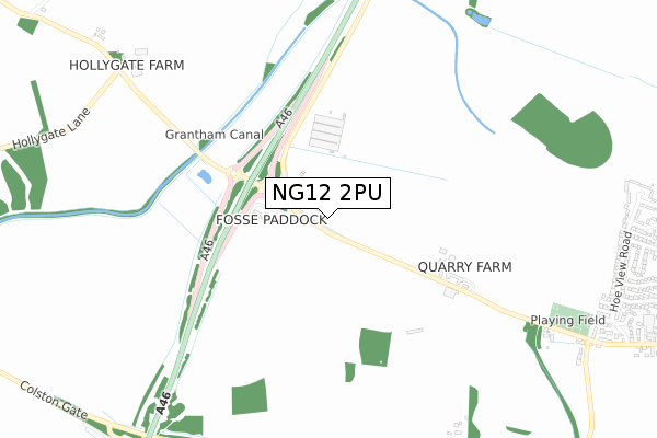
NG12 2PU is located in the Cropwell electoral ward, within the local authority district of Rushcliffe and the English Parliamentary constituency of Rushcliffe. The Sub Integrated Care Board (ICB) Location is NHS Nottingham and Nottinghamshire ICB - 52R and the police force is Nottinghamshire. This postcode has been in use since August 2019.


GetTheData
Source: OS Open Zoomstack (Ordnance Survey)
Licence: Open Government Licence (requires attribution)
Attribution: Contains OS data © Crown copyright and database right 2025
Source: Open Postcode Geo
Licence: Open Government Licence (requires attribution)
Attribution: Contains OS data © Crown copyright and database right 2025; Contains Royal Mail data © Royal Mail copyright and database right 2025; Source: Office for National Statistics licensed under the Open Government Licence v.3.0
| Easting | 466989 |
| Northing | 335962 |
| Latitude | 52.916933 |
| Longitude | -1.005178 |
GetTheData
Source: Open Postcode Geo
Licence: Open Government Licence
| Country | England |
| Postcode District | NG12 |
➜ See where NG12 is on a map | |
GetTheData
Source: Land Registry Price Paid Data
Licence: Open Government Licence
| Ward | Cropwell |
| Constituency | Rushcliffe |
GetTheData
Source: ONS Postcode Database
Licence: Open Government Licence
| Kinoulton Road (Nottingham Road) | Cropwell Bishop | 1,092m |
| Kinoulton Road (Nottingham Road) | Cropwell Bishop | 1,111m |
| Brownhill Close (Hoe View Road) | Cropwell Bishop | 1,141m |
| Parkin Close (Hoe View Road) | Cropwell Bishop | 1,148m |
| Brownhill Close (Hoe View Road) | Cropwell Bishop | 1,151m |
| Radcliffe (Notts) Station | 4.2km |
| Bingham Station | 5.5km |
GetTheData
Source: NaPTAN
Licence: Open Government Licence
GetTheData
Source: ONS Postcode Database
Licence: Open Government Licence


➜ Get more ratings from the Food Standards Agency
GetTheData
Source: Food Standards Agency
Licence: FSA terms & conditions
| Last Collection | |||
|---|---|---|---|
| Location | Mon-Fri | Sat | Distance |
| Hollygate Farm | 17:30 | 11:15 | 972m |
| Hoeview Road | 17:00 | 11:30 | 1,175m |
| Cropwell Bishop Post Office | 17:00 | 11:30 | 1,509m |
GetTheData
Source: Dracos
Licence: Creative Commons Attribution-ShareAlike
The below table lists the International Territorial Level (ITL) codes (formerly Nomenclature of Territorial Units for Statistics (NUTS) codes) and Local Administrative Units (LAU) codes for NG12 2PU:
| ITL 1 Code | Name |
|---|---|
| TLF | East Midlands (England) |
| ITL 2 Code | Name |
| TLF1 | Derbyshire and Nottinghamshire |
| ITL 3 Code | Name |
| TLF16 | South Nottinghamshire |
| LAU 1 Code | Name |
| E07000176 | Rushcliffe |
GetTheData
Source: ONS Postcode Directory
Licence: Open Government Licence
The below table lists the Census Output Area (OA), Lower Layer Super Output Area (LSOA), and Middle Layer Super Output Area (MSOA) for NG12 2PU:
| Code | Name | |
|---|---|---|
| OA | E00144817 | |
| LSOA | E01028419 | Rushcliffe 010B |
| MSOA | E02005915 | Rushcliffe 010 |
GetTheData
Source: ONS Postcode Directory
Licence: Open Government Licence
| NG12 2JU | 205m | |
| NG12 3BA | Nottingham Road | 941m |
| NG12 3BD | Kinoulton Road | 1105m |
| NG12 2JW | 1107m | |
| NG12 3DQ | Mercia Avenue | 1113m |
| NG12 3DR | Clarke Close | 1131m |
| NG12 3GP | Old Lenton Close | 1137m |
| NG12 3DH | Hoe View Road | 1144m |
| NG12 3BG | Skylark Hill | 1156m |
| NG12 3DJ | Hoe View Road | 1161m |
GetTheData
Source: Open Postcode Geo; Land Registry Price Paid Data
Licence: Open Government Licence