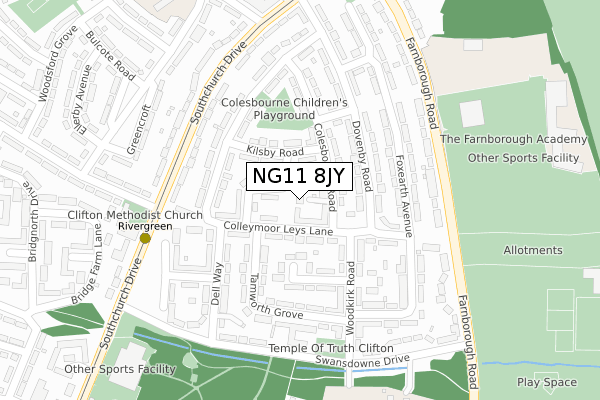
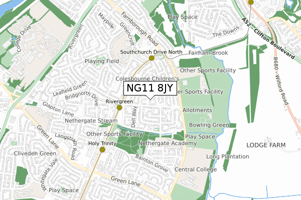
NG11 8JY is located in the Clifton East electoral ward, within the unitary authority of Nottingham and the English Parliamentary constituency of Nottingham South. The Sub Integrated Care Board (ICB) Location is NHS Nottingham and Nottinghamshire ICB - 52R and the police force is Nottinghamshire. This postcode has been in use since August 2017.


GetTheData
Source: OS Open Zoomstack (Ordnance Survey)
Licence: Open Government Licence (requires attribution)
Attribution: Contains OS data © Crown copyright and database right 2025
Source: Open Postcode Geo
Licence: Open Government Licence (requires attribution)
Attribution: Contains OS data © Crown copyright and database right 2025; Contains Royal Mail data © Royal Mail copyright and database right 2025; Source: Office for National Statistics licensed under the Open Government Licence v.3.0
| Easting | 455858 |
| Northing | 334766 |
| Latitude | 52.907452 |
| Longitude | -1.170903 |
GetTheData
Source: Open Postcode Geo
Licence: Open Government Licence
| Country | England |
| Postcode District | NG11 |
➜ See where NG11 is on a map ➜ Where is Clifton? | |
GetTheData
Source: Land Registry Price Paid Data
Licence: Open Government Licence
| Ward | Clifton East |
| Constituency | Nottingham South |
GetTheData
Source: ONS Postcode Database
Licence: Open Government Licence
| Rivergreen (Southchurch Drive) | Clifton | 238m |
| Varney Road (Southchurch Drive) | Clifton | 241m |
| Varney Road (Southchurch Drive) | Clifton | 262m |
| Farnborough School (Farnborough Road) | Clifton | 269m |
| Farnborough School (Farnborough Road) | Clifton | 271m |
| Rivergreen Tram Stop (Southchurch Drive) | Clifton | 267m |
| Southchurch Drive North Tram Stop (Southchurch Drive) | Clifton | 368m |
| Clifton Centre Tram Stop (Southchurch Drive) | Clifton | 580m |
| Ruddington Lane Tram Stop (Ruddington Lane) | Compton Acres | 1,169m |
| Holy Trinity Tram Stop (Southchurch Drive) | Clifton | 1,352m |
| Beeston Station | 2.9km |
| Attenborough Station | 4.1km |
| Nottingham Station | 4.7km |
GetTheData
Source: NaPTAN
Licence: Open Government Licence
| Percentage of properties with Next Generation Access | 100.0% |
| Percentage of properties with Superfast Broadband | 100.0% |
| Percentage of properties with Ultrafast Broadband | 100.0% |
| Percentage of properties with Full Fibre Broadband | 0.0% |
Superfast Broadband is between 30Mbps and 300Mbps
Ultrafast Broadband is > 300Mbps
| Percentage of properties unable to receive 2Mbps | 0.0% |
| Percentage of properties unable to receive 5Mbps | 0.0% |
| Percentage of properties unable to receive 10Mbps | 0.0% |
| Percentage of properties unable to receive 30Mbps | 0.0% |
GetTheData
Source: Ofcom
Licence: Ofcom Terms of Use (requires attribution)
GetTheData
Source: ONS Postcode Database
Licence: Open Government Licence


➜ Get more ratings from the Food Standards Agency
GetTheData
Source: Food Standards Agency
Licence: FSA terms & conditions
| Last Collection | |||
|---|---|---|---|
| Location | Mon-Fri | Sat | Distance |
| Southchurch Drive | 17:30 | 12:00 | 243m |
| Farnborough Road | 17:30 | 11:00 | 258m |
| Sunburgh Road | 17:30 | 12:00 | 567m |
GetTheData
Source: Dracos
Licence: Creative Commons Attribution-ShareAlike
The below table lists the International Territorial Level (ITL) codes (formerly Nomenclature of Territorial Units for Statistics (NUTS) codes) and Local Administrative Units (LAU) codes for NG11 8JY:
| ITL 1 Code | Name |
|---|---|
| TLF | East Midlands (England) |
| ITL 2 Code | Name |
| TLF1 | Derbyshire and Nottinghamshire |
| ITL 3 Code | Name |
| TLF14 | Nottingham |
| LAU 1 Code | Name |
| E06000018 | Nottingham |
GetTheData
Source: ONS Postcode Directory
Licence: Open Government Licence
The below table lists the Census Output Area (OA), Lower Layer Super Output Area (LSOA), and Middle Layer Super Output Area (MSOA) for NG11 8JY:
| Code | Name | |
|---|---|---|
| OA | E00070140 | |
| LSOA | E01013900 | Nottingham 035D |
| MSOA | E02002902 | Nottingham 035 |
GetTheData
Source: ONS Postcode Directory
Licence: Open Government Licence
| NG11 8JD | Colley Moor Leys Lane | 34m |
| NG11 8JG | Colesbourne Road | 48m |
| NG11 8JE | Whinfell Close | 61m |
| NG11 8JF | Kilsby Road | 98m |
| NG11 8HZ | Belwood Close | 116m |
| NG11 8JL | Dovenby Road | 123m |
| NG11 8AL | Colley Moor Leys Lane | 155m |
| NG11 8JR | Old Oak Road | 168m |
| NG11 8JB | Tamworth Grove | 176m |
| NG11 8AH | Dellway | 177m |
GetTheData
Source: Open Postcode Geo; Land Registry Price Paid Data
Licence: Open Government Licence