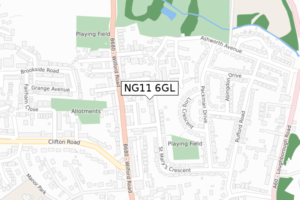
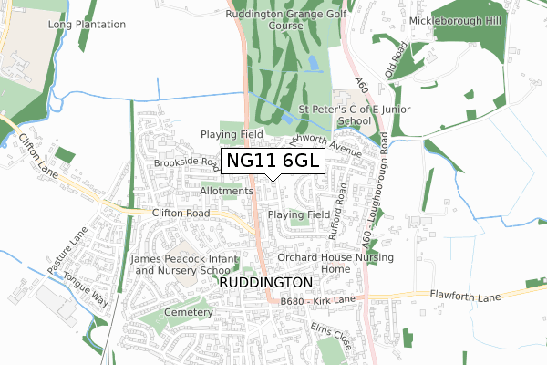
NG11 6GL is located in the Ruddington electoral ward, within the local authority district of Rushcliffe and the English Parliamentary constituency of Rushcliffe. The Sub Integrated Care Board (ICB) Location is NHS Nottingham and Nottinghamshire ICB - 52R and the police force is Nottinghamshire. This postcode has been in use since September 2017.


GetTheData
Source: OS Open Zoomstack (Ordnance Survey)
Licence: Open Government Licence (requires attribution)
Attribution: Contains OS data © Crown copyright and database right 2025
Source: Open Postcode Geo
Licence: Open Government Licence (requires attribution)
Attribution: Contains OS data © Crown copyright and database right 2025; Contains Royal Mail data © Royal Mail copyright and database right 2025; Source: Office for National Statistics licensed under the Open Government Licence v.3.0
| Easting | 457353 |
| Northing | 333572 |
| Latitude | 52.896563 |
| Longitude | -1.148887 |
GetTheData
Source: Open Postcode Geo
Licence: Open Government Licence
| Country | England |
| Postcode District | NG11 |
➜ See where NG11 is on a map ➜ Where is Ruddington? | |
GetTheData
Source: Land Registry Price Paid Data
Licence: Open Government Licence
| Ward | Ruddington |
| Constituency | Rushcliffe |
GetTheData
Source: ONS Postcode Database
Licence: Open Government Licence
1, ST FRANCIS DRIVE, RUDDINGTON, NOTTINGHAM, NG11 6GL 2018 9 FEB £500,000 |
2, ST FRANCIS DRIVE, RUDDINGTON, NOTTINGHAM, NG11 6GL 2017 22 DEC £500,000 |
3, ST FRANCIS DRIVE, RUDDINGTON, NOTTINGHAM, NG11 6GL 2017 2 NOV £490,000 |
GetTheData
Source: HM Land Registry Price Paid Data
Licence: Contains HM Land Registry data © Crown copyright and database right 2025. This data is licensed under the Open Government Licence v3.0.
| Savages Road (Wilford Road) | Ruddington | 88m |
| Savages Road (Wilford Road) | Ruddington | 112m |
| Paget Crescent (Wilford Road) | Ruddington | 175m |
| Upper Canaan (Packman Drive) | Ruddington | 182m |
| Upper Canaan (Packman Drive) | Ruddington | 186m |
| Beeston Station | 4.8km |
GetTheData
Source: NaPTAN
Licence: Open Government Licence
| Percentage of properties with Next Generation Access | 100.0% |
| Percentage of properties with Superfast Broadband | 100.0% |
| Percentage of properties with Ultrafast Broadband | 100.0% |
| Percentage of properties with Full Fibre Broadband | 0.0% |
Superfast Broadband is between 30Mbps and 300Mbps
Ultrafast Broadband is > 300Mbps
| Percentage of properties unable to receive 2Mbps | 0.0% |
| Percentage of properties unable to receive 5Mbps | 0.0% |
| Percentage of properties unable to receive 10Mbps | 0.0% |
| Percentage of properties unable to receive 30Mbps | 0.0% |
GetTheData
Source: Ofcom
Licence: Ofcom Terms of Use (requires attribution)
GetTheData
Source: ONS Postcode Database
Licence: Open Government Licence


➜ Get more ratings from the Food Standards Agency
GetTheData
Source: Food Standards Agency
Licence: FSA terms & conditions
| Last Collection | |||
|---|---|---|---|
| Location | Mon-Fri | Sat | Distance |
| Wilford Road | 17:30 | 12:00 | 167m |
| Ashworth Avenue | 17:30 | 09:30 | 381m |
| Clifton Road | 17:30 | 12:00 | 463m |
GetTheData
Source: Dracos
Licence: Creative Commons Attribution-ShareAlike
The below table lists the International Territorial Level (ITL) codes (formerly Nomenclature of Territorial Units for Statistics (NUTS) codes) and Local Administrative Units (LAU) codes for NG11 6GL:
| ITL 1 Code | Name |
|---|---|
| TLF | East Midlands (England) |
| ITL 2 Code | Name |
| TLF1 | Derbyshire and Nottinghamshire |
| ITL 3 Code | Name |
| TLF16 | South Nottinghamshire |
| LAU 1 Code | Name |
| E07000176 | Rushcliffe |
GetTheData
Source: ONS Postcode Directory
Licence: Open Government Licence
The below table lists the Census Output Area (OA), Lower Layer Super Output Area (LSOA), and Middle Layer Super Output Area (MSOA) for NG11 6GL:
| Code | Name | |
|---|---|---|
| OA | E00144738 | |
| LSOA | E01028407 | Rushcliffe 011D |
| MSOA | E02005916 | Rushcliffe 011 |
GetTheData
Source: ONS Postcode Directory
Licence: Open Government Licence
| NG11 6EZ | Wilford Crescent | 55m |
| NG11 6EW | Savages Road | 62m |
| NG11 6EX | Savages Row | 65m |
| NG11 6FQ | St Marys Crescent | 80m |
| NG11 6EY | Wilford Road | 83m |
| NG11 6EU | St Johns Road | 105m |
| NG11 6GQ | The Approach | 132m |
| NG11 6GG | Ling Crescent | 138m |
| NG11 6BN | Wilford Road | 142m |
| NG11 6FD | Paget Crescent | 142m |
GetTheData
Source: Open Postcode Geo; Land Registry Price Paid Data
Licence: Open Government Licence