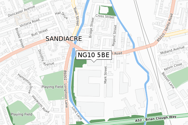
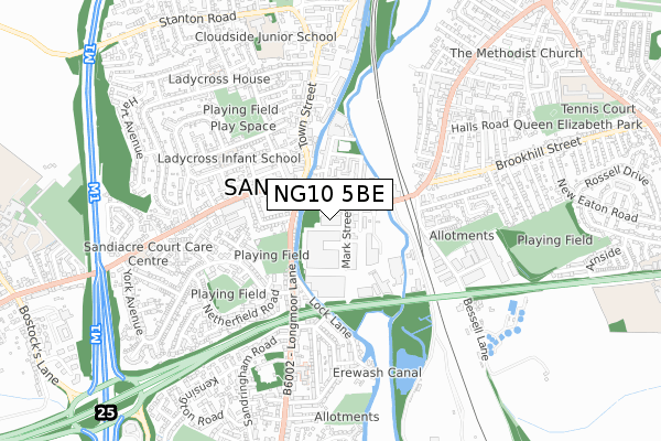
NG10 5BE is in London Road, Nottingham. NG10 5BE is located in the Sandiacre electoral ward, within the local authority district of Erewash and the English Parliamentary constituency of Erewash. The Sub Integrated Care Board (ICB) Location is NHS Derby and Derbyshire ICB - 15M and the police force is Derbyshire. This postcode has been in use since September 2017.


GetTheData
Source: OS Open Zoomstack (Ordnance Survey)
Licence: Open Government Licence (requires attribution)
Attribution: Contains OS data © Crown copyright and database right 2025
Source: Open Postcode Geo
Licence: Open Government Licence (requires attribution)
Attribution: Contains OS data © Crown copyright and database right 2025; Contains Royal Mail data © Royal Mail copyright and database right 2025; Source: Office for National Statistics licensed under the Open Government Licence v.3.0
| Easting | 448043 |
| Northing | 336310 |
| Latitude | 52.922083 |
| Longitude | -1.286863 |
GetTheData
Source: Open Postcode Geo
Licence: Open Government Licence
| Locality | London Road |
| Town/City | Nottingham |
| Country | England |
| Postcode District | NG10 |
➜ See where NG10 is on a map ➜ Where is Sandiacre? | |
GetTheData
Source: Land Registry Price Paid Data
Licence: Open Government Licence
| Ward | Sandiacre |
| Constituency | Erewash |
GetTheData
Source: ONS Postcode Database
Licence: Open Government Licence
7, LONDON ROAD, NOTTINGHAM, NG10 5BE 2000 18 OCT £80,000 |
GetTheData
Source: HM Land Registry Price Paid Data
Licence: Contains HM Land Registry data © Crown copyright and database right 2025. This data is licensed under the Open Government Licence v3.0.
| Regent Street (Station Road) | Sandiacre | 51m |
| Regent Street (Station Road) | Sandiacre | 124m |
| Dorothy Avenue (Longmoor Lane) | Sandiacre | 135m |
| Dorothy Avenue (Longmoor Lane) | Sandiacre | 168m |
| White Lion (Derby Road) | Sandiacre | 263m |
| Long Eaton Station | 4.1km |
| Attenborough Station | 4.1km |
GetTheData
Source: NaPTAN
Licence: Open Government Licence
GetTheData
Source: ONS Postcode Database
Licence: Open Government Licence


➜ Get more ratings from the Food Standards Agency
GetTheData
Source: Food Standards Agency
Licence: FSA terms & conditions
| Last Collection | |||
|---|---|---|---|
| Location | Mon-Fri | Sat | Distance |
| Sandiacre Post Office | 17:45 | 12:00 | 225m |
| Derby Road | 16:45 | 11:45 | 378m |
| Town Street | 17:00 | 12:00 | 493m |
GetTheData
Source: Dracos
Licence: Creative Commons Attribution-ShareAlike
| Risk of NG10 5BE flooding from rivers and sea | Low |
| ➜ NG10 5BE flood map | |
GetTheData
Source: Open Flood Risk by Postcode
Licence: Open Government Licence
The below table lists the International Territorial Level (ITL) codes (formerly Nomenclature of Territorial Units for Statistics (NUTS) codes) and Local Administrative Units (LAU) codes for NG10 5BE:
| ITL 1 Code | Name |
|---|---|
| TLF | East Midlands (England) |
| ITL 2 Code | Name |
| TLF1 | Derbyshire and Nottinghamshire |
| ITL 3 Code | Name |
| TLF13 | South and West Derbyshire |
| LAU 1 Code | Name |
| E07000036 | Erewash |
GetTheData
Source: ONS Postcode Directory
Licence: Open Government Licence
The below table lists the Census Output Area (OA), Lower Layer Super Output Area (LSOA), and Middle Layer Super Output Area (MSOA) for NG10 5BE:
| Code | Name | |
|---|---|---|
| OA | E00099646 | |
| LSOA | E01019696 | Erewash 008F |
| MSOA | E02004085 | Erewash 008 |
GetTheData
Source: ONS Postcode Directory
Licence: Open Government Licence
| NG10 5BG | Station Road | 70m |
| NG10 5AS | Station Road | 129m |
| NG10 5AH | Bradley Street | 129m |
| NG10 5AT | Westminster Avenue | 139m |
| NG10 5AG | Station Road | 142m |
| NG10 5BD | Grasmere Street | 154m |
| NG10 5JJ | Longmoor Lane | 156m |
| NG10 5QT | Bridge Street | 174m |
| NG10 5JH | Longmoor Lane | 175m |
| NG10 5AU | Regent Street | 188m |
GetTheData
Source: Open Postcode Geo; Land Registry Price Paid Data
Licence: Open Government Licence