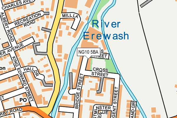
NG10 5BA is located in the Sandiacre electoral ward, within the local authority district of Erewash and the English Parliamentary constituency of Erewash. The Sub Integrated Care Board (ICB) Location is NHS Derby and Derbyshire ICB - 15M and the police force is Derbyshire. This postcode has been in use since January 1980.


GetTheData
Source: OS OpenMap – Local (Ordnance Survey)
Source: OS VectorMap District (Ordnance Survey)
Licence: Open Government Licence (requires attribution)
| Easting | 448010 |
| Northing | 336473 |
| Latitude | 52.923551 |
| Longitude | -1.287330 |
GetTheData
Source: Open Postcode Geo
Licence: Open Government Licence
| Country | England |
| Postcode District | NG10 |
➜ See where NG10 is on a map ➜ Where is Sandiacre? | |
GetTheData
Source: Land Registry Price Paid Data
Licence: Open Government Licence
Elevation or altitude of NG10 5BA as distance above sea level:
| Metres | Feet | |
|---|---|---|
| Elevation | 40m | 131ft |
Elevation is measured from the approximate centre of the postcode, to the nearest point on an OS contour line from OS Terrain 50, which has contour spacing of ten vertical metres.
➜ How high above sea level am I? Find the elevation of your current position using your device's GPS.
GetTheData
Source: Open Postcode Elevation
Licence: Open Government Licence
| Ward | Sandiacre |
| Constituency | Erewash |
GetTheData
Source: ONS Postcode Database
Licence: Open Government Licence
| Town Street | Sandiacre | 112m |
| Regent Street (Station Road) | Sandiacre | 115m |
| Dorothy Avenue (Longmoor Lane) | Sandiacre | 156m |
| Regent Street (Station Road) | Sandiacre | 183m |
| White Lion (Derby Road) | Sandiacre | 208m |
| Attenborough Station | 4.2km |
| Long Eaton Station | 4.3km |
GetTheData
Source: NaPTAN
Licence: Open Government Licence
GetTheData
Source: ONS Postcode Database
Licence: Open Government Licence


➜ Get more ratings from the Food Standards Agency
GetTheData
Source: Food Standards Agency
Licence: FSA terms & conditions
| Last Collection | |||
|---|---|---|---|
| Location | Mon-Fri | Sat | Distance |
| Sandiacre Post Office | 17:45 | 12:00 | 142m |
| Town Street | 17:00 | 12:00 | 327m |
| Derby Road | 16:45 | 11:45 | 383m |
GetTheData
Source: Dracos
Licence: Creative Commons Attribution-ShareAlike
| Risk of NG10 5BA flooding from rivers and sea | Low |
| ➜ NG10 5BA flood map | |
GetTheData
Source: Open Flood Risk by Postcode
Licence: Open Government Licence
The below table lists the International Territorial Level (ITL) codes (formerly Nomenclature of Territorial Units for Statistics (NUTS) codes) and Local Administrative Units (LAU) codes for NG10 5BA:
| ITL 1 Code | Name |
|---|---|
| TLF | East Midlands (England) |
| ITL 2 Code | Name |
| TLF1 | Derbyshire and Nottinghamshire |
| ITL 3 Code | Name |
| TLF13 | South and West Derbyshire |
| LAU 1 Code | Name |
| E07000036 | Erewash |
GetTheData
Source: ONS Postcode Directory
Licence: Open Government Licence
The below table lists the Census Output Area (OA), Lower Layer Super Output Area (LSOA), and Middle Layer Super Output Area (MSOA) for NG10 5BA:
| Code | Name | |
|---|---|---|
| OA | E00099626 | |
| LSOA | E01019693 | Erewash 008D |
| MSOA | E02004085 | Erewash 008 |
GetTheData
Source: ONS Postcode Directory
Licence: Open Government Licence
| NG10 5QT | Bridge Street | 30m |
| NG10 5BD | Grasmere Street | 36m |
| NG10 5QD | Springfield Mill | 80m |
| NG10 5QU | Bramble Court | 93m |
| NG10 5QX | Springfield Mill | 95m |
| NG10 5BG | Station Road | 97m |
| NG10 5AT | Westminster Avenue | 103m |
| NG10 5QS | Cross Street | 141m |
| NG10 5BT | King Edward Gardens | 143m |
| NG10 5HW | Derby Road | 149m |
GetTheData
Source: Open Postcode Geo; Land Registry Price Paid Data
Licence: Open Government Licence