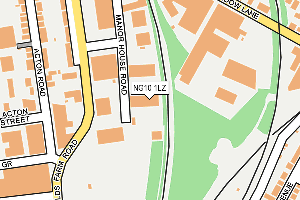
NG10 1LZ is located in the Long Eaton Central electoral ward, within the local authority district of Erewash and the English Parliamentary constituency of Erewash. The Sub Integrated Care Board (ICB) Location is NHS Derby and Derbyshire ICB - 15M and the police force is Derbyshire. This postcode has been in use since March 2008.


GetTheData
Source: OS OpenMap – Local (Ordnance Survey)
Source: OS VectorMap District (Ordnance Survey)
Licence: Open Government Licence (requires attribution)
| Easting | 449694 |
| Northing | 332817 |
| Latitude | 52.890517 |
| Longitude | -1.262846 |
GetTheData
Source: Open Postcode Geo
Licence: Open Government Licence
| Country | England |
| Postcode District | NG10 |
➜ See where NG10 is on a map ➜ Where is Long Eaton? | |
GetTheData
Source: Land Registry Price Paid Data
Licence: Open Government Licence
Elevation or altitude of NG10 1LZ as distance above sea level:
| Metres | Feet | |
|---|---|---|
| Elevation | 30m | 98ft |
Elevation is measured from the approximate centre of the postcode, to the nearest point on an OS contour line from OS Terrain 50, which has contour spacing of ten vertical metres.
➜ How high above sea level am I? Find the elevation of your current position using your device's GPS.
GetTheData
Source: Open Postcode Elevation
Licence: Open Government Licence
| Ward | Long Eaton Central |
| Constituency | Erewash |
GetTheData
Source: ONS Postcode Database
Licence: Open Government Licence
| Manor House Road (Fields Farm Road) | Long Eaton | 184m |
| Manor House Road (Fields Farm Road) | Long Eaton | 190m |
| Acton Close (Fields Farm Road) | Long Eaton | 215m |
| Acton Close (Fields Farm Road) | Long Eaton | 286m |
| Newbery Avenue Middle (Newbery Avenue) | Long Eaton | 323m |
| Long Eaton Station | 1.8km |
| Attenborough Station | 2.7km |
| East Midlands Parkway Station | 3.1km |
GetTheData
Source: NaPTAN
Licence: Open Government Licence
GetTheData
Source: ONS Postcode Database
Licence: Open Government Licence


➜ Get more ratings from the Food Standards Agency
GetTheData
Source: Food Standards Agency
Licence: FSA terms & conditions
| Last Collection | |||
|---|---|---|---|
| Location | Mon-Fri | Sat | Distance |
| Acton Road Ind Est | 220m | ||
| Meadow Lane | 17:00 | 12:00 | 328m |
| Main Street | 17:00 | 12:00 | 493m |
GetTheData
Source: Dracos
Licence: Creative Commons Attribution-ShareAlike
| Risk of NG10 1LZ flooding from rivers and sea | Low |
| ➜ NG10 1LZ flood map | |
GetTheData
Source: Open Flood Risk by Postcode
Licence: Open Government Licence
The below table lists the International Territorial Level (ITL) codes (formerly Nomenclature of Territorial Units for Statistics (NUTS) codes) and Local Administrative Units (LAU) codes for NG10 1LZ:
| ITL 1 Code | Name |
|---|---|
| TLF | East Midlands (England) |
| ITL 2 Code | Name |
| TLF1 | Derbyshire and Nottinghamshire |
| ITL 3 Code | Name |
| TLF13 | South and West Derbyshire |
| LAU 1 Code | Name |
| E07000036 | Erewash |
GetTheData
Source: ONS Postcode Directory
Licence: Open Government Licence
The below table lists the Census Output Area (OA), Lower Layer Super Output Area (LSOA), and Middle Layer Super Output Area (MSOA) for NG10 1LZ:
| Code | Name | |
|---|---|---|
| OA | E00099552 | |
| LSOA | E01019678 | Erewash 014C |
| MSOA | E02004091 | Erewash 014 |
GetTheData
Source: ONS Postcode Directory
Licence: Open Government Licence
| NG10 1GB | Nathaniel Road | 233m |
| NG10 2FD | Meadow Lane | 283m |
| NG10 2FE | Meadow Lane | 285m |
| NG10 1FR | Acton Road | 288m |
| NG10 2FU | Newbery Avenue | 311m |
| NG10 2FW | Trent Cottages | 319m |
| NG10 2FJ | Holyoake Drive | 325m |
| NG10 1GT | Main Street | 341m |
| NG10 1FY | Acton Grove | 346m |
| NG10 2FT | Newbery Avenue | 346m |
GetTheData
Source: Open Postcode Geo; Land Registry Price Paid Data
Licence: Open Government Licence