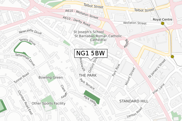
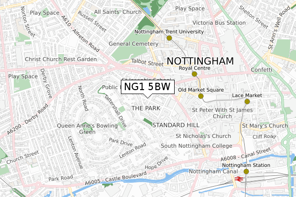
NG1 5BW is located in the Castle electoral ward, within the unitary authority of Nottingham and the English Parliamentary constituency of Nottingham South. The Sub Integrated Care Board (ICB) Location is NHS Nottingham and Nottinghamshire ICB - 52R and the police force is Nottinghamshire. This postcode has been in use since August 2018.


GetTheData
Source: OS Open Zoomstack (Ordnance Survey)
Licence: Open Government Licence (requires attribution)
Attribution: Contains OS data © Crown copyright and database right 2025
Source: Open Postcode Geo
Licence: Open Government Licence (requires attribution)
Attribution: Contains OS data © Crown copyright and database right 2025; Contains Royal Mail data © Royal Mail copyright and database right 2025; Source: Office for National Statistics licensed under the Open Government Licence v.3.0
| Easting | 456677 |
| Northing | 339887 |
| Latitude | 52.953395 |
| Longitude | -1.157835 |
GetTheData
Source: Open Postcode Geo
Licence: Open Government Licence
| Country | England |
| Postcode District | NG1 |
➜ See where NG1 is on a map ➜ Where is Nottingham? | |
GetTheData
Source: Land Registry Price Paid Data
Licence: Open Government Licence
| Ward | Castle |
| Constituency | Nottingham South |
GetTheData
Source: ONS Postcode Database
Licence: Open Government Licence
| Albert Hall (North Circus Street) | Nottingham | 130m |
| Cathedral (Derby Road) | Nottingham | 169m |
| Cathedral (Derby Road) | Nottingham | 177m |
| Cathedral (Derby Road) | Nottingham | 186m |
| Cathedral (Derby Road) | Nottingham | 193m |
| Royal Centre Tram Stop (Wollaton Street) | Nottingham | 436m |
| Old Market Square Tram Stop (South Parade) | Nottingham | 479m |
| Ntu Tram Stop (Goldsmith Street) | Nottingham Trent University In City Centre | 562m |
| Lace Market Tram Stop (Fletcher Gate) | Nottingham | 837m |
| High School Tram Stop (Waverley Street) | Arboretum | 1,062m |
| Nottingham Station | 1km |
| Beeston Station | 4.9km |
GetTheData
Source: NaPTAN
Licence: Open Government Licence
| Percentage of properties with Next Generation Access | 100.0% |
| Percentage of properties with Superfast Broadband | 100.0% |
| Percentage of properties with Ultrafast Broadband | 100.0% |
| Percentage of properties with Full Fibre Broadband | 0.0% |
Superfast Broadband is between 30Mbps and 300Mbps
Ultrafast Broadband is > 300Mbps
| Percentage of properties unable to receive 2Mbps | 0.0% |
| Percentage of properties unable to receive 5Mbps | 0.0% |
| Percentage of properties unable to receive 10Mbps | 0.0% |
| Percentage of properties unable to receive 30Mbps | 0.0% |
GetTheData
Source: Ofcom
Licence: Ofcom Terms of Use (requires attribution)
GetTheData
Source: ONS Postcode Database
Licence: Open Government Licence


➜ Get more ratings from the Food Standards Agency
GetTheData
Source: Food Standards Agency
Licence: FSA terms & conditions
| Last Collection | |||
|---|---|---|---|
| Location | Mon-Fri | Sat | Distance |
| Regent Street | 18:30 | 12:30 | 31m |
| Regent Street | 18:30 | 12:30 | 34m |
| The Ropewalk | 18:45 | 179m | |
GetTheData
Source: Dracos
Licence: Creative Commons Attribution-ShareAlike
The below table lists the International Territorial Level (ITL) codes (formerly Nomenclature of Territorial Units for Statistics (NUTS) codes) and Local Administrative Units (LAU) codes for NG1 5BW:
| ITL 1 Code | Name |
|---|---|
| TLF | East Midlands (England) |
| ITL 2 Code | Name |
| TLF1 | Derbyshire and Nottinghamshire |
| ITL 3 Code | Name |
| TLF14 | Nottingham |
| LAU 1 Code | Name |
| E06000018 | Nottingham |
GetTheData
Source: ONS Postcode Directory
Licence: Open Government Licence
The below table lists the Census Output Area (OA), Lower Layer Super Output Area (LSOA), and Middle Layer Super Output Area (MSOA) for NG1 5BW:
| Code | Name | |
|---|---|---|
| OA | E00173524 | |
| LSOA | E01032522 | Nottingham 028F |
| MSOA | E02002895 | Nottingham 028 |
GetTheData
Source: ONS Postcode Directory
Licence: Open Government Licence
| NG1 5BH | Oxford Street | 16m |
| NG1 5BT | Regent Street | 33m |
| NG1 5BG | Oxford Street | 48m |
| NG1 5AL | Wellington Circus | 71m |
| NG1 5AQ | College Street | 75m |
| NG1 5BS | Regent Street | 75m |
| NG1 5DN | Park Terrace | 82m |
| NG1 5DW | The Ropewalk | 84m |
| NG1 5AY | Park Terrace | 86m |
| NG1 5AF | East Circus Street | 88m |
GetTheData
Source: Open Postcode Geo; Land Registry Price Paid Data
Licence: Open Government Licence
| Wellington Circus | At Any Time | 100m |
| East Circus Street | At Any Time | 102m |
| The Ropewalk | 8am-8pm | 146m |
GetTheData
Source: Disabled parking spaces, Nottingham City Council, 19/02/2013
Licence: Open Government Licence