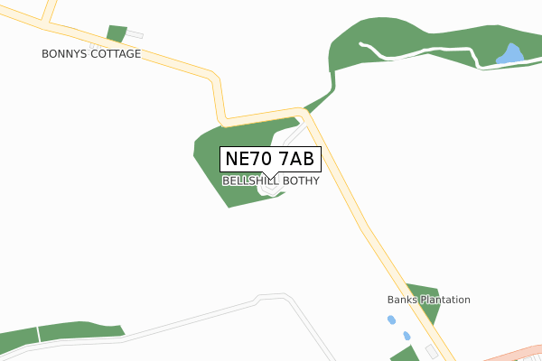
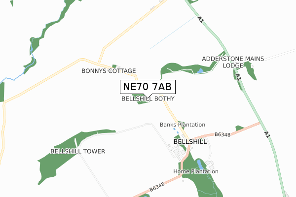
NE70 7AB is located in the Bamburgh electoral ward, within the unitary authority of Northumberland and the English Parliamentary constituency of Berwick-upon-Tweed. The Sub Integrated Care Board (ICB) Location is NHS North East and North Cumbria ICB - 00L and the police force is Northumbria. This postcode has been in use since January 2020.


GetTheData
Source: OS Open Zoomstack (Ordnance Survey)
Licence: Open Government Licence (requires attribution)
Attribution: Contains OS data © Crown copyright and database right 2025
Source: Open Postcode Geo
Licence: Open Government Licence (requires attribution)
Attribution: Contains OS data © Crown copyright and database right 2025; Contains Royal Mail data © Royal Mail copyright and database right 2025; Source: Office for National Statistics licensed under the Open Government Licence v.3.0
| Easting | 412019 |
| Northing | 631113 |
| Latitude | 55.573533 |
| Longitude | -1.810960 |
GetTheData
Source: Open Postcode Geo
Licence: Open Government Licence
| Country | England |
| Postcode District | NE70 |
➜ See where NE70 is on a map | |
GetTheData
Source: Land Registry Price Paid Data
Licence: Open Government Licence
| Ward | Bamburgh |
| Constituency | Berwick-upon-tweed |
GetTheData
Source: ONS Postcode Database
Licence: Open Government Licence
| Motel (A1) | Adderstone | 1,408m |
| Motel (A1) | Adderstone | 1,464m |
GetTheData
Source: NaPTAN
Licence: Open Government Licence
GetTheData
Source: ONS Postcode Database
Licence: Open Government Licence


➜ Get more ratings from the Food Standards Agency
GetTheData
Source: Food Standards Agency
Licence: FSA terms & conditions
| Last Collection | |||
|---|---|---|---|
| Location | Mon-Fri | Sat | Distance |
| Bellshill | 16:30 | 08:00 | 503m |
| Newlands Lodge | 16:45 | 08:30 | 1,599m |
| The Meadows | 16:45 | 08:00 | 2,503m |
GetTheData
Source: Dracos
Licence: Creative Commons Attribution-ShareAlike
The below table lists the International Territorial Level (ITL) codes (formerly Nomenclature of Territorial Units for Statistics (NUTS) codes) and Local Administrative Units (LAU) codes for NE70 7AB:
| ITL 1 Code | Name |
|---|---|
| TLC | North East (England) |
| ITL 2 Code | Name |
| TLC2 | Northumberland, and Tyne and Wear |
| ITL 3 Code | Name |
| TLC21 | Northumberland |
| LAU 1 Code | Name |
| E06000057 | Northumberland |
GetTheData
Source: ONS Postcode Directory
Licence: Open Government Licence
The below table lists the Census Output Area (OA), Lower Layer Super Output Area (LSOA), and Middle Layer Super Output Area (MSOA) for NE70 7AB:
| Code | Name | |
|---|---|---|
| OA | E00139292 | |
| LSOA | E01027374 | Northumberland 003A |
| MSOA | E02005708 | Northumberland 003 |
GetTheData
Source: ONS Postcode Directory
Licence: Open Government Licence
| NE70 7HR | The Square | 431m |
| NE70 7HP | 470m | |
| NE70 7HN | 759m | |
| NE70 7DS | 1420m | |
| NE70 7HS | 1541m | |
| NE70 7HW | 1553m | |
| NE70 7DR | 1613m | |
| NE70 7JU | 1615m | |
| NE70 7JA | Adderstone Cottages | 1914m |
| NE70 7DP | South Road | 2094m |
GetTheData
Source: Open Postcode Geo; Land Registry Price Paid Data
Licence: Open Government Licence