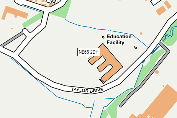
NE66 2DH is located in the Alnwick electoral ward, within the unitary authority of Northumberland and the English Parliamentary constituency of Berwick-upon-Tweed. The Sub Integrated Care Board (ICB) Location is NHS North East and North Cumbria ICB - 00L and the police force is Northumbria. This postcode has been in use since June 2016.


GetTheData
Source: OS OpenMap – Local (Ordnance Survey)
Source: OS VectorMap District (Ordnance Survey)
Licence: Open Government Licence (requires attribution)
| Easting | 419251 |
| Northing | 611634 |
| Latitude | 55.398281 |
| Longitude | -1.697611 |
GetTheData
Source: Open Postcode Geo
Licence: Open Government Licence
| Country | England |
| Postcode District | NE66 |
➜ See where NE66 is on a map | |
GetTheData
Source: Land Registry Price Paid Data
Licence: Open Government Licence
Elevation or altitude of NE66 2DH as distance above sea level:
| Metres | Feet | |
|---|---|---|
| Elevation | 70m | 230ft |
Elevation is measured from the approximate centre of the postcode, to the nearest point on an OS contour line from OS Terrain 50, which has contour spacing of ten vertical metres.
➜ How high above sea level am I? Find the elevation of your current position using your device's GPS.
GetTheData
Source: Open Postcode Elevation
Licence: Open Government Licence
| Ward | Alnwick |
| Constituency | Berwick-upon-tweed |
GetTheData
Source: ONS Postcode Database
Licence: Open Government Licence
| A1 Slip Road (A1068) | Willowburn Trading Est | 284m |
| Retail Park (Willowburn Avenue) | Greensfield | 328m |
| Retail Park (Willowburn Avenue) | Greensfield | 335m |
| Lionheart Enterprise Park (Road To Shilbottle) | Willowburn Trading Est | 350m |
| Lionheart Enterprise Park (Road To Shilbottle) | Willowburn Trading Est | 365m |
| Alnmouth Station | 3.9km |
GetTheData
Source: NaPTAN
Licence: Open Government Licence
GetTheData
Source: ONS Postcode Database
Licence: Open Government Licence


➜ Get more ratings from the Food Standards Agency
GetTheData
Source: Food Standards Agency
Licence: FSA terms & conditions
| Last Collection | |||
|---|---|---|---|
| Location | Mon-Fri | Sat | Distance |
| Alnwick Delivery Office | 18:00 | 12:45 | 328m |
| Lionheart Enterprise Park | 16:45 | 11:30 | 423m |
| Weavers Way | 17:45 | 11:30 | 564m |
GetTheData
Source: Dracos
Licence: Creative Commons Attribution-ShareAlike
The below table lists the International Territorial Level (ITL) codes (formerly Nomenclature of Territorial Units for Statistics (NUTS) codes) and Local Administrative Units (LAU) codes for NE66 2DH:
| ITL 1 Code | Name |
|---|---|
| TLC | North East (England) |
| ITL 2 Code | Name |
| TLC2 | Northumberland, and Tyne and Wear |
| ITL 3 Code | Name |
| TLC21 | Northumberland |
| LAU 1 Code | Name |
| E06000057 | Northumberland |
GetTheData
Source: ONS Postcode Directory
Licence: Open Government Licence
The below table lists the Census Output Area (OA), Lower Layer Super Output Area (LSOA), and Middle Layer Super Output Area (MSOA) for NE66 2DH:
| Code | Name | |
|---|---|---|
| OA | E00139177 | |
| LSOA | E01027356 | Northumberland 004A |
| MSOA | E02005702 | Northumberland 004 |
GetTheData
Source: ONS Postcode Directory
Licence: Open Government Licence
| NE66 2GD | Linnet Court | 358m |
| NE66 2HH | 419m | |
| NE66 1BW | Fullers Walk | 537m |
| NE66 1BH | Cawledge View | 576m |
| NE66 1SW | Farriers Court | 589m |
| NE66 1BS | Arkle Court | 613m |
| NE66 1BQ | St James Estate | 636m |
| NE66 1BL | Tanners Garth | 643m |
| NE66 1BN | The Cordwainers | 670m |
| NE66 1BG | St James Estate | 683m |
GetTheData
Source: Open Postcode Geo; Land Registry Price Paid Data
Licence: Open Government Licence