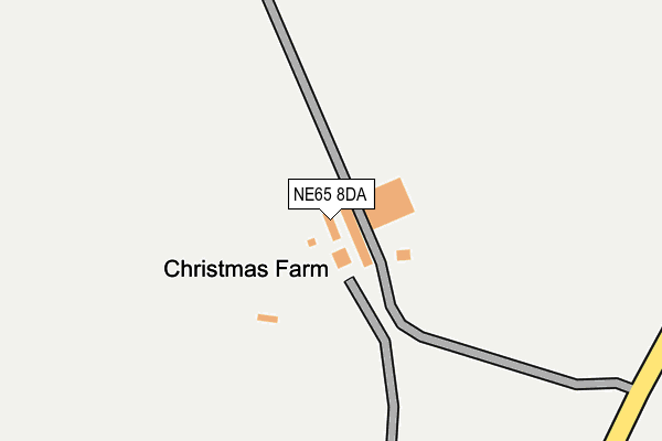
NE65 8DA is in Longframlington, Morpeth. NE65 8DA is located in the Shilbottle electoral ward, within the unitary authority of Northumberland and the English Parliamentary constituency of Berwick-upon-Tweed. The Sub Integrated Care Board (ICB) Location is NHS North East and North Cumbria ICB - 00L and the police force is Northumbria. This postcode has been in use since January 1992.


GetTheData
Source: OS OpenMap – Local (Ordnance Survey)
Source: OS VectorMap District (Ordnance Survey)
Licence: Open Government Licence (requires attribution)
| Easting | 413024 |
| Northing | 602656 |
| Latitude | 55.317813 |
| Longitude | -1.796340 |
GetTheData
Source: Open Postcode Geo
Licence: Open Government Licence
| Locality | Longframlington |
| Town/City | Morpeth |
| Country | England |
| Postcode District | NE65 |
➜ See where NE65 is on a map ➜ Where is North End? | |
GetTheData
Source: Land Registry Price Paid Data
Licence: Open Government Licence
Elevation or altitude of NE65 8DA as distance above sea level:
| Metres | Feet | |
|---|---|---|
| Elevation | 140m | 459ft |
Elevation is measured from the approximate centre of the postcode, to the nearest point on an OS contour line from OS Terrain 50, which has contour spacing of ten vertical metres.
➜ How high above sea level am I? Find the elevation of your current position using your device's GPS.
GetTheData
Source: Open Postcode Elevation
Licence: Open Government Licence
| Ward | Shilbottle |
| Constituency | Berwick-upon-tweed |
GetTheData
Source: ONS Postcode Database
Licence: Open Government Licence
GetTheData
Source: ONS Postcode Database
Licence: Open Government Licence


➜ Get more ratings from the Food Standards Agency
GetTheData
Source: Food Standards Agency
Licence: FSA terms & conditions
| Last Collection | |||
|---|---|---|---|
| Location | Mon-Fri | Sat | Distance |
| North End | 16:45 | 09:00 | 776m |
| Church Street | 16:45 | 09:15 | 1,725m |
| Carn View | 16:45 | 09:00 | 1,905m |
GetTheData
Source: Dracos
Licence: Creative Commons Attribution-ShareAlike
The below table lists the International Territorial Level (ITL) codes (formerly Nomenclature of Territorial Units for Statistics (NUTS) codes) and Local Administrative Units (LAU) codes for NE65 8DA:
| ITL 1 Code | Name |
|---|---|
| TLC | North East (England) |
| ITL 2 Code | Name |
| TLC2 | Northumberland, and Tyne and Wear |
| ITL 3 Code | Name |
| TLC21 | Northumberland |
| LAU 1 Code | Name |
| E06000057 | Northumberland |
GetTheData
Source: ONS Postcode Directory
Licence: Open Government Licence
The below table lists the Census Output Area (OA), Lower Layer Super Output Area (LSOA), and Middle Layer Super Output Area (MSOA) for NE65 8DA:
| Code | Name | |
|---|---|---|
| OA | E00139248 | |
| LSOA | E01027365 | Northumberland 007A |
| MSOA | E02005705 | Northumberland 007 |
GetTheData
Source: ONS Postcode Directory
Licence: Open Government Licence
| NE65 8EF | 609m | |
| NE65 8EA | Harrogate Lane | 730m |
| NE65 8EB | Harrogate Cottages | 824m |
| NE65 8EN | 834m | |
| NE65 8EE | 893m | |
| NE65 8ED | 926m | |
| NE65 8DZ | 976m | |
| NE65 8DX | 1092m | |
| NE65 8DU | 1155m | |
| NE65 8AS | The Orchard | 1229m |
GetTheData
Source: Open Postcode Geo; Land Registry Price Paid Data
Licence: Open Government Licence