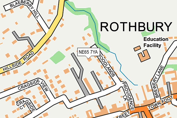
NE65 7YA is in Rothbury, Morpeth. NE65 7YA is located in the Rothbury electoral ward, within the unitary authority of Northumberland and the English Parliamentary constituency of Berwick-upon-Tweed. The Sub Integrated Care Board (ICB) Location is NHS North East and North Cumbria ICB - 00L and the police force is Northumbria. This postcode has been in use since January 1980.


GetTheData
Source: OS OpenMap – Local (Ordnance Survey)
Source: OS VectorMap District (Ordnance Survey)
Licence: Open Government Licence (requires attribution)
| Easting | 405626 |
| Northing | 601933 |
| Latitude | 55.311452 |
| Longitude | -1.912912 |
GetTheData
Source: Open Postcode Geo
Licence: Open Government Licence
| Locality | Rothbury |
| Town/City | Morpeth |
| Country | England |
| Postcode District | NE65 |
➜ See where NE65 is on a map ➜ Where is Rothbury? | |
GetTheData
Source: Land Registry Price Paid Data
Licence: Open Government Licence
Elevation or altitude of NE65 7YA as distance above sea level:
| Metres | Feet | |
|---|---|---|
| Elevation | 100m | 328ft |
Elevation is measured from the approximate centre of the postcode, to the nearest point on an OS contour line from OS Terrain 50, which has contour spacing of ten vertical metres.
➜ How high above sea level am I? Find the elevation of your current position using your device's GPS.
GetTheData
Source: Open Postcode Elevation
Licence: Open Government Licence
| Ward | Rothbury |
| Constituency | Berwick-upon-tweed |
GetTheData
Source: ONS Postcode Database
Licence: Open Government Licence
LOW HAVEN, BACKCROFT, ROTHBURY, MORPETH, NE65 7YA 2024 6 AUG £485,000 |
LOW HAVEN, BACKCROFT, ROTHBURY, MORPETH, NE65 7YA 2004 8 DEC £292,500 |
THE HAVEN, ROTHBURY, MORPETH, NE65 7YA 2001 7 SEP £225,000 |
GetTheData
Source: HM Land Registry Price Paid Data
Licence: Contains HM Land Registry data © Crown copyright and database right 2025. This data is licensed under the Open Government Licence v3.0.
| Queen's Head (Townfoot) | Rothbury | 269m |
| Queen's Head (Town Foot) | Rothbury | 281m |
| Library (High Street) | Rothbury | 294m |
| Library (High Street) | Rothbury | 305m |
| West End (High Street) | Rothbury | 416m |
GetTheData
Source: NaPTAN
Licence: Open Government Licence
GetTheData
Source: ONS Postcode Database
Licence: Open Government Licence


➜ Get more ratings from the Food Standards Agency
GetTheData
Source: Food Standards Agency
Licence: FSA terms & conditions
| Last Collection | |||
|---|---|---|---|
| Location | Mon-Fri | Sat | Distance |
| Rothbury Post Office | 17:15 | 12:00 | 296m |
| Hillside Road | 16:15 | 08:00 | 526m |
| Addeycombe Gardens | 16:45 | 09:00 | 536m |
GetTheData
Source: Dracos
Licence: Creative Commons Attribution-ShareAlike
The below table lists the International Territorial Level (ITL) codes (formerly Nomenclature of Territorial Units for Statistics (NUTS) codes) and Local Administrative Units (LAU) codes for NE65 7YA:
| ITL 1 Code | Name |
|---|---|
| TLC | North East (England) |
| ITL 2 Code | Name |
| TLC2 | Northumberland, and Tyne and Wear |
| ITL 3 Code | Name |
| TLC21 | Northumberland |
| LAU 1 Code | Name |
| E06000057 | Northumberland |
GetTheData
Source: ONS Postcode Directory
Licence: Open Government Licence
The below table lists the Census Output Area (OA), Lower Layer Super Output Area (LSOA), and Middle Layer Super Output Area (MSOA) for NE65 7YA:
| Code | Name | |
|---|---|---|
| OA | E00139258 | |
| LSOA | E01027369 | Northumberland 007C |
| MSOA | E02005705 | Northumberland 007 |
GetTheData
Source: ONS Postcode Directory
Licence: Open Government Licence
| NE65 7XZ | Woodlands | 35m |
| NE65 7YB | Back Crofts | 79m |
| NE65 7XY | Back Crofts | 110m |
| NE65 7YZ | Glendale Close | 130m |
| NE65 7YD | Mount Pleasant Villas | 151m |
| NE65 7SY | Providence Place | 179m |
| NE65 7TE | High Street | 190m |
| NE65 7YU | Cragside View | 194m |
| NE65 7TD | High Street | 194m |
| NE65 7TB | High Street | 194m |
GetTheData
Source: Open Postcode Geo; Land Registry Price Paid Data
Licence: Open Government Licence