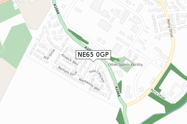
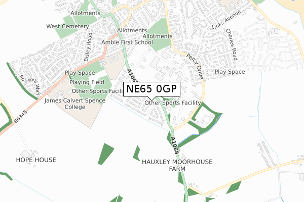
NE65 0GP is located in the Amble electoral ward, within the unitary authority of Northumberland and the English Parliamentary constituency of Berwick-upon-Tweed. The Sub Integrated Care Board (ICB) Location is NHS North East and North Cumbria ICB - 00L and the police force is Northumbria. This postcode has been in use since January 2018.


GetTheData
Source: OS Open Zoomstack (Ordnance Survey)
Licence: Open Government Licence (requires attribution)
Attribution: Contains OS data © Crown copyright and database right 2025
Source: Open Postcode Geo
Licence: Open Government Licence (requires attribution)
Attribution: Contains OS data © Crown copyright and database right 2025; Contains Royal Mail data © Royal Mail copyright and database right 2025; Source: Office for National Statistics licensed under the Open Government Licence v.3.0
| Easting | 426563 |
| Northing | 603617 |
| Latitude | 55.325907 |
| Longitude | -1.582922 |
GetTheData
Source: Open Postcode Geo
Licence: Open Government Licence
| Country | England |
| Postcode District | NE65 |
➜ See where NE65 is on a map ➜ Where is Amble? | |
GetTheData
Source: Land Registry Price Paid Data
Licence: Open Government Licence
| Ward | Amble |
| Constituency | Berwick-upon-tweed |
GetTheData
Source: ONS Postcode Database
Licence: Open Government Licence
2024 21 NOV £310,000 |
9, CHILLINGHAM COURT, AMBLE, MORPETH, NE65 0GP 2019 6 DEC £214,950 |
2, CHILLINGHAM COURT, AMBLE, MORPETH, NE65 0GP 2018 29 JUN £234,950 |
7, CHILLINGHAM COURT, AMBLE, MORPETH, NE65 0GP 2018 31 MAY £189,000 |
5, CHILLINGHAM COURT, AMBLE, MORPETH, NE65 0GP 2018 30 APR £192,700 |
3, CHILLINGHAM COURT, AMBLE, MORPETH, NE65 0GP 2018 29 MAR £194,000 |
2018 24 JAN £208,700 |
GetTheData
Source: HM Land Registry Price Paid Data
Licence: Contains HM Land Registry data © Crown copyright and database right 2025. This data is licensed under the Open Government Licence v3.0.
| Acklington Road | Amble By The Sea | 576m |
| Woodbine Street | Amble By The Sea | 620m |
| Philip Drive | Links Estate | 750m |
| Hauxley Road End (A1068) | Radcliffe | 794m |
| Estate Entrance (Acklington Road) | Gloster Park | 803m |
| Acklington Station | 4.8km |
GetTheData
Source: NaPTAN
Licence: Open Government Licence
| Percentage of properties with Next Generation Access | 0.0% |
| Percentage of properties with Superfast Broadband | 0.0% |
| Percentage of properties with Ultrafast Broadband | 0.0% |
| Percentage of properties with Full Fibre Broadband | 0.0% |
Superfast Broadband is between 30Mbps and 300Mbps
Ultrafast Broadband is > 300Mbps
| Median download speed | 19.9Mbps |
| Average download speed | 19.7Mbps |
| Maximum download speed | 21.18Mbps |
| Median upload speed | 1.1Mbps |
| Average upload speed | 1.1Mbps |
| Maximum upload speed | 1.24Mbps |
| Percentage of properties unable to receive 2Mbps | 0.0% |
| Percentage of properties unable to receive 5Mbps | 0.0% |
| Percentage of properties unable to receive 10Mbps | 0.0% |
| Percentage of properties unable to receive 30Mbps | 100.0% |
GetTheData
Source: Ofcom
Licence: Ofcom Terms of Use (requires attribution)
GetTheData
Source: ONS Postcode Database
Licence: Open Government Licence


➜ Get more ratings from the Food Standards Agency
GetTheData
Source: Food Standards Agency
Licence: FSA terms & conditions
| Last Collection | |||
|---|---|---|---|
| Location | Mon-Fri | Sat | Distance |
| Amble Industrial Estate | 16:30 | 09:00 | 67m |
| Percy Drive | 16:45 | 08:30 | 520m |
| Acklington Road | 17:00 | 09:00 | 619m |
GetTheData
Source: Dracos
Licence: Creative Commons Attribution-ShareAlike
The below table lists the International Territorial Level (ITL) codes (formerly Nomenclature of Territorial Units for Statistics (NUTS) codes) and Local Administrative Units (LAU) codes for NE65 0GP:
| ITL 1 Code | Name |
|---|---|
| TLC | North East (England) |
| ITL 2 Code | Name |
| TLC2 | Northumberland, and Tyne and Wear |
| ITL 3 Code | Name |
| TLC21 | Northumberland |
| LAU 1 Code | Name |
| E06000057 | Northumberland |
GetTheData
Source: ONS Postcode Directory
Licence: Open Government Licence
The below table lists the Census Output Area (OA), Lower Layer Super Output Area (LSOA), and Middle Layer Super Output Area (MSOA) for NE65 0GP:
| Code | Name | |
|---|---|---|
| OA | E00139217 | |
| LSOA | E01027362 | Northumberland 006B |
| MSOA | E02005704 | Northumberland 006 |
GetTheData
Source: ONS Postcode Directory
Licence: Open Government Licence
| NE65 0GQ | Alnwick Way | 120m |
| NE65 0GU | Norham Drive | 147m |
| NE65 0GT | Dunstanburgh Walk | 191m |
| NE65 0NB | Marks Bridge | 242m |
| NE65 0WH | Southmead | 407m |
| NE65 0QD | Newmoor Close | 436m |
| NE65 0PH | Meadowburn | 437m |
| NE65 0NA | Albert Street | 470m |
| NE65 0EH | Lindisfarne Road | 482m |
| NE65 0HY | Priory Park | 516m |
GetTheData
Source: Open Postcode Geo; Land Registry Price Paid Data
Licence: Open Government Licence