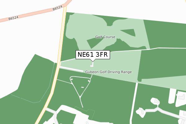
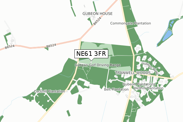
NE61 3FR is located in the Ponteland East and Stannington electoral ward, within the unitary authority of Northumberland and the English Parliamentary constituency of Hexham. The Sub Integrated Care Board (ICB) Location is NHS North East and North Cumbria ICB - 00L and the police force is Northumbria. This postcode has been in use since January 2020.


GetTheData
Source: OS Open Zoomstack (Ordnance Survey)
Licence: Open Government Licence (requires attribution)
Attribution: Contains OS data © Crown copyright and database right 2024
Source: Open Postcode Geo
Licence: Open Government Licence (requires attribution)
Attribution: Contains OS data © Crown copyright and database right 2024; Contains Royal Mail data © Royal Mail copyright and database right 2024; Source: Office for National Statistics licensed under the Open Government Licence v.3.0
| Easting | 416878 |
| Northing | 582273 |
| Latitude | 55.134543 |
| Longitude | -1.736825 |
GetTheData
Source: Open Postcode Geo
Licence: Open Government Licence
| Country | England |
| Postcode District | NE61 |
➜ See where NE61 is on a map | |
GetTheData
Source: Land Registry Price Paid Data
Licence: Open Government Licence
| Ward | Ponteland East And Stannington |
| Constituency | Hexham |
GetTheData
Source: ONS Postcode Database
Licence: Open Government Licence
| Cock Hill (Street) | Shilvington | 1,344m |
| Cock Hill (Street) | Shilvington | 1,352m |
| Bus Terminus (St Mary's Lane) | St Mary's | 1,825m |
| Morpeth Station | 4.6km |
GetTheData
Source: NaPTAN
Licence: Open Government Licence
GetTheData
Source: ONS Postcode Database
Licence: Open Government Licence


➜ Get more ratings from the Food Standards Agency
GetTheData
Source: Food Standards Agency
Licence: FSA terms & conditions
| Last Collection | |||
|---|---|---|---|
| Location | Mon-Fri | Sat | Distance |
| Tranwell Woods | 16:00 | 09:15 | 933m |
| Wellhill | 16:00 | 09:15 | 1,789m |
| West Duddo Post Office | 16:00 | 09:15 | 1,836m |
GetTheData
Source: Dracos
Licence: Creative Commons Attribution-ShareAlike
The below table lists the International Territorial Level (ITL) codes (formerly Nomenclature of Territorial Units for Statistics (NUTS) codes) and Local Administrative Units (LAU) codes for NE61 3FR:
| ITL 1 Code | Name |
|---|---|
| TLC | North East (England) |
| ITL 2 Code | Name |
| TLC2 | Northumberland, and Tyne and Wear |
| ITL 3 Code | Name |
| TLC21 | Northumberland |
| LAU 1 Code | Name |
| E06000057 | Northumberland |
GetTheData
Source: ONS Postcode Directory
Licence: Open Government Licence
The below table lists the Census Output Area (OA), Lower Layer Super Output Area (LSOA), and Middle Layer Super Output Area (MSOA) for NE61 3FR:
| Code | Name | |
|---|---|---|
| OA | E00139823 | |
| LSOA | E01027473 | Northumberland 015D |
| MSOA | E02005722 | Northumberland 015 |
GetTheData
Source: ONS Postcode Directory
Licence: Open Government Licence
| NE61 6AQ | 911m | |
| NE61 6BH | Gubeon Wood | 1125m |
| NE61 6BG | 1204m | |
| NE61 6AG | 1234m | |
| NE61 6BY | Rowan Drive | 1403m |
| NE61 6DA | Bowmont Walk | 1425m |
| NE61 6DB | Beamish Way | 1451m |
| NE61 3YL | 1464m | |
| NE61 6BP | Eden Walk | 1512m |
| NE61 6BN | Cheviot Way | 1600m |
GetTheData
Source: Open Postcode Geo; Land Registry Price Paid Data
Licence: Open Government Licence