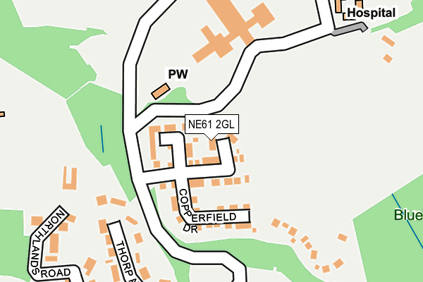
NE61 2GL is located in the Morpeth North electoral ward, within the unitary authority of Northumberland and the English Parliamentary constituency of Wansbeck. The Sub Integrated Care Board (ICB) Location is NHS North East and North Cumbria ICB - 00L and the police force is Northumbria. This postcode has been in use since June 2017.


GetTheData
Source: OS OpenMap – Local (Ordnance Survey)
Source: OS VectorMap District (Ordnance Survey)
Licence: Open Government Licence (requires attribution)
| Easting | 420187 |
| Northing | 586780 |
| Latitude | 55.174918 |
| Longitude | -1.684605 |
GetTheData
Source: Open Postcode Geo
Licence: Open Government Licence
| Country | England |
| Postcode District | NE61 |
➜ See where NE61 is on a map ➜ Where is Morpeth? | |
GetTheData
Source: Land Registry Price Paid Data
Licence: Open Government Licence
| Ward | Morpeth North |
| Constituency | Wansbeck |
GetTheData
Source: ONS Postcode Database
Licence: Open Government Licence
| The Mount (Dark Lane) | East Cottingwood | 408m |
| The Mount (Dark Lane) | East Cottingwood | 411m |
| East Mill (Whorral Bank) | East Cottingwood | 468m |
| East Mill (Whorral Bank) | East Cottingwood | 489m |
| Dark Lane | Morpeth | 644m |
| Morpeth Station | 1.4km |
| Pegswood Station | 2.6km |
GetTheData
Source: NaPTAN
Licence: Open Government Licence
| Percentage of properties with Next Generation Access | 100.0% |
| Percentage of properties with Superfast Broadband | 100.0% |
| Percentage of properties with Ultrafast Broadband | 0.0% |
| Percentage of properties with Full Fibre Broadband | 0.0% |
Superfast Broadband is between 30Mbps and 300Mbps
Ultrafast Broadband is > 300Mbps
| Median download speed | 29.8Mbps |
| Average download speed | 26.5Mbps |
| Maximum download speed | 33.59Mbps |
| Median upload speed | 3.8Mbps |
| Average upload speed | 4.2Mbps |
| Maximum upload speed | 7.65Mbps |
| Percentage of properties unable to receive 2Mbps | 0.0% |
| Percentage of properties unable to receive 5Mbps | 0.0% |
| Percentage of properties unable to receive 10Mbps | 0.0% |
| Percentage of properties unable to receive 30Mbps | 0.0% |
GetTheData
Source: Ofcom
Licence: Ofcom Terms of Use (requires attribution)
GetTheData
Source: ONS Postcode Database
Licence: Open Government Licence


➜ Get more ratings from the Food Standards Agency
GetTheData
Source: Food Standards Agency
Licence: FSA terms & conditions
| Last Collection | |||
|---|---|---|---|
| Location | Mon-Fri | Sat | Distance |
| Chantry Place | 17:30 | 12:00 | 890m |
| Chantry Place | 17:30 | 12:00 | 890m |
| Fulbeck House | 17:45 | 10:15 | 1,157m |
GetTheData
Source: Dracos
Licence: Creative Commons Attribution-ShareAlike
The below table lists the International Territorial Level (ITL) codes (formerly Nomenclature of Territorial Units for Statistics (NUTS) codes) and Local Administrative Units (LAU) codes for NE61 2GL:
| ITL 1 Code | Name |
|---|---|
| TLC | North East (England) |
| ITL 2 Code | Name |
| TLC2 | Northumberland, and Tyne and Wear |
| ITL 3 Code | Name |
| TLC21 | Northumberland |
| LAU 1 Code | Name |
| E06000057 | Northumberland |
GetTheData
Source: ONS Postcode Directory
Licence: Open Government Licence
The below table lists the Census Output Area (OA), Lower Layer Super Output Area (LSOA), and Middle Layer Super Output Area (MSOA) for NE61 2GL:
| Code | Name | |
|---|---|---|
| OA | E00139740 | |
| LSOA | E01027457 | Northumberland 011A |
| MSOA | E02005721 | Northumberland 011 |
GetTheData
Source: ONS Postcode Directory
Licence: Open Government Licence
| NE61 1JR | Thorp Avenue | 198m |
| NE61 1JL | Upper Fenwick Grove | 262m |
| NE61 1JJ | Northlands Road | 278m |
| NE61 1JS | Thorp Avenue | 288m |
| NE61 1JN | Oswald Road | 296m |
| NE61 1JP | Morrison Road | 337m |
| NE61 1JH | Olympia Hill | 366m |
| NE61 1JT | Thorp Avenue | 386m |
| NE61 1JG | Northbourne Avenue | 387m |
| NE61 1JW | Fenwick Grove | 414m |
GetTheData
Source: Open Postcode Geo; Land Registry Price Paid Data
Licence: Open Government Licence