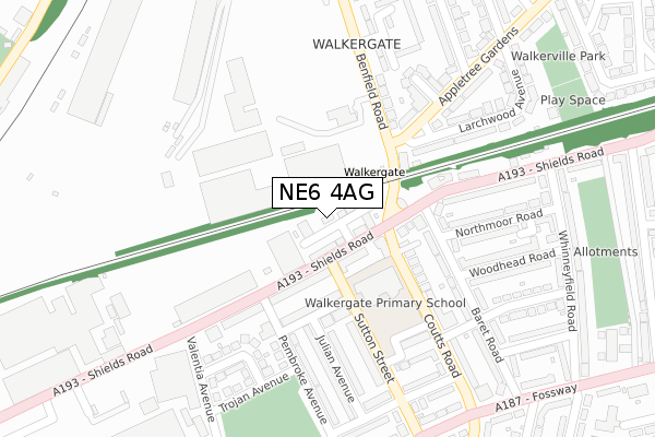
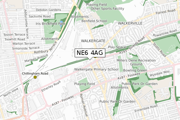
NE6 4AG is located in the Walkergate electoral ward, within the metropolitan district of Newcastle upon Tyne and the English Parliamentary constituency of Newcastle upon Tyne East. The Sub Integrated Care Board (ICB) Location is NHS North East and North Cumbria ICB - 13T and the police force is Northumbria. This postcode has been in use since June 2019.


GetTheData
Source: OS Open Zoomstack (Ordnance Survey)
Licence: Open Government Licence (requires attribution)
Attribution: Contains OS data © Crown copyright and database right 2025
Source: Open Postcode Geo
Licence: Open Government Licence (requires attribution)
Attribution: Contains OS data © Crown copyright and database right 2025; Contains Royal Mail data © Royal Mail copyright and database right 2025; Source: Office for National Statistics licensed under the Open Government Licence v.3.0
| Easting | 428228 |
| Northing | 565677 |
| Latitude | 54.984903 |
| Longitude | -1.560444 |
GetTheData
Source: Open Postcode Geo
Licence: Open Government Licence
| Country | England |
| Postcode District | NE6 |
➜ See where NE6 is on a map ➜ Where is Newcastle upon Tyne? | |
GetTheData
Source: Land Registry Price Paid Data
Licence: Open Government Licence
| Ward | Walkergate |
| Constituency | Newcastle Upon Tyne East |
GetTheData
Source: ONS Postcode Database
Licence: Open Government Licence
| Shields Road - Sutton Street (Shields Road) | Walkergate | 62m |
| Shields Road - Benfield Road (Shields Road) | Walkergate | 76m |
| Sutton Street | Walkergate | 94m |
| Sutton Street | Walkergate | 98m |
| Benfield Road - Appletree Gardens (Benfield Road) | Walkergate | 149m |
| Walkergate (Tyne And Wear Metro Station) (Benfield Road) | Walkergate | 109m |
| Chillingham Road (Tyne And Wear Metro Station) (Depot Road) | Heaton | 755m |
| Byker (Tyne And Wear Metro Station) (Byker Bridge) | Byker | 1,565m |
| Manors Station | 3.1km |
| Heworth Station | 3.7km |
| Newcastle Station | 4.1km |
GetTheData
Source: NaPTAN
Licence: Open Government Licence
| Percentage of properties with Next Generation Access | 100.0% |
| Percentage of properties with Superfast Broadband | 100.0% |
| Percentage of properties with Ultrafast Broadband | 100.0% |
| Percentage of properties with Full Fibre Broadband | 100.0% |
Superfast Broadband is between 30Mbps and 300Mbps
Ultrafast Broadband is > 300Mbps
| Percentage of properties unable to receive 2Mbps | 0.0% |
| Percentage of properties unable to receive 5Mbps | 0.0% |
| Percentage of properties unable to receive 10Mbps | 0.0% |
| Percentage of properties unable to receive 30Mbps | 0.0% |
GetTheData
Source: Ofcom
Licence: Ofcom Terms of Use (requires attribution)
GetTheData
Source: ONS Postcode Database
Licence: Open Government Licence


➜ Get more ratings from the Food Standards Agency
GetTheData
Source: Food Standards Agency
Licence: FSA terms & conditions
| Last Collection | |||
|---|---|---|---|
| Location | Mon-Fri | Sat | Distance |
| Walkergate Post Office | 17:30 | 12:00 | 114m |
| Appletree Gardens | 17:30 | 12:00 | 474m |
| Walkerville Post Office | 17:30 | 12:00 | 747m |
GetTheData
Source: Dracos
Licence: Creative Commons Attribution-ShareAlike
The below table lists the International Territorial Level (ITL) codes (formerly Nomenclature of Territorial Units for Statistics (NUTS) codes) and Local Administrative Units (LAU) codes for NE6 4AG:
| ITL 1 Code | Name |
|---|---|
| TLC | North East (England) |
| ITL 2 Code | Name |
| TLC2 | Northumberland, and Tyne and Wear |
| ITL 3 Code | Name |
| TLC22 | Tyneside |
| LAU 1 Code | Name |
| E08000021 | Newcastle upon Tyne |
GetTheData
Source: ONS Postcode Directory
Licence: Open Government Licence
The below table lists the Census Output Area (OA), Lower Layer Super Output Area (LSOA), and Middle Layer Super Output Area (MSOA) for NE6 4AG:
| Code | Name | |
|---|---|---|
| OA | E00042558 | |
| LSOA | E01008392 | Newcastle upon Tyne 026F |
| MSOA | E02001733 | Newcastle upon Tyne 026 |
GetTheData
Source: ONS Postcode Directory
Licence: Open Government Licence
| NE6 4QP | Shields Road | 90m |
| NE6 4NS | Shields Road | 117m |
| NE6 4RL | Walpole Street | 134m |
| NE6 4QN | Shields Road | 142m |
| NE6 4RB | Coutts Road | 158m |
| NE6 4RU | Baret Road | 197m |
| NE6 4RH | Sutton Street | 203m |
| NE6 4RJ | Julian Avenue | 220m |
| NE6 4RN | Ellesmere Avenue | 230m |
| NE6 4QU | Pembroke Avenue | 234m |
GetTheData
Source: Open Postcode Geo; Land Registry Price Paid Data
Licence: Open Government Licence