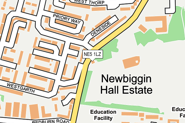
NE5 1LZ lies on Newbiggin Lane in Newcastle Upon Tyne. NE5 1LZ is located in the Kingston Park South & Newbiggin Hall electoral ward, within the metropolitan district of Newcastle upon Tyne and the English Parliamentary constituency of Newcastle upon Tyne North. The Sub Integrated Care Board (ICB) Location is NHS North East and North Cumbria ICB - 13T and the police force is Northumbria. This postcode has been in use since January 1980.


GetTheData
Source: OS OpenMap – Local (Ordnance Survey)
Source: OS VectorMap District (Ordnance Survey)
Licence: Open Government Licence (requires attribution)
| Easting | 419915 |
| Northing | 567822 |
| Latitude | 55.004577 |
| Longitude | -1.690197 |
GetTheData
Source: Open Postcode Geo
Licence: Open Government Licence
| Street | Newbiggin Lane |
| Town/City | Newcastle Upon Tyne |
| Country | England |
| Postcode District | NE5 |
➜ See where NE5 is on a map ➜ Where is Newcastle upon Tyne? | |
GetTheData
Source: Land Registry Price Paid Data
Licence: Open Government Licence
Elevation or altitude of NE5 1LZ as distance above sea level:
| Metres | Feet | |
|---|---|---|
| Elevation | 110m | 361ft |
Elevation is measured from the approximate centre of the postcode, to the nearest point on an OS contour line from OS Terrain 50, which has contour spacing of ten vertical metres.
➜ How high above sea level am I? Find the elevation of your current position using your device's GPS.
GetTheData
Source: Open Postcode Elevation
Licence: Open Government Licence
| Ward | Kingston Park South & Newbiggin Hall |
| Constituency | Newcastle Upon Tyne North |
GetTheData
Source: ONS Postcode Database
Licence: Open Government Licence
| Bedeburn Road-deneside (Bedeburn Road) | Newbiggin Hall | 170m |
| Newbiggin Lane-redburn Road (Newbiggin Lane) | Newbiggin Hall | 244m |
| Bedeburn Road-westgarth (Bedeburn Road) | Newbiggin Hall | 252m |
| Newbiggin Lane-trevelyan Drive (Newbiggin Lane) | Newbiggin Hall | 284m |
| Trevelyan Drive-anson Place (Trevelyan Drive) | Newbiggin Hall | 297m |
| Bank Foot (Tyne And Wear Metro Station) (Station Road) | Kenton Bank Foot | 1,305m |
| Newcastle Airport Metro | 3.7km |
| Blaydon Station | 4.5km |
| Newcastle Station | 6.2km |
GetTheData
Source: NaPTAN
Licence: Open Government Licence
| Percentage of properties with Next Generation Access | 100.0% |
| Percentage of properties with Superfast Broadband | 100.0% |
| Percentage of properties with Ultrafast Broadband | 0.0% |
| Percentage of properties with Full Fibre Broadband | 0.0% |
Superfast Broadband is between 30Mbps and 300Mbps
Ultrafast Broadband is > 300Mbps
| Percentage of properties unable to receive 2Mbps | 0.0% |
| Percentage of properties unable to receive 5Mbps | 0.0% |
| Percentage of properties unable to receive 10Mbps | 0.0% |
| Percentage of properties unable to receive 30Mbps | 0.0% |
GetTheData
Source: Ofcom
Licence: Ofcom Terms of Use (requires attribution)
GetTheData
Source: ONS Postcode Database
Licence: Open Government Licence


➜ Get more ratings from the Food Standards Agency
GetTheData
Source: Food Standards Agency
Licence: FSA terms & conditions
| Last Collection | |||
|---|---|---|---|
| Location | Mon-Fri | Sat | Distance |
| Grosvenor Way | 16:00 | 11:00 | 1,111m |
| Tudor Way | 17:30 | 11:15 | 1,280m |
| Hillheads Post Office | 17:45 | 11:15 | 1,393m |
GetTheData
Source: Dracos
Licence: Creative Commons Attribution-ShareAlike
The below table lists the International Territorial Level (ITL) codes (formerly Nomenclature of Territorial Units for Statistics (NUTS) codes) and Local Administrative Units (LAU) codes for NE5 1LZ:
| ITL 1 Code | Name |
|---|---|
| TLC | North East (England) |
| ITL 2 Code | Name |
| TLC2 | Northumberland, and Tyne and Wear |
| ITL 3 Code | Name |
| TLC22 | Tyneside |
| LAU 1 Code | Name |
| E08000021 | Newcastle upon Tyne |
GetTheData
Source: ONS Postcode Directory
Licence: Open Government Licence
The below table lists the Census Output Area (OA), Lower Layer Super Output Area (LSOA), and Middle Layer Super Output Area (MSOA) for NE5 1LZ:
| Code | Name | |
|---|---|---|
| OA | E00042928 | |
| LSOA | E01008457 | Newcastle upon Tyne 004C |
| MSOA | E02001711 | Newcastle upon Tyne 004 |
GetTheData
Source: ONS Postcode Directory
Licence: Open Government Licence
| NE5 4NR | Deneside | 128m |
| NE5 4NS | Westgarth | 181m |
| NE5 1NA | Newbiggin Lane | 186m |
| NE5 4NF | West Thorp | 193m |
| NE5 4DG | Shirlaw Close | 207m |
| NE5 4AZ | St Marks Court | 237m |
| NE5 4NE | West Thorp | 238m |
| NE5 4PN | Priory Way | 239m |
| NE5 4JN | Bedeburn Road | 242m |
| NE5 4PA | Westgarth | 258m |
GetTheData
Source: Open Postcode Geo; Land Registry Price Paid Data
Licence: Open Government Licence