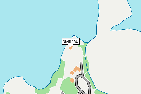
NE48 1AU is located in the Bellingham electoral ward, within the unitary authority of Northumberland and the English Parliamentary constituency of Hexham. The Sub Integrated Care Board (ICB) Location is NHS North East and North Cumbria ICB - 00L and the police force is Northumbria. This postcode has been in use since July 1986.


GetTheData
Source: OS OpenMap – Local (Ordnance Survey)
Source: OS VectorMap District (Ordnance Survey)
Licence: Open Government Licence (requires attribution)
| Easting | 369817 |
| Northing | 586916 |
| Latitude | 55.175615 |
| Longitude | -2.475442 |
GetTheData
Source: Open Postcode Geo
Licence: Open Government Licence
| Country | England |
| Postcode District | NE48 |
➜ See where NE48 is on a map | |
GetTheData
Source: Land Registry Price Paid Data
Licence: Open Government Licence
Elevation or altitude of NE48 1AU as distance above sea level:
| Metres | Feet | |
|---|---|---|
| Elevation | 190m | 623ft |
Elevation is measured from the approximate centre of the postcode, to the nearest point on an OS contour line from OS Terrain 50, which has contour spacing of ten vertical metres.
➜ How high above sea level am I? Find the elevation of your current position using your device's GPS.
GetTheData
Source: Open Postcode Elevation
Licence: Open Government Licence
| Ward | Bellingham |
| Constituency | Hexham |
GetTheData
Source: ONS Postcode Database
Licence: Open Government Licence
| Visitor Centre Road End (C200) | Tower Knowe | 275m |
| Visitor Centre Road End (C200) | Tower Knowe | 282m |
| Moor Cottages (C200) | Yarrow | 1,040m |
| Moor Cottages (C200) | Yarrow | 1,044m |
| Car Park (Hawkhope Road) | Hawkhope | 1,627m |
GetTheData
Source: NaPTAN
Licence: Open Government Licence
GetTheData
Source: ONS Postcode Database
Licence: Open Government Licence


➜ Get more ratings from the Food Standards Agency
GetTheData
Source: Food Standards Agency
Licence: FSA terms & conditions
| Last Collection | |||
|---|---|---|---|
| Location | Mon-Fri | Sat | Distance |
| Kielder Information Centre | 16:00 | 10:45 | 118m |
| Stannersburn | 16:00 | 10:30 | 2,402m |
| Falstone Post Office | 16:00 | 10:00 | 2,568m |
GetTheData
Source: Dracos
Licence: Creative Commons Attribution-ShareAlike
| Risk of NE48 1AU flooding from rivers and sea | High |
| ➜ NE48 1AU flood map | |
GetTheData
Source: Open Flood Risk by Postcode
Licence: Open Government Licence
The below table lists the International Territorial Level (ITL) codes (formerly Nomenclature of Territorial Units for Statistics (NUTS) codes) and Local Administrative Units (LAU) codes for NE48 1AU:
| ITL 1 Code | Name |
|---|---|
| TLC | North East (England) |
| ITL 2 Code | Name |
| TLC2 | Northumberland, and Tyne and Wear |
| ITL 3 Code | Name |
| TLC21 | Northumberland |
| LAU 1 Code | Name |
| E06000057 | Northumberland |
GetTheData
Source: ONS Postcode Directory
Licence: Open Government Licence
The below table lists the Census Output Area (OA), Lower Layer Super Output Area (LSOA), and Middle Layer Super Output Area (MSOA) for NE48 1AU:
| Code | Name | |
|---|---|---|
| OA | E00140008 | |
| LSOA | E01027503 | Northumberland 019C |
| MSOA | E02005727 | Northumberland 019 |
GetTheData
Source: ONS Postcode Directory
Licence: Open Government Licence
| NE48 1BH | Yarrow Moor | 1051m |
| NE48 1BG | 1719m | |
| NE48 1BB | 2043m | |
| NE48 1BD | Hawkhope Road | 2325m |
| NE48 1DD | 2426m | |
| NE48 1BJ | Braeside | 2524m |
| NE48 1AE | 2599m | |
| NE48 1AA | 2624m | |
| NE48 1BZ | Hawkhope Hill | 2647m |
| NE48 1AB | 2815m |
GetTheData
Source: Open Postcode Geo; Land Registry Price Paid Data
Licence: Open Government Licence