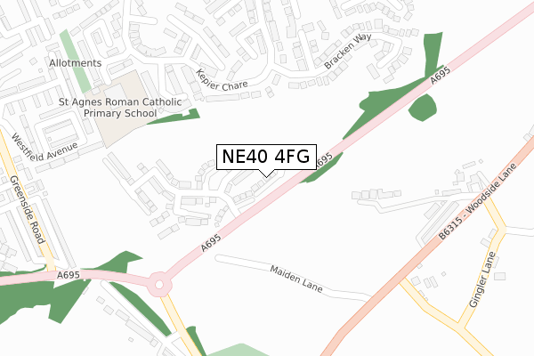
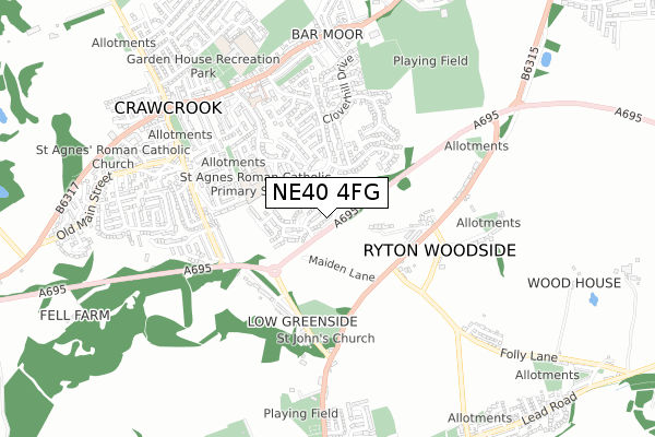
NE40 4FG is located in the Crawcrook and Greenside electoral ward, within the metropolitan district of Gateshead and the English Parliamentary constituency of Blaydon. The Sub Integrated Care Board (ICB) Location is NHS North East and North Cumbria ICB - 13T and the police force is Northumbria. This postcode has been in use since March 2018.


GetTheData
Source: OS Open Zoomstack (Ordnance Survey)
Licence: Open Government Licence (requires attribution)
Attribution: Contains OS data © Crown copyright and database right 2025
Source: Open Postcode Geo
Licence: Open Government Licence (requires attribution)
Attribution: Contains OS data © Crown copyright and database right 2025; Contains Royal Mail data © Royal Mail copyright and database right 2025; Source: Office for National Statistics licensed under the Open Government Licence v.3.0
| Easting | 414084 |
| Northing | 563174 |
| Latitude | 54.963008 |
| Longitude | -1.781582 |
GetTheData
Source: Open Postcode Geo
Licence: Open Government Licence
| Country | England |
| Postcode District | NE40 |
➜ See where NE40 is on a map ➜ Where is Crawcrook? | |
GetTheData
Source: Land Registry Price Paid Data
Licence: Open Government Licence
| Ward | Crawcrook And Greenside |
| Constituency | Blaydon |
GetTheData
Source: ONS Postcode Database
Licence: Open Government Licence
2024 6 SEP £352,000 |
2024 26 JUL £375,000 |
17, GLEBE VIEW, RYTON, NE40 4FG 2022 11 JUL £337,495 |
15, GLEBE VIEW, RYTON, NE40 4FG 2022 20 MAY £362,500 |
13, GLEBE VIEW, RYTON, NE40 4FG 2022 20 MAY £319,995 |
5, GLEBE VIEW, RYTON, NE40 4FG 2022 1 APR £327,495 |
3, GLEBE VIEW, RYTON, NE40 4FG 2022 31 MAR £232,750 |
1, GLEBE VIEW, RYTON, NE40 4FG 2022 31 MAR £314,995 |
11, GLEBE VIEW, RYTON, NE40 4FG 2022 25 MAR £332,995 |
9, GLEBE VIEW, RYTON, NE40 4FG 2022 25 MAR £354,995 |
GetTheData
Source: HM Land Registry Price Paid Data
Licence: Contains HM Land Registry data © Crown copyright and database right 2025. This data is licensed under the Open Government Licence v3.0.
| Kepier Chare | Crawcrook | 135m |
| Woodside Lane-maiden Lane (Woodside Lane) | Ryton Woodside | 330m |
| Woodside Lane-maiden Lane (Woodside Lane) | Ryton Woodside | 343m |
| Folly Lane-woodside Lane (Folly Lane) | Ryton Woodside | 389m |
| Woodside (Woodside Lane) | Ryton Woodside | 395m |
| Wylam Station | 2.5km |
| Blaydon Station | 4.4km |
GetTheData
Source: NaPTAN
Licence: Open Government Licence
| Percentage of properties with Next Generation Access | 100.0% |
| Percentage of properties with Superfast Broadband | 100.0% |
| Percentage of properties with Ultrafast Broadband | 100.0% |
| Percentage of properties with Full Fibre Broadband | 100.0% |
Superfast Broadband is between 30Mbps and 300Mbps
Ultrafast Broadband is > 300Mbps
| Percentage of properties unable to receive 2Mbps | 0.0% |
| Percentage of properties unable to receive 5Mbps | 0.0% |
| Percentage of properties unable to receive 10Mbps | 0.0% |
| Percentage of properties unable to receive 30Mbps | 0.0% |
GetTheData
Source: Ofcom
Licence: Ofcom Terms of Use (requires attribution)
GetTheData
Source: ONS Postcode Database
Licence: Open Government Licence


➜ Get more ratings from the Food Standards Agency
GetTheData
Source: Food Standards Agency
Licence: FSA terms & conditions
| Last Collection | |||
|---|---|---|---|
| Location | Mon-Fri | Sat | Distance |
| Kepier Chare | 17:30 | 11:00 | 145m |
| Woodside Lane | 16:15 | 10:30 | 381m |
| Dale View Gardens | 17:45 | 11:00 | 487m |
GetTheData
Source: Dracos
Licence: Creative Commons Attribution-ShareAlike
The below table lists the International Territorial Level (ITL) codes (formerly Nomenclature of Territorial Units for Statistics (NUTS) codes) and Local Administrative Units (LAU) codes for NE40 4FG:
| ITL 1 Code | Name |
|---|---|
| TLC | North East (England) |
| ITL 2 Code | Name |
| TLC2 | Northumberland, and Tyne and Wear |
| ITL 3 Code | Name |
| TLC22 | Tyneside |
| LAU 1 Code | Name |
| E08000037 | Gateshead |
GetTheData
Source: ONS Postcode Directory
Licence: Open Government Licence
The below table lists the Census Output Area (OA), Lower Layer Super Output Area (LSOA), and Middle Layer Super Output Area (MSOA) for NE40 4FG:
| Code | Name | |
|---|---|---|
| OA | E00041540 | |
| LSOA | E01008197 | Gateshead 002B |
| MSOA | E02001683 | Gateshead 002 |
GetTheData
Source: ONS Postcode Directory
Licence: Open Government Licence
| NE40 4UR | Kepier Chare | 159m |
| NE40 4TD | Greenacres Close | 202m |
| NE40 4QR | Delhi View | 205m |
| NE40 4XW | Laurel Way | 219m |
| NE40 4UL | Hill Rise | 238m |
| NE40 4XP | Bracken Way | 256m |
| NE40 4UT | Shaftoe Close | 264m |
| NE40 4TE | Long Meadow Close | 274m |
| NE40 4XN | Catkin Walk | 289m |
| NE40 4QS | Delhi Gardens | 318m |
GetTheData
Source: Open Postcode Geo; Land Registry Price Paid Data
Licence: Open Government Licence