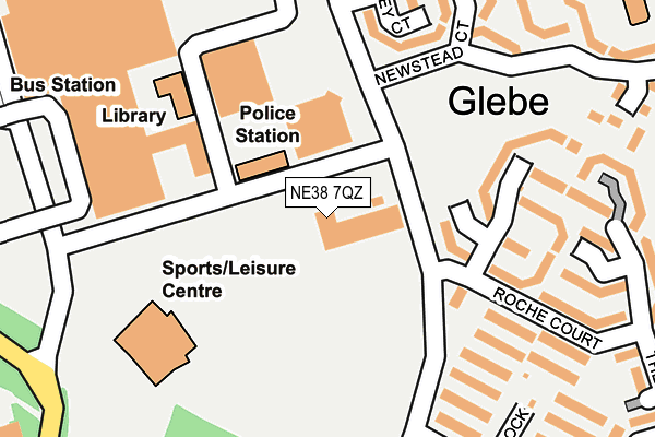
NE38 7QZ is located in the Washington Central electoral ward, within the metropolitan district of Sunderland and the English Parliamentary constituency of Washington and Sunderland West. The Sub Integrated Care Board (ICB) Location is NHS North East and North Cumbria ICB - 00P and the police force is Northumbria. This postcode has been in use since May 2007.


GetTheData
Source: OS OpenMap – Local (Ordnance Survey)
Source: OS VectorMap District (Ordnance Survey)
Licence: Open Government Licence (requires attribution)
| Easting | 430295 |
| Northing | 556031 |
| Latitude | 54.898096 |
| Longitude | -1.529145 |
GetTheData
Source: Open Postcode Geo
Licence: Open Government Licence
| Country | England |
| Postcode District | NE38 |
➜ See where NE38 is on a map ➜ Where is Washington? | |
GetTheData
Source: Land Registry Price Paid Data
Licence: Open Government Licence
Elevation or altitude of NE38 7QZ as distance above sea level:
| Metres | Feet | |
|---|---|---|
| Elevation | 60m | 197ft |
Elevation is measured from the approximate centre of the postcode, to the nearest point on an OS contour line from OS Terrain 50, which has contour spacing of ten vertical metres.
➜ How high above sea level am I? Find the elevation of your current position using your device's GPS.
GetTheData
Source: Open Postcode Elevation
Licence: Open Government Licence
| Ward | Washington Central |
| Constituency | Washington And Sunderland West |
GetTheData
Source: ONS Postcode Database
Licence: Open Government Licence
| Police Link Road - Leisure Centre (Police Link Road) | Washington | 55m |
| Police Link Road - Leisure Centre (Police Link Road) | Washington | 61m |
| Glebe (Newstead Court) | Washington | 254m |
| Glebe (Newstead Court) | Washington | 257m |
| Titchfield Road | Biddick | 339m |
| Chester-le-Street Station | 5.8km |
GetTheData
Source: NaPTAN
Licence: Open Government Licence
GetTheData
Source: ONS Postcode Database
Licence: Open Government Licence


➜ Get more ratings from the Food Standards Agency
GetTheData
Source: Food Standards Agency
Licence: FSA terms & conditions
| Last Collection | |||
|---|---|---|---|
| Location | Mon-Fri | Sat | Distance |
| Asda, The Galleries | 18:30 | 13:00 | 232m |
| The Galleries | 18:30 | 253m | |
| Newstead Court | 17:00 | 10:30 | 261m |
GetTheData
Source: Dracos
Licence: Creative Commons Attribution-ShareAlike
The below table lists the International Territorial Level (ITL) codes (formerly Nomenclature of Territorial Units for Statistics (NUTS) codes) and Local Administrative Units (LAU) codes for NE38 7QZ:
| ITL 1 Code | Name |
|---|---|
| TLC | North East (England) |
| ITL 2 Code | Name |
| TLC2 | Northumberland, and Tyne and Wear |
| ITL 3 Code | Name |
| TLC23 | Sunderland |
| LAU 1 Code | Name |
| E08000024 | Sunderland |
GetTheData
Source: ONS Postcode Directory
Licence: Open Government Licence
The below table lists the Census Output Area (OA), Lower Layer Super Output Area (LSOA), and Middle Layer Super Output Area (MSOA) for NE38 7QZ:
| Code | Name | |
|---|---|---|
| OA | E00044915 | |
| LSOA | E01008848 | Sunderland 019C |
| MSOA | E02001809 | Sunderland 019 |
GetTheData
Source: ONS Postcode Directory
Licence: Open Government Licence
| NE38 7PH | Roche Court | 110m |
| NE38 7PD | Talley Court | 169m |
| NE38 7PS | Roche Court | 176m |
| NE38 7QU | Wenlock | 200m |
| NE38 7PJ | Roche Court | 205m |
| NE38 7QS | Roche Court | 215m |
| NE38 7PN | Roche Court | 222m |
| NE38 7PF | Newstead Court | 226m |
| NE38 7PB | Talley Court | 227m |
| NE38 7PR | Roche Court | 246m |
GetTheData
Source: Open Postcode Geo; Land Registry Price Paid Data
Licence: Open Government Licence