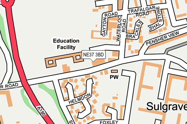
NE37 3BD is located in the Washington North electoral ward, within the metropolitan district of Sunderland and the English Parliamentary constituency of Washington and Sunderland West. The Sub Integrated Care Board (ICB) Location is NHS North East and North Cumbria ICB - 00P and the police force is Northumbria. This postcode has been in use since January 1980.


GetTheData
Source: OS OpenMap – Local (Ordnance Survey)
Source: OS VectorMap District (Ordnance Survey)
Licence: Open Government Licence (requires attribution)
| Easting | 431324 |
| Northing | 558014 |
| Latitude | 54.915852 |
| Longitude | -1.512886 |
GetTheData
Source: Open Postcode Geo
Licence: Open Government Licence
| Country | England |
| Postcode District | NE37 |
➜ See where NE37 is on a map ➜ Where is Washington? | |
GetTheData
Source: Land Registry Price Paid Data
Licence: Open Government Licence
Elevation or altitude of NE37 3BD as distance above sea level:
| Metres | Feet | |
|---|---|---|
| Elevation | 50m | 164ft |
Elevation is measured from the approximate centre of the postcode, to the nearest point on an OS contour line from OS Terrain 50, which has contour spacing of ten vertical metres.
➜ How high above sea level am I? Find the elevation of your current position using your device's GPS.
GetTheData
Source: Open Postcode Elevation
Licence: Open Government Licence
| Ward | Washington North |
| Constituency | Washington And Sunderland West |
GetTheData
Source: ONS Postcode Database
Licence: Open Government Licence
| Waterloo Road | Sulgrave | 113m |
| Marlborough Road | Sulgrave | 124m |
| Marlborough Road | Sulgrave | 133m |
| Waterloo Road | Sulgrave | 148m |
| Manor Road-northumberland Way (Manor Road) | Concord | 253m |
| Heworth Station | 4.8km |
| Brockley Whins Station | 5.9km |
GetTheData
Source: NaPTAN
Licence: Open Government Licence
GetTheData
Source: ONS Postcode Database
Licence: Open Government Licence


➜ Get more ratings from the Food Standards Agency
GetTheData
Source: Food Standards Agency
Licence: FSA terms & conditions
| Last Collection | |||
|---|---|---|---|
| Location | Mon-Fri | Sat | Distance |
| Manor Road | 12:45 | 10:00 | 290m |
| Trafalgar Road | 12:45 | 09:30 | 301m |
| Edith Avenue | 16:00 | 13:00 | 321m |
GetTheData
Source: Dracos
Licence: Creative Commons Attribution-ShareAlike
The below table lists the International Territorial Level (ITL) codes (formerly Nomenclature of Territorial Units for Statistics (NUTS) codes) and Local Administrative Units (LAU) codes for NE37 3BD:
| ITL 1 Code | Name |
|---|---|
| TLC | North East (England) |
| ITL 2 Code | Name |
| TLC2 | Northumberland, and Tyne and Wear |
| ITL 3 Code | Name |
| TLC23 | Sunderland |
| LAU 1 Code | Name |
| E08000024 | Sunderland |
GetTheData
Source: ONS Postcode Directory
Licence: Open Government Licence
The below table lists the Census Output Area (OA), Lower Layer Super Output Area (LSOA), and Middle Layer Super Output Area (MSOA) for NE37 3BD:
| Code | Name | |
|---|---|---|
| OA | E00044950 | |
| LSOA | E01008855 | Sunderland 007A |
| MSOA | E02001797 | Sunderland 007 |
GetTheData
Source: ONS Postcode Directory
Licence: Open Government Licence
| NE37 3BB | Manor Road | 50m |
| NE37 3AP | Helmdon | 115m |
| NE37 3EN | Waterloo Walk | 156m |
| NE37 3BN | Foxley | 158m |
| NE37 3DP | Brackley | 161m |
| NE37 3DT | Wellington Court | 187m |
| NE37 3DX | Waterloo Court | 187m |
| NE37 3DU | Wellington Court | 193m |
| NE37 3EL | Waterloo Walk | 199m |
| NE37 3EZ | Cornwallis | 215m |
GetTheData
Source: Open Postcode Geo; Land Registry Price Paid Data
Licence: Open Government Licence