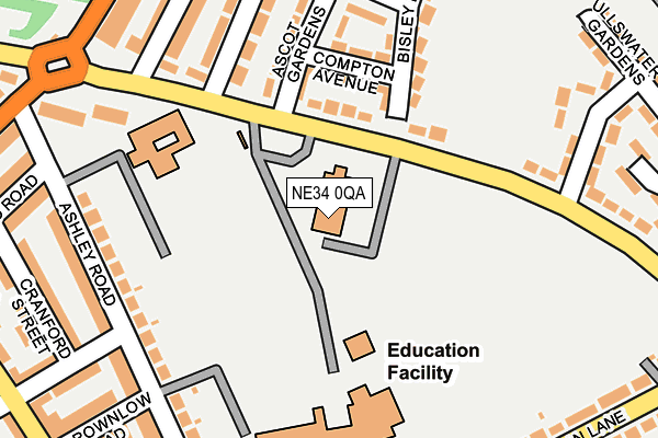
NE34 0QA is located in the West Park electoral ward, within the metropolitan district of South Tyneside and the English Parliamentary constituency of South Shields. The Sub Integrated Care Board (ICB) Location is NHS North East and North Cumbria ICB - 00N and the police force is Northumbria. This postcode has been in use since January 1980.


GetTheData
Source: OS OpenMap – Local (Ordnance Survey)
Source: OS VectorMap District (Ordnance Survey)
Licence: Open Government Licence (requires attribution)
| Easting | 436639 |
| Northing | 564886 |
| Latitude | 54.977242 |
| Longitude | -1.429104 |
GetTheData
Source: Open Postcode Geo
Licence: Open Government Licence
| Country | England |
| Postcode District | NE34 |
➜ See where NE34 is on a map ➜ Where is South Shields? | |
GetTheData
Source: Land Registry Price Paid Data
Licence: Open Government Licence
Elevation or altitude of NE34 0QA as distance above sea level:
| Metres | Feet | |
|---|---|---|
| Elevation | 20m | 66ft |
Elevation is measured from the approximate centre of the postcode, to the nearest point on an OS contour line from OS Terrain 50, which has contour spacing of ten vertical metres.
➜ How high above sea level am I? Find the elevation of your current position using your device's GPS.
GetTheData
Source: Open Postcode Elevation
Licence: Open Government Licence
| Ward | West Park |
| Constituency | South Shields |
GetTheData
Source: ONS Postcode Database
Licence: Open Government Licence
| St Wilfrid's Rc Comprehensive School (Brownlow Road) | Harton Moor | 135m |
| Temple Park Road-ullswater Gardens (Temple Park Road) | West Park | 152m |
| Temple Park Road-recreation Ground (Temple Park Road) | West Park | 173m |
| Temple Park Road-stanhope Road (Temple Park Road) | West Park | 235m |
| Harton Lane-school (Harton Lane) | Harton Moor | 287m |
| Tyne Dock (Tyne And Wear Metro Station) (Napier Street) | Tyne Dock | 814m |
| Chichester (Tyne And Wear Metro Station) (Laygate) | Chichester | 1,035m |
| Brockley Whins Station | 2.9km |
| East Boldon Station | 3.5km |
GetTheData
Source: NaPTAN
Licence: Open Government Licence
GetTheData
Source: ONS Postcode Database
Licence: Open Government Licence


➜ Get more ratings from the Food Standards Agency
GetTheData
Source: Food Standards Agency
Licence: FSA terms & conditions
| Last Collection | |||
|---|---|---|---|
| Location | Mon-Fri | Sat | Distance |
| Temple Park Road | 17:00 | 09:30 | 218m |
| St Oswins Street | 17:00 | 09:30 | 331m |
| West Park Post Office | 17:30 | 10:30 | 336m |
GetTheData
Source: Dracos
Licence: Creative Commons Attribution-ShareAlike
The below table lists the International Territorial Level (ITL) codes (formerly Nomenclature of Territorial Units for Statistics (NUTS) codes) and Local Administrative Units (LAU) codes for NE34 0QA:
| ITL 1 Code | Name |
|---|---|
| TLC | North East (England) |
| ITL 2 Code | Name |
| TLC2 | Northumberland, and Tyne and Wear |
| ITL 3 Code | Name |
| TLC22 | Tyneside |
| LAU 1 Code | Name |
| E08000023 | South Tyneside |
GetTheData
Source: ONS Postcode Directory
Licence: Open Government Licence
The below table lists the Census Output Area (OA), Lower Layer Super Output Area (LSOA), and Middle Layer Super Output Area (MSOA) for NE34 0QA:
| Code | Name | |
|---|---|---|
| OA | E00044077 | |
| LSOA | E01008679 | South Tyneside 005A |
| MSOA | E02001772 | South Tyneside 005 |
GetTheData
Source: ONS Postcode Directory
Licence: Open Government Licence
| NE34 0PU | Temple Park Road | 98m |
| NE34 0PZ | Compton Avenue | 127m |
| NE33 4RS | Temple Park Road | 182m |
| NE34 0PX | Ascot Gardens | 183m |
| NE33 4SG | Reading Road | 217m |
| NE34 0PD | Ashley Road | 228m |
| NE34 0PY | Bisley Drive | 230m |
| NE33 4SB | Birchington Avenue | 254m |
| NE34 0QN | Cranford Street | 266m |
| NE34 0PE | Ashley Road | 267m |
GetTheData
Source: Open Postcode Geo; Land Registry Price Paid Data
Licence: Open Government Licence