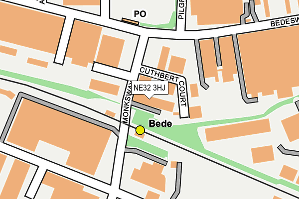
NE32 3HJ is located in the Bede electoral ward, within the metropolitan district of South Tyneside and the English Parliamentary constituency of Jarrow. The Sub Integrated Care Board (ICB) Location is NHS North East and North Cumbria ICB - 00N and the police force is Northumbria. This postcode has been in use since January 1980.


GetTheData
Source: OS OpenMap – Local (Ordnance Survey)
Source: OS VectorMap District (Ordnance Survey)
Licence: Open Government Licence (requires attribution)
| Easting | 434355 |
| Northing | 564584 |
| Latitude | 54.974691 |
| Longitude | -1.464822 |
GetTheData
Source: Open Postcode Geo
Licence: Open Government Licence
| Country | England |
| Postcode District | NE32 |
➜ See where NE32 is on a map ➜ Where is Jarrow? | |
GetTheData
Source: Land Registry Price Paid Data
Licence: Open Government Licence
Elevation or altitude of NE32 3HJ as distance above sea level:
| Metres | Feet | |
|---|---|---|
| Elevation | 10m | 33ft |
Elevation is measured from the approximate centre of the postcode, to the nearest point on an OS contour line from OS Terrain 50, which has contour spacing of ten vertical metres.
➜ How high above sea level am I? Find the elevation of your current position using your device's GPS.
GetTheData
Source: Open Postcode Elevation
Licence: Open Government Licence
| Ward | Bede |
| Constituency | Jarrow |
GetTheData
Source: ONS Postcode Database
Licence: Open Government Licence
| Bede Industrial Estate (Bedesway) | Bede | 128m |
| Bede Industrial Estate (Bedesway) | Bede | 170m |
| Pilgrimsway (Pilgrimsway East) | Bede | 216m |
| Bedesway | Bede | 329m |
| Swinburne Street | Bede | 350m |
| Bede (Tyne And Wear Metro Station) (Monksway) | Bede | 35m |
| Simonside (Tyne And Wear Metro Station) (Not Specified) | Simonside | 740m |
| Tyne Dock (Tyne And Wear Metro Station) (Napier Street) | Tyne Dock | 1,490m |
| Brockley Whins Station | 1.7km |
| East Boldon Station | 4.2km |
GetTheData
Source: NaPTAN
Licence: Open Government Licence
GetTheData
Source: ONS Postcode Database
Licence: Open Government Licence


➜ Get more ratings from the Food Standards Agency
GetTheData
Source: Food Standards Agency
Licence: FSA terms & conditions
| Last Collection | |||
|---|---|---|---|
| Location | Mon-Fri | Sat | Distance |
| Bede Trading Estate | 17:30 | 10:30 | 151m |
| Falmouth Drive | 17:30 | 10:30 | 469m |
| Salcombe Avenue | 17:30 | 10:30 | 580m |
GetTheData
Source: Dracos
Licence: Creative Commons Attribution-ShareAlike
The below table lists the International Territorial Level (ITL) codes (formerly Nomenclature of Territorial Units for Statistics (NUTS) codes) and Local Administrative Units (LAU) codes for NE32 3HJ:
| ITL 1 Code | Name |
|---|---|
| TLC | North East (England) |
| ITL 2 Code | Name |
| TLC2 | Northumberland, and Tyne and Wear |
| ITL 3 Code | Name |
| TLC22 | Tyneside |
| LAU 1 Code | Name |
| E08000023 | South Tyneside |
GetTheData
Source: ONS Postcode Directory
Licence: Open Government Licence
The below table lists the Census Output Area (OA), Lower Layer Super Output Area (LSOA), and Middle Layer Super Output Area (MSOA) for NE32 3HJ:
| Code | Name | |
|---|---|---|
| OA | E00043669 | |
| LSOA | E01008600 | South Tyneside 007A |
| MSOA | E02001774 | South Tyneside 007 |
GetTheData
Source: ONS Postcode Directory
Licence: Open Government Licence
| NE32 3EG | Bedesway | 94m |
| NE32 3UP | Tyne Point Industrial Estate | 249m |
| NE34 9PZ | Waldridge Way | 336m |
| NE32 3RR | Taunton Avenue | 380m |
| NE34 9PH | Shaftesbury Avenue | 396m |
| NE34 9QA | Finlay Court | 411m |
| NE32 3TD | Falmouth Drive | 416m |
| NE32 3TB | Tavistock Place | 434m |
| NE32 3RS | Clovelly Place | 438m |
| NE32 3RT | Taunton Avenue | 449m |
GetTheData
Source: Open Postcode Geo; Land Registry Price Paid Data
Licence: Open Government Licence