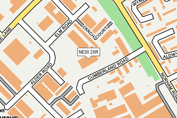
NE30 2XR is located in the Collingwood electoral ward, within the metropolitan district of North Tyneside and the English Parliamentary constituency of Tynemouth. The Sub Integrated Care Board (ICB) Location is NHS North East and North Cumbria ICB - 99C and the police force is Northumbria. This postcode has been in use since March 2008.


GetTheData
Source: OS OpenMap – Local (Ordnance Survey)
Source: OS VectorMap District (Ordnance Survey)
Licence: Open Government Licence (requires attribution)
| Easting | 432687 |
| Northing | 569414 |
| Latitude | 55.018204 |
| Longitude | -1.490329 |
GetTheData
Source: Open Postcode Geo
Licence: Open Government Licence
| Country | England |
| Postcode District | NE30 |
➜ See where NE30 is on a map ➜ Where is Tynemouth? | |
GetTheData
Source: Land Registry Price Paid Data
Licence: Open Government Licence
Elevation or altitude of NE30 2XR as distance above sea level:
| Metres | Feet | |
|---|---|---|
| Elevation | 60m | 197ft |
Elevation is measured from the approximate centre of the postcode, to the nearest point on an OS contour line from OS Terrain 50, which has contour spacing of ten vertical metres.
➜ How high above sea level am I? Find the elevation of your current position using your device's GPS.
GetTheData
Source: Open Postcode Elevation
Licence: Open Government Licence
| Ward | Collingwood |
| Constituency | Tynemouth |
GetTheData
Source: ONS Postcode Database
Licence: Open Government Licence
| Norham Road North-balkwall Farm (Norham Road North) | West Chirton | 188m |
| Norham Road North-balkwell Farm (Norham Road North) | West Chirton | 201m |
| Norham Road North-elm Road (Norham Road North) | New York | 273m |
| Middle Engine Lane-alder Road (Middle Engine Lane) | Cobalt | 276m |
| Middle Engine Lane-new York Way (Middle Engine Lane) | Cobalt | 282m |
GetTheData
Source: NaPTAN
Licence: Open Government Licence
GetTheData
Source: ONS Postcode Database
Licence: Open Government Licence


➜ Get more ratings from the Food Standards Agency
GetTheData
Source: Food Standards Agency
Licence: FSA terms & conditions
| Last Collection | |||
|---|---|---|---|
| Location | Mon-Fri | Sat | Distance |
| Silverlink Industrial Estate | 18:45 | 10:30 | 153m |
| North Tyneside Delivery Office | 18:45 | 12:45 | 313m |
| Malvern Rod | 16:30 | 12:45 | 1,236m |
GetTheData
Source: Dracos
Licence: Creative Commons Attribution-ShareAlike
The below table lists the International Territorial Level (ITL) codes (formerly Nomenclature of Territorial Units for Statistics (NUTS) codes) and Local Administrative Units (LAU) codes for NE30 2XR:
| ITL 1 Code | Name |
|---|---|
| TLC | North East (England) |
| ITL 2 Code | Name |
| TLC2 | Northumberland, and Tyne and Wear |
| ITL 3 Code | Name |
| TLC22 | Tyneside |
| LAU 1 Code | Name |
| E08000022 | North Tyneside |
GetTheData
Source: ONS Postcode Directory
Licence: Open Government Licence
The below table lists the Census Output Area (OA), Lower Layer Super Output Area (LSOA), and Middle Layer Super Output Area (MSOA) for NE30 2XR:
| Code | Name | |
|---|---|---|
| OA | E00043079 | |
| LSOA | E01008491 | North Tyneside 015D |
| MSOA | E02001752 | North Tyneside 015 |
GetTheData
Source: ONS Postcode Directory
Licence: Open Government Licence
| NE29 8RZ | Norham Road North | 202m |
| NE29 8SX | Wyndham Way | 244m |
| NE29 8RQ | Gloucester Road | 259m |
| NE29 8SY | Aldwych Drive | 281m |
| NE29 8SZ | Aldwych Drive | 281m |
| NE29 8SU | Wyndham Way | 283m |
| NE29 8SD | Alder Road | 299m |
| NE29 8BU | Dereham Way | 306m |
| NE29 8ST | Ambassadors Way | 309m |
| NE29 8RY | Moor Park Road | 312m |
GetTheData
Source: Open Postcode Geo; Land Registry Price Paid Data
Licence: Open Government Licence