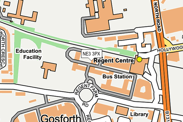
NE3 3PX is located in the Fawdon & West Gosforth electoral ward, within the metropolitan district of Newcastle upon Tyne and the English Parliamentary constituency of Newcastle upon Tyne Central. The Sub Integrated Care Board (ICB) Location is NHS North East and North Cumbria ICB - 13T and the police force is Northumbria. This postcode has been in use since January 1992.


GetTheData
Source: OS OpenMap – Local (Ordnance Survey)
Source: OS VectorMap District (Ordnance Survey)
Licence: Open Government Licence (requires attribution)
| Easting | 424117 |
| Northing | 568663 |
| Latitude | 55.011943 |
| Longitude | -1.624418 |
GetTheData
Source: Open Postcode Geo
Licence: Open Government Licence
| Country | England |
| Postcode District | NE3 |
➜ See where NE3 is on a map ➜ Where is Newcastle upon Tyne? | |
GetTheData
Source: Land Registry Price Paid Data
Licence: Open Government Licence
Elevation or altitude of NE3 3PX as distance above sea level:
| Metres | Feet | |
|---|---|---|
| Elevation | 60m | 197ft |
Elevation is measured from the approximate centre of the postcode, to the nearest point on an OS contour line from OS Terrain 50, which has contour spacing of ten vertical metres.
➜ How high above sea level am I? Find the elevation of your current position using your device's GPS.
GetTheData
Source: Open Postcode Elevation
Licence: Open Government Licence
| Ward | Fawdon & West Gosforth |
| Constituency | Newcastle Upon Tyne Central |
GetTheData
Source: ONS Postcode Database
Licence: Open Government Licence
| Gosforth High School (Knightsbridge) | Gosforth | 185m |
| Hollywood Avenue-asda (Hollywood Avenue) | Gosforth | 283m |
| Great North Road-park Avenue (Great North Road) | Gosforth | 344m |
| Gosforth Asda (Asda Carpark) | Gosforth | 370m |
| Great North Road-park Avenue (Great North Road) | Gosforth | 404m |
| Regent Centre (Tyne And Wear Metro Station) (Great North Road) | Regent Centre | 155m |
| Wansbeck Road (Tyne And Wear Metro Station) (Wansbeck Road North) | Coxlodge | 714m |
| South Gosforth (Tyne And Wear Metro Station) (Balmoral Terrace) | South Gosforth | 1,226m |
| Fawdon (Tyne And Wear Metro Station) (Fawdon Lane) | Fawdon | 1,306m |
| Ilford Road (Tyne And Wear Metro Station) (Ilford Road) | West Jesmond | 1,573m |
| Manors Station | 4.5km |
| Newcastle Station | 4.9km |
GetTheData
Source: NaPTAN
Licence: Open Government Licence
GetTheData
Source: ONS Postcode Database
Licence: Open Government Licence


➜ Get more ratings from the Food Standards Agency
GetTheData
Source: Food Standards Agency
Licence: FSA terms & conditions
| Last Collection | |||
|---|---|---|---|
| Location | Mon-Fri | Sat | Distance |
| Henry Street | 17:30 | 11:45 | 345m |
| Grange Park Post Office | 17:30 | 12:00 | 417m |
| Ashburton Road | 17:45 | 11:00 | 443m |
GetTheData
Source: Dracos
Licence: Creative Commons Attribution-ShareAlike
The below table lists the International Territorial Level (ITL) codes (formerly Nomenclature of Territorial Units for Statistics (NUTS) codes) and Local Administrative Units (LAU) codes for NE3 3PX:
| ITL 1 Code | Name |
|---|---|
| TLC | North East (England) |
| ITL 2 Code | Name |
| TLC2 | Northumberland, and Tyne and Wear |
| ITL 3 Code | Name |
| TLC22 | Tyneside |
| LAU 1 Code | Name |
| E08000021 | Newcastle upon Tyne |
GetTheData
Source: ONS Postcode Directory
Licence: Open Government Licence
The below table lists the Census Output Area (OA), Lower Layer Super Output Area (LSOA), and Middle Layer Super Output Area (MSOA) for NE3 3PX:
| Code | Name | |
|---|---|---|
| OA | E00042397 | |
| LSOA | E01008358 | Newcastle upon Tyne 002E |
| MSOA | E02001709 | Newcastle upon Tyne 002 |
GetTheData
Source: ONS Postcode Directory
Licence: Open Government Licence
| NE3 2JW | Knightsbridge Court | 168m |
| NE3 2JZ | Knightsbridge Court | 177m |
| NE3 1DP | Hedley Terrace | 245m |
| NE3 1EH | Regent Road North | 261m |
| NE3 5JG | Great North Road | 278m |
| NE3 2HL | Park Avenue | 288m |
| NE3 1HS | Lansdowne Crescent | 301m |
| NE3 2HJ | Park Avenue | 307m |
| NE3 3JA | Warkworth Crescent | 311m |
| NE3 2LD | Park Avenue | 324m |
GetTheData
Source: Open Postcode Geo; Land Registry Price Paid Data
Licence: Open Government Licence