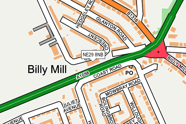
NE29 8NB is located in the Collingwood electoral ward, within the metropolitan district of North Tyneside and the English Parliamentary constituency of Tynemouth. The Sub Integrated Care Board (ICB) Location is NHS North East and North Cumbria ICB - 99C and the police force is Northumbria. This postcode has been in use since January 1980.


GetTheData
Source: OS OpenMap – Local (Ordnance Survey)
Source: OS VectorMap District (Ordnance Survey)
Licence: Open Government Licence (requires attribution)
| Easting | 433850 |
| Northing | 569051 |
| Latitude | 55.014865 |
| Longitude | -1.472185 |
GetTheData
Source: Open Postcode Geo
Licence: Open Government Licence
| Country | England |
| Postcode District | NE29 |
➜ See where NE29 is on a map ➜ Where is Tynemouth? | |
GetTheData
Source: Land Registry Price Paid Data
Licence: Open Government Licence
Elevation or altitude of NE29 8NB as distance above sea level:
| Metres | Feet | |
|---|---|---|
| Elevation | 60m | 197ft |
Elevation is measured from the approximate centre of the postcode, to the nearest point on an OS contour line from OS Terrain 50, which has contour spacing of ten vertical metres.
➜ How high above sea level am I? Find the elevation of your current position using your device's GPS.
GetTheData
Source: Open Postcode Elevation
Licence: Open Government Licence
| Ward | Collingwood |
| Constituency | Tynemouth |
GetTheData
Source: ONS Postcode Database
Licence: Open Government Licence
| Coast Road - Glanton Road (Coast Road) | Billy Mill | 121m |
| Coast Road - Glanton Road (Coast Road) | Billy Mill | 135m |
| Lynn Road - Heaton Terrace (Lynn Road) | Billy Mill | 199m |
| Lynn Road - Hedgeley Road (Lynn Road) | Billy Mill | 206m |
| Morwick Road | Billy Mill | 313m |
| Meadow Well (Tyne And Wear Metro Station) (Ripley Avenue) | Meadow Well | 1,534m |
GetTheData
Source: NaPTAN
Licence: Open Government Licence
GetTheData
Source: ONS Postcode Database
Licence: Open Government Licence


➜ Get more ratings from the Food Standards Agency
GetTheData
Source: Food Standards Agency
Licence: FSA terms & conditions
| Last Collection | |||
|---|---|---|---|
| Location | Mon-Fri | Sat | Distance |
| Norham Road North | 16:45 | 12:15 | 261m |
| Lynn Road | 16:15 | 12:30 | 582m |
| Monkswood | 16:00 | 11:45 | 1,054m |
GetTheData
Source: Dracos
Licence: Creative Commons Attribution-ShareAlike
The below table lists the International Territorial Level (ITL) codes (formerly Nomenclature of Territorial Units for Statistics (NUTS) codes) and Local Administrative Units (LAU) codes for NE29 8NB:
| ITL 1 Code | Name |
|---|---|
| TLC | North East (England) |
| ITL 2 Code | Name |
| TLC2 | Northumberland, and Tyne and Wear |
| ITL 3 Code | Name |
| TLC22 | Tyneside |
| LAU 1 Code | Name |
| E08000022 | North Tyneside |
GetTheData
Source: ONS Postcode Directory
Licence: Open Government Licence
The below table lists the Census Output Area (OA), Lower Layer Super Output Area (LSOA), and Middle Layer Super Output Area (MSOA) for NE29 8NB:
| Code | Name | |
|---|---|---|
| OA | E00043064 | |
| LSOA | E01008487 | North Tyneside 020B |
| MSOA | E02001757 | North Tyneside 020 |
GetTheData
Source: ONS Postcode Directory
Licence: Open Government Licence
| NE29 8LW | Cornhill Crescent | 37m |
| NE29 7PG | Coast Road | 69m |
| NE29 8LN | Cornhill Crescent | 70m |
| NE29 7NQ | Hollywell Road | 99m |
| NE29 8LP | Billy Mill Lane | 108m |
| NE29 7NA | Mowbray Road | 108m |
| NE29 8ND | Coast Road | 110m |
| NE29 8LJ | Glanton Road | 118m |
| NE29 7LY | Heaton Terrace | 133m |
| NE29 8NA | Cornhill Close | 159m |
GetTheData
Source: Open Postcode Geo; Land Registry Price Paid Data
Licence: Open Government Licence