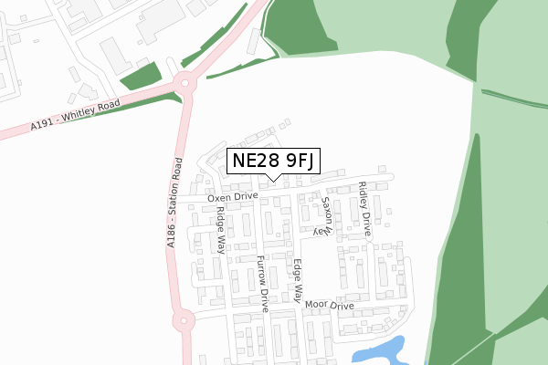
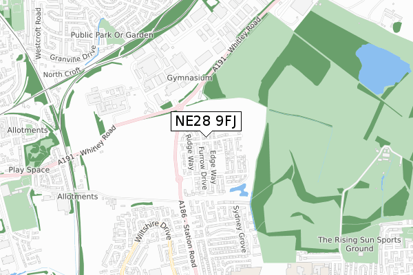
NE28 9FJ is located in the Northumberland electoral ward, within the metropolitan district of North Tyneside and the English Parliamentary constituency of North Tyneside. The Sub Integrated Care Board (ICB) Location is NHS North East and North Cumbria ICB - 99C and the police force is Northumbria. This postcode has been in use since December 2017.


GetTheData
Source: OS Open Zoomstack (Ordnance Survey)
Licence: Open Government Licence (requires attribution)
Attribution: Contains OS data © Crown copyright and database right 2024
Source: Open Postcode Geo
Licence: Open Government Licence (requires attribution)
Attribution: Contains OS data © Crown copyright and database right 2024; Contains Royal Mail data © Royal Mail copyright and database right 2024; Source: Office for National Statistics licensed under the Open Government Licence v.3.0
| Easting | 429204 |
| Northing | 568842 |
| Latitude | 55.013288 |
| Longitude | -1.544872 |
GetTheData
Source: Open Postcode Geo
Licence: Open Government Licence
| Country | England |
| Postcode District | NE28 |
➜ See where NE28 is on a map ➜ Where is Wallsend? | |
GetTheData
Source: Land Registry Price Paid Data
Licence: Open Government Licence
| Ward | Northumberland |
| Constituency | North Tyneside |
GetTheData
Source: ONS Postcode Database
Licence: Open Government Licence
2024 7 JUN £235,000 |
2024 23 FEB £295,000 |
2023 1 DEC £240,000 |
2023 14 JUL £275,000 |
2023 5 MAY £340,000 |
2023 6 JAN £302,599 |
35, OXEN DRIVE, WALLSEND, NE28 9FJ 2021 22 MAR £246,950 |
67, OXEN DRIVE, WALLSEND, NE28 9FJ 2021 4 FEB £252,950 |
69, OXEN DRIVE, WALLSEND, NE28 9FJ 2021 13 JAN £256,950 |
3, OXEN DRIVE, WALLSEND, NE28 9FJ 2020 22 DEC £239,950 |
GetTheData
Source: HM Land Registry Price Paid Data
Licence: Contains HM Land Registry data © Crown copyright and database right 2024. This data is licensed under the Open Government Licence v3.0.
| Station Road-whitley Road (Station Road) | Benton | 250m |
| Station Road-whitley Road (Station Road) | Benton | 255m |
| Whitley Road-atlas Garage (Whitley Road) | Benton | 289m |
| Whitley Road-car Mart (Whitley Road) | Benton | 441m |
| Whitley Road-proctor & Gamble (Whitley Road) | Benton | 520m |
| Palmersville (Tyne And Wear Metro Station) (Great Lime Road) | Palmersville | 1,213m |
| Benton (Tyne And Wear Metro Station) (Station Approach) | Benton | 1,466m |
| Manors Station | 5.9km |
GetTheData
Source: NaPTAN
Licence: Open Government Licence
| Percentage of properties with Next Generation Access | 53.8% |
| Percentage of properties with Superfast Broadband | 53.8% |
| Percentage of properties with Ultrafast Broadband | 53.8% |
| Percentage of properties with Full Fibre Broadband | 0.0% |
Superfast Broadband is between 30Mbps and 300Mbps
Ultrafast Broadband is > 300Mbps
| Median download speed | 12.0Mbps |
| Average download speed | 11.9Mbps |
| Maximum download speed | 13.73Mbps |
| Median upload speed | 1.1Mbps |
| Average upload speed | 1.0Mbps |
| Maximum upload speed | 1.18Mbps |
| Percentage of properties unable to receive 2Mbps | 0.0% |
| Percentage of properties unable to receive 5Mbps | 0.0% |
| Percentage of properties unable to receive 10Mbps | 0.0% |
| Percentage of properties unable to receive 30Mbps | 0.0% |
GetTheData
Source: Ofcom
Licence: Ofcom Terms of Use (requires attribution)
GetTheData
Source: ONS Postcode Database
Licence: Open Government Licence


➜ Get more ratings from the Food Standards Agency
GetTheData
Source: Food Standards Agency
Licence: FSA terms & conditions
| Last Collection | |||
|---|---|---|---|
| Location | Mon-Fri | Sat | Distance |
| Mead Crescent | 17:30 | 12:00 | 1,129m |
| Studley Road | 17:30 | 12:00 | 1,136m |
| The Oval | 17:30 | 12:00 | 1,238m |
GetTheData
Source: Dracos
Licence: Creative Commons Attribution-ShareAlike
The below table lists the International Territorial Level (ITL) codes (formerly Nomenclature of Territorial Units for Statistics (NUTS) codes) and Local Administrative Units (LAU) codes for NE28 9FJ:
| ITL 1 Code | Name |
|---|---|
| TLC | North East (England) |
| ITL 2 Code | Name |
| TLC2 | Northumberland, and Tyne and Wear |
| ITL 3 Code | Name |
| TLC22 | Tyneside |
| LAU 1 Code | Name |
| E08000022 | North Tyneside |
GetTheData
Source: ONS Postcode Directory
Licence: Open Government Licence
The below table lists the Census Output Area (OA), Lower Layer Super Output Area (LSOA), and Middle Layer Super Output Area (MSOA) for NE28 9FJ:
| Code | Name | |
|---|---|---|
| OA | E00043323 | |
| LSOA | E01008538 | North Tyneside 025D |
| MSOA | E02001762 | North Tyneside 025 |
GetTheData
Source: ONS Postcode Directory
Licence: Open Government Licence
| NE28 9YU | Sunholme Drive | 433m |
| NE28 9YT | Sunholme Drive | 437m |
| NE28 9YX | Leicester Close | 459m |
| NE28 9YY | Leicester Close | 461m |
| NE28 9YS | Sydney Grove | 509m |
| NE12 9SW | Bellway Industrial Estate | 516m |
| NE28 9YZ | Leicester Close | 529m |
| NE28 9YW | Sunholme Drive | 529m |
| NE28 9YP | Exeter Road | 535m |
| NE28 8TP | Wharfedale | 585m |
GetTheData
Source: Open Postcode Geo; Land Registry Price Paid Data
Licence: Open Government Licence