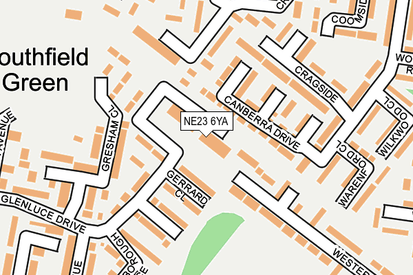
NE23 6YA is located in the Cramlington South East electoral ward, within the unitary authority of Northumberland and the English Parliamentary constituency of Blyth Valley. The Sub Integrated Care Board (ICB) Location is NHS North East and North Cumbria ICB - 00L and the police force is Northumbria. This postcode has been in use since October 1985.


GetTheData
Source: OS OpenMap – Local (Ordnance Survey)
Source: OS VectorMap District (Ordnance Survey)
Licence: Open Government Licence (requires attribution)
| Easting | 426879 |
| Northing | 575622 |
| Latitude | 55.074341 |
| Longitude | -1.580592 |
GetTheData
Source: Open Postcode Geo
Licence: Open Government Licence
| Country | England |
| Postcode District | NE23 |
➜ See where NE23 is on a map ➜ Where is Cramlington? | |
GetTheData
Source: Land Registry Price Paid Data
Licence: Open Government Licence
Elevation or altitude of NE23 6YA as distance above sea level:
| Metres | Feet | |
|---|---|---|
| Elevation | 60m | 197ft |
Elevation is measured from the approximate centre of the postcode, to the nearest point on an OS contour line from OS Terrain 50, which has contour spacing of ten vertical metres.
➜ How high above sea level am I? Find the elevation of your current position using your device's GPS.
GetTheData
Source: Open Postcode Elevation
Licence: Open Government Licence
| Ward | Cramlington South East |
| Constituency | Blyth Valley |
GetTheData
Source: ONS Postcode Database
Licence: Open Government Licence
| Bay Horse (B1505) | Southfield | 446m |
| Bay Horse (B1505) | Southfield | 460m |
| Collingwood Chase (B1505) | Southfield | 464m |
| Collingwood Chase (B1505) | Southfield | 470m |
| Alexandra Park (Northumbrian Road) | Cramlington | 534m |
| Cramlington Station | 1.9km |
GetTheData
Source: NaPTAN
Licence: Open Government Licence
GetTheData
Source: ONS Postcode Database
Licence: Open Government Licence


➜ Get more ratings from the Food Standards Agency
GetTheData
Source: Food Standards Agency
Licence: FSA terms & conditions
| Last Collection | |||
|---|---|---|---|
| Location | Mon-Fri | Sat | Distance |
| Southfield Green Post Office | 17:45 | 11:45 | 22m |
| Weetwood Road | 16:00 | 12:00 | 407m |
| Winburgh Avenue | 16:00 | 12:00 | 470m |
GetTheData
Source: Dracos
Licence: Creative Commons Attribution-ShareAlike
The below table lists the International Territorial Level (ITL) codes (formerly Nomenclature of Territorial Units for Statistics (NUTS) codes) and Local Administrative Units (LAU) codes for NE23 6YA:
| ITL 1 Code | Name |
|---|---|
| TLC | North East (England) |
| ITL 2 Code | Name |
| TLC2 | Northumberland, and Tyne and Wear |
| ITL 3 Code | Name |
| TLC21 | Northumberland |
| LAU 1 Code | Name |
| E06000057 | Northumberland |
GetTheData
Source: ONS Postcode Directory
Licence: Open Government Licence
The below table lists the Census Output Area (OA), Lower Layer Super Output Area (LSOA), and Middle Layer Super Output Area (MSOA) for NE23 6YA:
| Code | Name | |
|---|---|---|
| OA | E00139474 | |
| LSOA | E01027407 | Northumberland 031C |
| MSOA | E02005718 | Northumberland 031 |
GetTheData
Source: ONS Postcode Directory
Licence: Open Government Licence
| NE23 6EG | Canberra Drive | 53m |
| NE23 6QZ | Gerrard Close | 64m |
| NE23 6FB | Cassini Close | 91m |
| NE23 6FA | Corinto Close | 97m |
| NE23 6QX | Glenluce Drive | 118m |
| NE23 6FD | Copernicus Close | 122m |
| NE23 6HP | Cragside | 139m |
| NE23 6NE | Westerkirk | 154m |
| NE23 6QY | Gunnerton Close | 161m |
| NE23 6EJ | Gresham Close | 175m |
GetTheData
Source: Open Postcode Geo; Land Registry Price Paid Data
Licence: Open Government Licence