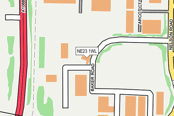
NE23 1WL is located in the Cramlington West electoral ward, within the unitary authority of Northumberland and the English Parliamentary constituency of Blyth Valley. The Sub Integrated Care Board (ICB) Location is NHS North East and North Cumbria ICB - 00L and the police force is Northumbria. This postcode has been in use since March 2005.


GetTheData
Source: OS OpenMap – Local (Ordnance Survey)
Source: OS VectorMap District (Ordnance Survey)
Licence: Open Government Licence (requires attribution)
| Easting | 424702 |
| Northing | 578172 |
| Latitude | 55.097367 |
| Longitude | -1.614466 |
GetTheData
Source: Open Postcode Geo
Licence: Open Government Licence
| Country | England |
| Postcode District | NE23 |
➜ See where NE23 is on a map ➜ Where is Cramlington? | |
GetTheData
Source: Land Registry Price Paid Data
Licence: Open Government Licence
Elevation or altitude of NE23 1WL as distance above sea level:
| Metres | Feet | |
|---|---|---|
| Elevation | 60m | 197ft |
Elevation is measured from the approximate centre of the postcode, to the nearest point on an OS contour line from OS Terrain 50, which has contour spacing of ten vertical metres.
➜ How high above sea level am I? Find the elevation of your current position using your device's GPS.
GetTheData
Source: Open Postcode Elevation
Licence: Open Government Licence
| Ward | Cramlington West |
| Constituency | Blyth Valley |
GetTheData
Source: ONS Postcode Database
Licence: Open Government Licence
| Nelson Road | Cramlington Industrial Est | 294m |
| Nelson Road | Cramlington Industrial Est | 304m |
| Stanley Bridges (Nelson Drive) | Cramlington Industrial Est | 340m |
| Stanley Bridges (Nelson Drive) | Cramlington Industrial Est | 365m |
| Nelson Way West End (Nelson Way) | Cramlington Industrial Est | 368m |
| Cramlington Station | 1.5km |
GetTheData
Source: NaPTAN
Licence: Open Government Licence
GetTheData
Source: ONS Postcode Database
Licence: Open Government Licence


➜ Get more ratings from the Food Standards Agency
GetTheData
Source: Food Standards Agency
Licence: FSA terms & conditions
| Last Collection | |||
|---|---|---|---|
| Location | Mon-Fri | Sat | Distance |
| Nelson Park Industrial Estate | 325m | ||
| Nelson Park Industril Estate | 18:30 | 11:15 | 325m |
| The Magpie Filling Station | 17:15 | 12:30 | 960m |
GetTheData
Source: Dracos
Licence: Creative Commons Attribution-ShareAlike
The below table lists the International Territorial Level (ITL) codes (formerly Nomenclature of Territorial Units for Statistics (NUTS) codes) and Local Administrative Units (LAU) codes for NE23 1WL:
| ITL 1 Code | Name |
|---|---|
| TLC | North East (England) |
| ITL 2 Code | Name |
| TLC2 | Northumberland, and Tyne and Wear |
| ITL 3 Code | Name |
| TLC21 | Northumberland |
| LAU 1 Code | Name |
| E06000057 | Northumberland |
GetTheData
Source: ONS Postcode Directory
Licence: Open Government Licence
The below table lists the Census Output Area (OA), Lower Layer Super Output Area (LSOA), and Middle Layer Super Output Area (MSOA) for NE23 1WL:
| Code | Name | |
|---|---|---|
| OA | E00139497 | |
| LSOA | E01027412 | Northumberland 029D |
| MSOA | E02005715 | Northumberland 029 |
GetTheData
Source: ONS Postcode Directory
Licence: Open Government Licence
| NE23 1BB | Arcot Court | 217m |
| NE23 1WQ | Baker Road | 269m |
| NE23 1WF | South Nelson Road | 528m |
| NE23 1WG | Nelson Way | 576m |
| NE23 1HJ | Blagdon Crescent | 800m |
| NE23 1WA | Atley Way | 809m |
| NE23 1EX | Arcot Avenue | 866m |
| NE23 1WP | Atley Business Park | 885m |
| NE23 3JQ | 887m | |
| NE23 1HH | Blagdon Crescent | 915m |
GetTheData
Source: Open Postcode Geo; Land Registry Price Paid Data
Licence: Open Government Licence