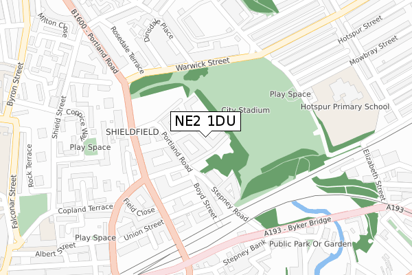
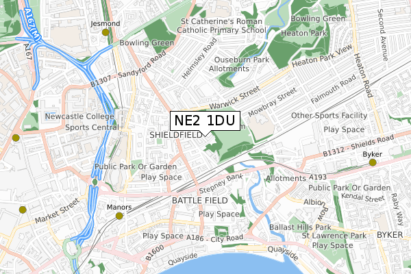
NE2 1DU is located in the Ouseburn electoral ward, within the metropolitan district of Newcastle upon Tyne and the English Parliamentary constituency of Newcastle upon Tyne East. The Sub Integrated Care Board (ICB) Location is NHS North East and North Cumbria ICB - 13T and the police force is Northumbria. This postcode has been in use since October 2018.


GetTheData
Source: OS Open Zoomstack (Ordnance Survey)
Licence: Open Government Licence (requires attribution)
Attribution: Contains OS data © Crown copyright and database right 2025
Source: Open Postcode Geo
Licence: Open Government Licence (requires attribution)
Attribution: Contains OS data © Crown copyright and database right 2025; Contains Royal Mail data © Royal Mail copyright and database right 2025; Source: Office for National Statistics licensed under the Open Government Licence v.3.0
| Easting | 425959 |
| Northing | 564845 |
| Latitude | 54.977549 |
| Longitude | -1.595974 |
GetTheData
Source: Open Postcode Geo
Licence: Open Government Licence
| Country | England |
| Postcode District | NE2 |
➜ See where NE2 is on a map ➜ Where is Newcastle upon Tyne? | |
GetTheData
Source: Land Registry Price Paid Data
Licence: Open Government Licence
| Ward | Ouseburn |
| Constituency | Newcastle Upon Tyne East |
GetTheData
Source: ONS Postcode Database
Licence: Open Government Licence
| Stoddart Street-garage (Stoddard Street) | Shieldfield | 164m |
| Stoddart Street-garage (Stoddart Street) | Shieldfield | 180m |
| Stoddart Street-bermondsey Street (Stoddart Street) | Shieldfield | 185m |
| Warwick Street-stadium (Warwick Street) | Shieldfield | 205m |
| Warwick Street-stadium (Warwick Street) | Shieldfield | 216m |
| Manors (Tyne And Wear Metro Station) (Argyll Street) | Manors | 689m |
| Jesmond (Tyne And Wear Metro Station) (Eslington Road) | Jesmond | 865m |
| Byker (Tyne And Wear Metro Station) (Byker Bridge) | Byker | 1,062m |
| Haymarket (Tyne And Wear Metro Station) (Percy Street) | Newcastle Upon Tyne | 1,147m |
| Monument (Tyne And Wear Metro Station) (Blackett Street) | Newcastle Upon Tyne | 1,203m |
| Manors Station | 0.8km |
| Newcastle Station | 1.7km |
| Heworth Station | 3.9km |
GetTheData
Source: NaPTAN
Licence: Open Government Licence
| Percentage of properties with Next Generation Access | 100.0% |
| Percentage of properties with Superfast Broadband | 100.0% |
| Percentage of properties with Ultrafast Broadband | 0.0% |
| Percentage of properties with Full Fibre Broadband | 0.0% |
Superfast Broadband is between 30Mbps and 300Mbps
Ultrafast Broadband is > 300Mbps
| Percentage of properties unable to receive 2Mbps | 0.0% |
| Percentage of properties unable to receive 5Mbps | 0.0% |
| Percentage of properties unable to receive 10Mbps | 0.0% |
| Percentage of properties unable to receive 30Mbps | 0.0% |
GetTheData
Source: Ofcom
Licence: Ofcom Terms of Use (requires attribution)
GetTheData
Source: ONS Postcode Database
Licence: Open Government Licence


➜ Get more ratings from the Food Standards Agency
GetTheData
Source: Food Standards Agency
Licence: FSA terms & conditions
| Last Collection | |||
|---|---|---|---|
| Location | Mon-Fri | Sat | Distance |
| Stepney Road | 18:30 | 11:45 | 72m |
| Portland Road | 18:30 | 11:30 | 271m |
| Shieldfield Post Office | 18:30 | 11:45 | 315m |
GetTheData
Source: Dracos
Licence: Creative Commons Attribution-ShareAlike
The below table lists the International Territorial Level (ITL) codes (formerly Nomenclature of Territorial Units for Statistics (NUTS) codes) and Local Administrative Units (LAU) codes for NE2 1DU:
| ITL 1 Code | Name |
|---|---|
| TLC | North East (England) |
| ITL 2 Code | Name |
| TLC2 | Northumberland, and Tyne and Wear |
| ITL 3 Code | Name |
| TLC22 | Tyneside |
| LAU 1 Code | Name |
| E08000021 | Newcastle upon Tyne |
GetTheData
Source: ONS Postcode Directory
Licence: Open Government Licence
The below table lists the Census Output Area (OA), Lower Layer Super Output Area (LSOA), and Middle Layer Super Output Area (MSOA) for NE2 1DU:
| Code | Name | |
|---|---|---|
| OA | E00042644 | |
| LSOA | E01008410 | Newcastle upon Tyne 023D |
| MSOA | E02001730 | Newcastle upon Tyne 023 |
GetTheData
Source: ONS Postcode Directory
Licence: Open Government Licence
| NE2 1BU | Portland Road | 92m |
| NE2 1TB | Portman Mews | 120m |
| NE2 1AA | Stoddart Street | 138m |
| NE2 1TZ | Stepney Road | 152m |
| NE2 1AN | Stoddart Street | 175m |
| NE6 5BD | Newington Road | 252m |
| NE1 2NS | Byker Bridge | 299m |
| NE2 1BD | Dinsdale Place | 305m |
| NE2 1XU | Wretham Place | 307m |
| NE2 1XS | Coppice Way | 311m |
GetTheData
Source: Open Postcode Geo; Land Registry Price Paid Data
Licence: Open Government Licence