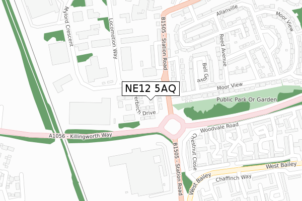
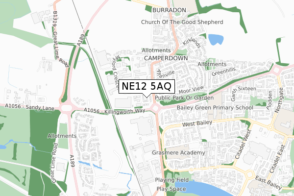
NE12 5AQ is located in the Weetslade electoral ward, within the metropolitan district of North Tyneside and the English Parliamentary constituency of North Tyneside. The Sub Integrated Care Board (ICB) Location is NHS North East and North Cumbria ICB - 99C and the police force is Northumbria. This postcode has been in use since August 2019.


GetTheData
Source: OS Open Zoomstack (Ordnance Survey)
Licence: Open Government Licence (requires attribution)
Attribution: Contains OS data © Crown copyright and database right 2024
Source: Open Postcode Geo
Licence: Open Government Licence (requires attribution)
Attribution: Contains OS data © Crown copyright and database right 2024; Contains Royal Mail data © Royal Mail copyright and database right 2024; Source: Office for National Statistics licensed under the Open Government Licence v.3.0
| Easting | 426296 |
| Northing | 571960 |
| Latitude | 55.041467 |
| Longitude | -1.590058 |
GetTheData
Source: Open Postcode Geo
Licence: Open Government Licence
| Country | England |
| Postcode District | NE12 |
➜ See where NE12 is on a map ➜ Where is Killingworth? | |
GetTheData
Source: Land Registry Price Paid Data
Licence: Open Government Licence
| Ward | Weetslade |
| Constituency | North Tyneside |
GetTheData
Source: ONS Postcode Database
Licence: Open Government Licence
20, PINETREE DRIVE, CAMPERDOWN, NEWCASTLE UPON TYNE, NE12 5AQ 2022 5 AUG £295,000 |
22, PINETREE DRIVE, CAMPERDOWN, NEWCASTLE UPON TYNE, NE12 5AQ 2021 25 JUN £256,995 |
19, PINETREE DRIVE, CAMPERDOWN, NEWCASTLE UPON TYNE, NE12 5AQ 2021 18 JUN £259,995 |
21, PINETREE DRIVE, CAMPERDOWN, NEWCASTLE UPON TYNE, NE12 5AQ 2021 18 JUN £289,995 |
20, PINETREE DRIVE, CAMPERDOWN, NEWCASTLE UPON TYNE, NE12 5AQ 2021 11 JUN £264,995 |
GetTheData
Source: HM Land Registry Price Paid Data
Licence: Contains HM Land Registry data © Crown copyright and database right 2024. This data is licensed under the Open Government Licence v3.0.
| Sandy Lane-coal Depot (Sandy Lane) | Wideopen | 439m |
| Sandy Lane-coal Depot (Sandy Lane) | Wideopen | 536m |
| Camperdown (Station Rd) | Burradon | 562m |
| Camperdown (Station Road) | Burradon | 573m |
| Burradon (Front Street) | Burradon | 717m |
GetTheData
Source: NaPTAN
Licence: Open Government Licence
GetTheData
Source: ONS Postcode Database
Licence: Open Government Licence


➜ Get more ratings from the Food Standards Agency
GetTheData
Source: Food Standards Agency
Licence: FSA terms & conditions
| Last Collection | |||
|---|---|---|---|
| Location | Mon-Fri | Sat | Distance |
| Camperdown Industrial Estate | 493m | ||
| Front Street | 18:30 | 12:00 | 694m |
| Allanville | 16:00 | 12:00 | 898m |
GetTheData
Source: Dracos
Licence: Creative Commons Attribution-ShareAlike
The below table lists the International Territorial Level (ITL) codes (formerly Nomenclature of Territorial Units for Statistics (NUTS) codes) and Local Administrative Units (LAU) codes for NE12 5AQ:
| ITL 1 Code | Name |
|---|---|
| TLC | North East (England) |
| ITL 2 Code | Name |
| TLC2 | Northumberland, and Tyne and Wear |
| ITL 3 Code | Name |
| TLC22 | Tyneside |
| LAU 1 Code | Name |
| E08000022 | North Tyneside |
GetTheData
Source: ONS Postcode Directory
Licence: Open Government Licence
The below table lists the Census Output Area (OA), Lower Layer Super Output Area (LSOA), and Middle Layer Super Output Area (MSOA) for NE12 5AQ:
| Code | Name | |
|---|---|---|
| OA | E00043567 | |
| LSOA | E01008577 | North Tyneside 004A |
| MSOA | E02001741 | North Tyneside 004 |
GetTheData
Source: ONS Postcode Directory
Licence: Open Government Licence
| NE12 5UJ | Mylord Crescent | 333m |
| NE12 5US | Locomotion Way | 365m |
| NE12 5UZ | Atkin Street | 525m |
| NE12 5UX | Station Road | 551m |
| NE12 5UY | Station Road | 578m |
| NE13 6PE | Sandy Lane | 591m |
| NE12 5XA | Station Road | 597m |
| NE12 5XD | Camperdown Avenue | 654m |
| NE12 5XS | Allanville | 666m |
| NE23 7NR | Means Drive | 689m |
GetTheData
Source: Open Postcode Geo; Land Registry Price Paid Data
Licence: Open Government Licence