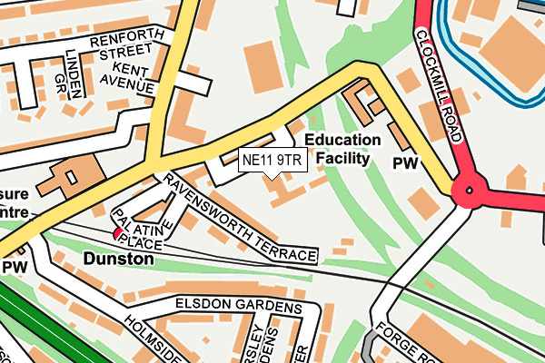
NE11 9TR is located in the Dunston and Teams electoral ward, within the metropolitan district of Gateshead and the English Parliamentary constituency of Gateshead. The Sub Integrated Care Board (ICB) Location is NHS North East and North Cumbria ICB - 13T and the police force is Northumbria. This postcode has been in use since January 1980.


GetTheData
Source: OS OpenMap – Local (Ordnance Survey)
Source: OS VectorMap District (Ordnance Survey)
Licence: Open Government Licence (requires attribution)
| Easting | 423229 |
| Northing | 561829 |
| Latitude | 54.950574 |
| Longitude | -1.638855 |
GetTheData
Source: Open Postcode Geo
Licence: Open Government Licence
| Country | England |
| Postcode District | NE11 |
➜ See where NE11 is on a map ➜ Where is Gateshead? | |
GetTheData
Source: Land Registry Price Paid Data
Licence: Open Government Licence
Elevation or altitude of NE11 9TR as distance above sea level:
| Metres | Feet | |
|---|---|---|
| Elevation | 10m | 33ft |
Elevation is measured from the approximate centre of the postcode, to the nearest point on an OS contour line from OS Terrain 50, which has contour spacing of ten vertical metres.
➜ How high above sea level am I? Find the elevation of your current position using your device's GPS.
GetTheData
Source: Open Postcode Elevation
Licence: Open Government Licence
| Ward | Dunston And Teams |
| Constituency | Gateshead |
GetTheData
Source: ONS Postcode Database
Licence: Open Government Licence
| Ellison Road | Dunston | 63m |
| Ellison Road-catholic Church (Ellison Road) | Teams | 167m |
| Dunston (Ravensworth Terrace) | Dunston | 177m |
| Ravensworth Road | Dunston | 184m |
| Ellison Road | Dunston | 186m |
| Dunston Station | 0.2km |
| Metrocentre Station | 1.9km |
| Newcastle Station | 2.4km |
GetTheData
Source: NaPTAN
Licence: Open Government Licence
GetTheData
Source: ONS Postcode Database
Licence: Open Government Licence


➜ Get more ratings from the Food Standards Agency
GetTheData
Source: Food Standards Agency
Licence: FSA terms & conditions
| Last Collection | |||
|---|---|---|---|
| Location | Mon-Fri | Sat | Distance |
| Dunston Activity Centre | 18:15 | 11:30 | 177m |
| Dunston Post Office | 18:30 | 12:00 | 244m |
| Knightside Gardens | 17:30 | 11:30 | 474m |
GetTheData
Source: Dracos
Licence: Creative Commons Attribution-ShareAlike
The below table lists the International Territorial Level (ITL) codes (formerly Nomenclature of Territorial Units for Statistics (NUTS) codes) and Local Administrative Units (LAU) codes for NE11 9TR:
| ITL 1 Code | Name |
|---|---|
| TLC | North East (England) |
| ITL 2 Code | Name |
| TLC2 | Northumberland, and Tyne and Wear |
| ITL 3 Code | Name |
| TLC22 | Tyneside |
| LAU 1 Code | Name |
| E08000037 | Gateshead |
GetTheData
Source: ONS Postcode Directory
Licence: Open Government Licence
The below table lists the Census Output Area (OA), Lower Layer Super Output Area (LSOA), and Middle Layer Super Output Area (MSOA) for NE11 9TR:
| Code | Name | |
|---|---|---|
| OA | E00041602 | |
| LSOA | E01008211 | Gateshead 013D |
| MSOA | E02001694 | Gateshead 013 |
GetTheData
Source: ONS Postcode Directory
Licence: Open Government Licence
| NE11 9TE | Ravensworth Terrace | 54m |
| NE11 9SR | Palatine Place | 122m |
| NE11 9TN | Elsdon Gardens | 137m |
| NE11 9AB | Ravensworth Road | 179m |
| NE11 9BP | Kent Avenue | 196m |
| NE11 9TL | Horsley Gardens | 203m |
| NE11 9TH | Rochester Gardens | 216m |
| NE11 9BH | Linden Grove | 225m |
| NE11 9TJ | Holmside Avenue | 240m |
| NE11 9BJ | Parkside | 270m |
GetTheData
Source: Open Postcode Geo; Land Registry Price Paid Data
Licence: Open Government Licence