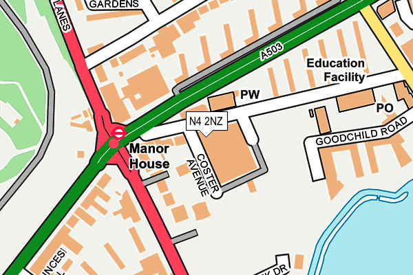
N4 2NZ is located in the Woodberry Down electoral ward, within the London borough of Hackney and the English Parliamentary constituency of Hackney North and Stoke Newington. The Sub Integrated Care Board (ICB) Location is NHS North East London ICB - A3A8R and the police force is Metropolitan Police. This postcode has been in use since February 2015.


GetTheData
Source: OS OpenMap – Local (Ordnance Survey)
Source: OS VectorMap District (Ordnance Survey)
Licence: Open Government Licence (requires attribution)
| Easting | 532190 |
| Northing | 187486 |
| Latitude | 51.570756 |
| Longitude | -0.094011 |
GetTheData
Source: Open Postcode Geo
Licence: Open Government Licence
| Country | England |
| Postcode District | N4 |
➜ See where N4 is on a map ➜ Where is Stoke Newington? | |
GetTheData
Source: Land Registry Price Paid Data
Licence: Open Government Licence
Elevation or altitude of N4 2NZ as distance above sea level:
| Metres | Feet | |
|---|---|---|
| Elevation | 40m | 131ft |
Elevation is measured from the approximate centre of the postcode, to the nearest point on an OS contour line from OS Terrain 50, which has contour spacing of ten vertical metres.
➜ How high above sea level am I? Find the elevation of your current position using your device's GPS.
GetTheData
Source: Open Postcode Elevation
Licence: Open Government Licence
| Ward | Woodberry Down |
| Constituency | Hackney North And Stoke Newington |
GetTheData
Source: ONS Postcode Database
Licence: Open Government Licence
| Manor House (Seven Sisters Road) | Manor House | 56m |
| Manor House (Seven Sisters Road) | Manor House | 65m |
| Manor House | Manor House | 74m |
| Manor House (Seven Sisters Road) | Manor House | 83m |
| Portland Rise Estate (Green Lanes) | Manor House | 129m |
| Manor House Underground Station | Manor House | 146m |
| Finsbury Park Underground Station | Finsbury Park | 1,152m |
| Arsenal Underground Station | Arsenal | 1,638m |
| Seven Sisters Underground Station | Seven Sisters | 2,040m |
| Harringay Green Lanes Station | 0.8km |
| Harringay Station | 1.1km |
| Finsbury Park Station | 1.1km |
GetTheData
Source: NaPTAN
Licence: Open Government Licence
| Percentage of properties with Next Generation Access | 100.0% |
| Percentage of properties with Superfast Broadband | 100.0% |
| Percentage of properties with Ultrafast Broadband | 100.0% |
| Percentage of properties with Full Fibre Broadband | 0.0% |
Superfast Broadband is between 30Mbps and 300Mbps
Ultrafast Broadband is > 300Mbps
| Median download speed | 100.0Mbps |
| Average download speed | 100.5Mbps |
| Maximum download speed | 200.00Mbps |
| Median upload speed | 5.4Mbps |
| Average upload speed | 5.4Mbps |
| Maximum upload speed | 10.00Mbps |
| Percentage of properties unable to receive 2Mbps | 0.0% |
| Percentage of properties unable to receive 5Mbps | 0.0% |
| Percentage of properties unable to receive 10Mbps | 0.0% |
| Percentage of properties unable to receive 30Mbps | 0.0% |
GetTheData
Source: Ofcom
Licence: Ofcom Terms of Use (requires attribution)
Estimated total energy consumption in N4 2NZ by fuel type, 2015.
| Consumption (kWh) | 17,694 |
|---|---|
| Meter count | 8 |
| Mean (kWh/meter) | 2,212 |
| Median (kWh/meter) | 2,352 |
GetTheData
Source: Postcode level gas estimates: 2015 (experimental)
Source: Postcode level electricity estimates: 2015 (experimental)
Licence: Open Government Licence
GetTheData
Source: ONS Postcode Database
Licence: Open Government Licence


➜ Get more ratings from the Food Standards Agency
GetTheData
Source: Food Standards Agency
Licence: FSA terms & conditions
| Last Collection | |||
|---|---|---|---|
| Location | Mon-Fri | Sat | Distance |
| Manor House | 17:30 | 12:00 | 106m |
| Woodberry Grove | 17:30 | 12:00 | 242m |
| 94 Woodberry Grove | 17:30 | 12:00 | 322m |
GetTheData
Source: Dracos
Licence: Creative Commons Attribution-ShareAlike
The below table lists the International Territorial Level (ITL) codes (formerly Nomenclature of Territorial Units for Statistics (NUTS) codes) and Local Administrative Units (LAU) codes for N4 2NZ:
| ITL 1 Code | Name |
|---|---|
| TLI | London |
| ITL 2 Code | Name |
| TLI4 | Inner London - East |
| ITL 3 Code | Name |
| TLI41 | Hackney and Newham |
| LAU 1 Code | Name |
| E09000012 | Hackney |
GetTheData
Source: ONS Postcode Directory
Licence: Open Government Licence
The below table lists the Census Output Area (OA), Lower Layer Super Output Area (LSOA), and Middle Layer Super Output Area (MSOA) for N4 2NZ:
| Code | Name | |
|---|---|---|
| OA | E00008578 | |
| LSOA | E01033701 | Hackney 002F |
| MSOA | E02000346 | Hackney 002 |
GetTheData
Source: ONS Postcode Directory
Licence: Open Government Licence
| N4 2JP | Coster Avenue | 30m |
| N4 2LD | Coster Avenue | 56m |
| N4 2TG | Woodberry Down | 58m |
| N4 2NJ | Green Lanes | 91m |
| N4 1QQ | Woodberry Down Estate | 93m |
| N4 2HE | Green Lanes | 117m |
| N4 1QH | Woodberry Down Estate | 144m |
| N4 1BX | Green Lanes | 158m |
| N4 2TR | Woodberry Down Estate | 159m |
| N4 1QJ | Woodberry Down Estate | 160m |
GetTheData
Source: Open Postcode Geo; Land Registry Price Paid Data
Licence: Open Government Licence