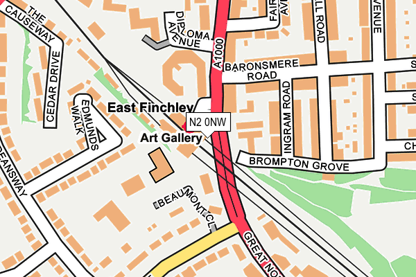
N2 0NW is located in the East Finchley electoral ward, within the London borough of Barnet and the English Parliamentary constituency of Finchley and Golders Green. The Sub Integrated Care Board (ICB) Location is NHS North Central London ICB - 93C and the police force is Metropolitan Police. This postcode has been in use since January 1980.


GetTheData
Source: OS OpenMap – Local (Ordnance Survey)
Source: OS VectorMap District (Ordnance Survey)
Licence: Open Government Licence (requires attribution)
| Easting | 527267 |
| Northing | 189184 |
| Latitude | 51.587147 |
| Longitude | -0.164390 |
GetTheData
Source: Open Postcode Geo
Licence: Open Government Licence
| Country | England |
| Postcode District | N2 |
➜ See where N2 is on a map ➜ Where is Finchley? | |
GetTheData
Source: Land Registry Price Paid Data
Licence: Open Government Licence
Elevation or altitude of N2 0NW as distance above sea level:
| Metres | Feet | |
|---|---|---|
| Elevation | 80m | 262ft |
Elevation is measured from the approximate centre of the postcode, to the nearest point on an OS contour line from OS Terrain 50, which has contour spacing of ten vertical metres.
➜ How high above sea level am I? Find the elevation of your current position using your device's GPS.
GetTheData
Source: Open Postcode Elevation
Licence: Open Government Licence
| Ward | East Finchley |
| Constituency | Finchley And Golders Green |
GetTheData
Source: ONS Postcode Database
Licence: Open Government Licence
| East Finchley (East Finchley High Road) | East Finchley | 19m |
| East Finchley (East Finchley High Road) | East Finchley | 37m |
| East Finchley (East Finchley High Road) | East Finchley | 59m |
| East Finchley (East Finchley High Road) | East Finchley | 63m |
| Great North Road | East Finchley | 152m |
| East Finchley Underground Station | East Finchley | 43m |
| Highgate Underground Station | Highgate | 1,672m |
| Alexandra Palace Station | 3.3km |
| New Southgate Station | 3.3km |
| Hampstead Heath Station | 3.6km |
GetTheData
Source: NaPTAN
Licence: Open Government Licence
GetTheData
Source: ONS Postcode Database
Licence: Open Government Licence


➜ Get more ratings from the Food Standards Agency
GetTheData
Source: Food Standards Agency
Licence: FSA terms & conditions
| Last Collection | |||
|---|---|---|---|
| Location | Mon-Fri | Sat | Distance |
| 32 High Road | 17:30 | 12:00 | 80m |
| Summerlee Avenue | 17:30 | 12:00 | 269m |
| 35 Deansway | 17:30 | 12:00 | 295m |
GetTheData
Source: Dracos
Licence: Creative Commons Attribution-ShareAlike
The below table lists the International Territorial Level (ITL) codes (formerly Nomenclature of Territorial Units for Statistics (NUTS) codes) and Local Administrative Units (LAU) codes for N2 0NW:
| ITL 1 Code | Name |
|---|---|
| TLI | London |
| ITL 2 Code | Name |
| TLI7 | Outer London - West and North West |
| ITL 3 Code | Name |
| TLI71 | Barnet |
| LAU 1 Code | Name |
| E09000003 | Barnet |
GetTheData
Source: ONS Postcode Directory
Licence: Open Government Licence
The below table lists the Census Output Area (OA), Lower Layer Super Output Area (LSOA), and Middle Layer Super Output Area (MSOA) for N2 0NW:
| Code | Name | |
|---|---|---|
| OA | E00000920 | |
| LSOA | E01000182 | Barnet 029E |
| MSOA | E02000052 | Barnet 029 |
GetTheData
Source: ONS Postcode Directory
Licence: Open Government Licence
| N2 9PJ | High Road | 82m |
| N2 9QB | Baronsmere Road | 112m |
| N2 9QA | Ingram Road | 131m |
| N2 9QD | Baronsmere Road | 151m |
| N2 9PX | Park Hall Road | 151m |
| N2 0NP | Great North Road | 166m |
| N2 0AN | The Bishops Avenue | 173m |
| N2 9QE | Baronsmere Road | 175m |
| N2 0GA | Beaumont Close | 177m |
| N2 8NY | Diploma Avenue | 179m |
GetTheData
Source: Open Postcode Geo; Land Registry Price Paid Data
Licence: Open Government Licence