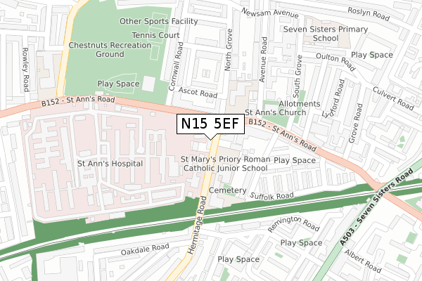
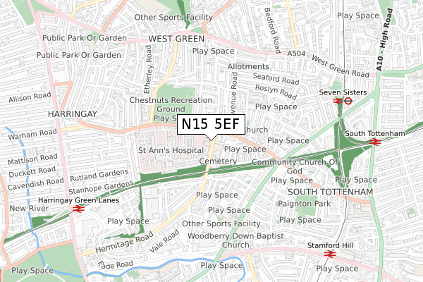
N15 5EF is located in the Hermitage & Gardens electoral ward, within the London borough of Haringey and the English Parliamentary constituency of Tottenham. The Sub Integrated Care Board (ICB) Location is NHS North Central London ICB - 93C and the police force is Metropolitan Police. This postcode has been in use since January 2019.


GetTheData
Source: OS Open Zoomstack (Ordnance Survey)
Licence: Open Government Licence (requires attribution)
Attribution: Contains OS data © Crown copyright and database right 2025
Source: Open Postcode Geo
Licence: Open Government Licence (requires attribution)
Attribution: Contains OS data © Crown copyright and database right 2025; Contains Royal Mail data © Royal Mail copyright and database right 2025; Source: Office for National Statistics licensed under the Open Government Licence v.3.0
| Easting | 532678 |
| Northing | 188599 |
| Latitude | 51.580645 |
| Longitude | -0.086528 |
GetTheData
Source: Open Postcode Geo
Licence: Open Government Licence
| Country | England |
| Postcode District | N15 |
➜ See where N15 is on a map | |
GetTheData
Source: Land Registry Price Paid Data
Licence: Open Government Licence
| Ward | Hermitage & Gardens |
| Constituency | Tottenham |
GetTheData
Source: ONS Postcode Database
Licence: Open Government Licence
| St. Ann's Road Police Station (St Anns Road) | Harringay | 106m |
| St. Ann's Road Police Station (St Anns Road) | Harringay | 108m |
| St. Ann's Hospital (St Ann's Road) | Harringay | 249m |
| Seven Sisters Rd Kerswell Cl (St Ann's Road) | South Tottenham | 320m |
| St. Ann's Hospital (St Ann's Road) | Harringay | 327m |
| Seven Sisters Underground Station | Seven Sisters | 1,013m |
| Manor House Underground Station | Manor House | 1,286m |
| Turnpike Lane Underground Station | Turnpike Lane | 1,562m |
| Seven Sisters Station | 0.8km |
| Harringay Green Lanes Station | 0.9km |
| Stamford Hill Station | 1km |
GetTheData
Source: NaPTAN
Licence: Open Government Licence
| Percentage of properties with Next Generation Access | 100.0% |
| Percentage of properties with Superfast Broadband | 100.0% |
| Percentage of properties with Ultrafast Broadband | 100.0% |
| Percentage of properties with Full Fibre Broadband | 0.0% |
Superfast Broadband is between 30Mbps and 300Mbps
Ultrafast Broadband is > 300Mbps
| Median download speed | 47.3Mbps |
| Average download speed | 46.5Mbps |
| Maximum download speed | 80.00Mbps |
| Median upload speed | 10.0Mbps |
| Average upload speed | 11.4Mbps |
| Maximum upload speed | 20.00Mbps |
| Percentage of properties unable to receive 2Mbps | 0.0% |
| Percentage of properties unable to receive 5Mbps | 0.0% |
| Percentage of properties unable to receive 10Mbps | 0.0% |
| Percentage of properties unable to receive 30Mbps | 0.0% |
GetTheData
Source: Ofcom
Licence: Ofcom Terms of Use (requires attribution)
GetTheData
Source: ONS Postcode Database
Licence: Open Government Licence


➜ Get more ratings from the Food Standards Agency
GetTheData
Source: Food Standards Agency
Licence: FSA terms & conditions
| Last Collection | |||
|---|---|---|---|
| Location | Mon-Fri | Sat | Distance |
| 266 St Anns Road | 17:30 | 12:00 | 95m |
| 2 Gorleston Road | 17:30 | 12:00 | 343m |
| St Anns Road/Near Bridge | 17:30 | 12:00 | 372m |
GetTheData
Source: Dracos
Licence: Creative Commons Attribution-ShareAlike
The below table lists the International Territorial Level (ITL) codes (formerly Nomenclature of Territorial Units for Statistics (NUTS) codes) and Local Administrative Units (LAU) codes for N15 5EF:
| ITL 1 Code | Name |
|---|---|
| TLI | London |
| ITL 2 Code | Name |
| TLI4 | Inner London - East |
| ITL 3 Code | Name |
| TLI43 | Haringey and Islington |
| LAU 1 Code | Name |
| E09000014 | Haringey |
GetTheData
Source: ONS Postcode Directory
Licence: Open Government Licence
The below table lists the Census Output Area (OA), Lower Layer Super Output Area (LSOA), and Middle Layer Super Output Area (MSOA) for N15 5EF:
| Code | Name | |
|---|---|---|
| OA | E00010279 | |
| LSOA | E01002042 | Haringey 027A |
| MSOA | E02000423 | Haringey 027 |
GetTheData
Source: ONS Postcode Directory
Licence: Open Government Licence
| N15 5BP | St Anns Road | 75m |
| N15 5QX | North Grove | 94m |
| N15 5RA | Ascot Road | 98m |
| N15 5AQ | St Anns Road | 99m |
| N15 5AH | Cornwall Road | 125m |
| N15 5QZ | Appleby Close | 155m |
| N15 5RG | St Anns Road | 178m |
| N15 5QY | Penrith Road | 198m |
| N15 5QL | South Grove | 206m |
| N15 5QB | St Anns Road | 208m |
GetTheData
Source: Open Postcode Geo; Land Registry Price Paid Data
Licence: Open Government Licence