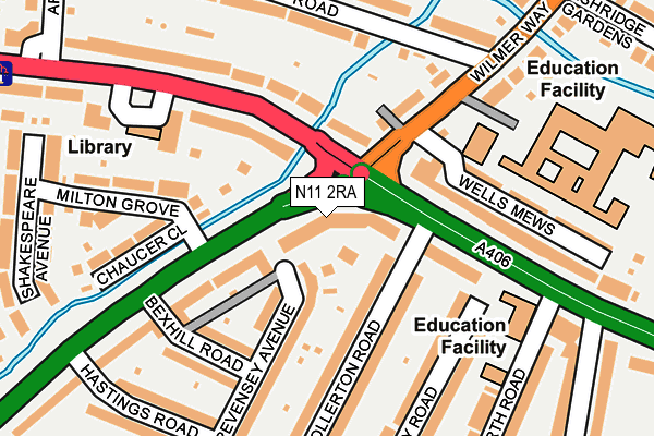
N11 2RA lies on Telford Road in London. N11 2RA is located in the New Southgate electoral ward, within the London borough of Enfield and the English Parliamentary constituency of Enfield, Southgate. The Sub Integrated Care Board (ICB) Location is NHS North Central London ICB - 93C and the police force is Metropolitan Police. This postcode has been in use since March 2017.


GetTheData
Source: OS OpenMap – Local (Ordnance Survey)
Source: OS VectorMap District (Ordnance Survey)
Licence: Open Government Licence (requires attribution)
| Easting | 529703 |
| Northing | 192302 |
| Latitude | 51.614615 |
| Longitude | -0.128071 |
GetTheData
Source: Open Postcode Geo
Licence: Open Government Licence
| Street | Telford Road |
| Town/City | London |
| Country | England |
| Postcode District | N11 |
➜ See where N11 is on a map ➜ Where is London? | |
GetTheData
Source: Land Registry Price Paid Data
Licence: Open Government Licence
| Ward | New Southgate |
| Constituency | Enfield, Southgate |
GetTheData
Source: ONS Postcode Database
Licence: Open Government Licence
| Telford Way Bowes Road (Bowes Road) | Palmers Green | 162m |
| Arnos Grove Swimming Pool | Arnos Grove | 178m |
| Telford Way Bowes Road | Palmers Green | 327m |
| Arnos Grove | Arnos Grove | 368m |
| Arnos Grove (Bowes Road) | Arnos Grove | 405m |
| Arnos Grove Underground Station | Arnos Grove | 400m |
| Bounds Green Underground Station | Wood Green | 885m |
| Bowes Park Station | 1km |
| New Southgate Station | 1km |
| Palmers Green Station | 1.3km |
GetTheData
Source: NaPTAN
Licence: Open Government Licence
| Percentage of properties with Next Generation Access | 100.0% |
| Percentage of properties with Superfast Broadband | 100.0% |
| Percentage of properties with Ultrafast Broadband | 97.6% |
| Percentage of properties with Full Fibre Broadband | 70.7% |
Superfast Broadband is between 30Mbps and 300Mbps
Ultrafast Broadband is > 300Mbps
| Median download speed | 40.0Mbps |
| Average download speed | 47.5Mbps |
| Maximum download speed | 80.00Mbps |
| Median upload speed | 10.0Mbps |
| Average upload speed | 11.0Mbps |
| Maximum upload speed | 20.00Mbps |
| Percentage of properties unable to receive 2Mbps | 0.0% |
| Percentage of properties unable to receive 5Mbps | 0.0% |
| Percentage of properties unable to receive 10Mbps | 0.0% |
| Percentage of properties unable to receive 30Mbps | 0.0% |
GetTheData
Source: Ofcom
Licence: Ofcom Terms of Use (requires attribution)
GetTheData
Source: ONS Postcode Database
Licence: Open Government Licence


➜ Get more ratings from the Food Standards Agency
GetTheData
Source: Food Standards Agency
Licence: FSA terms & conditions
| Last Collection | |||
|---|---|---|---|
| Location | Mon-Fri | Sat | Distance |
| Highworth Road/Bowes Road | 17:30 | 12:00 | 211m |
| Post Office Counters | 18:30 | 12:00 | 245m |
| 311 Bowes Road | 17:30 | 12:00 | 294m |
GetTheData
Source: Dracos
Licence: Creative Commons Attribution-ShareAlike
The below table lists the International Territorial Level (ITL) codes (formerly Nomenclature of Territorial Units for Statistics (NUTS) codes) and Local Administrative Units (LAU) codes for N11 2RA:
| ITL 1 Code | Name |
|---|---|
| TLI | London |
| ITL 2 Code | Name |
| TLI5 | Outer London - East and North East |
| ITL 3 Code | Name |
| TLI54 | Enfield |
| LAU 1 Code | Name |
| E09000010 | Enfield |
GetTheData
Source: ONS Postcode Directory
Licence: Open Government Licence
The below table lists the Census Output Area (OA), Lower Layer Super Output Area (LSOA), and Middle Layer Super Output Area (MSOA) for N11 2RA:
| Code | Name | |
|---|---|---|
| OA | E00007590 | |
| LSOA | E01001530 | Enfield 032D |
| MSOA | E02000308 | Enfield 032 |
GetTheData
Source: ONS Postcode Directory
Licence: Open Government Licence
| N11 2RD | Pevensey Avenue | 81m |
| N14 7HU | Wilmer Way | 114m |
| N11 2HJ | Bowes Road | 124m |
| N11 2RG | Bexhill Road | 153m |
| N11 1BD | Bowes Road | 154m |
| N11 2JY | Ollerton Road | 155m |
| N11 1AT | Bowes Road | 156m |
| N11 2LD | Stanley Road | 160m |
| N11 2RB | Pevensey Avenue | 161m |
| N11 2LA | Ollerton Road | 172m |
GetTheData
Source: Open Postcode Geo; Land Registry Price Paid Data
Licence: Open Government Licence