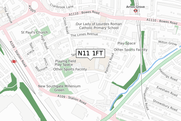
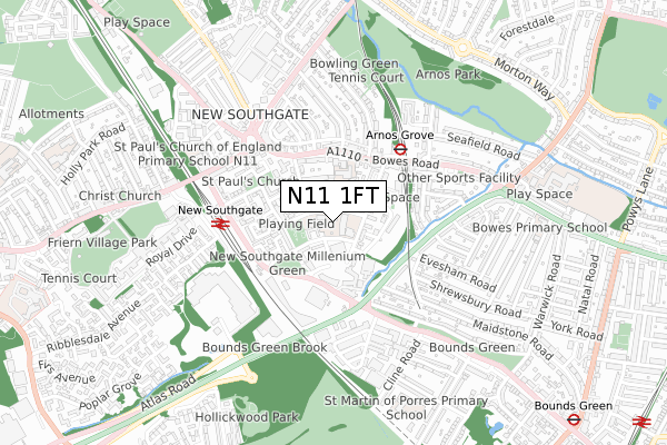
N11 1FT is located in the New Southgate electoral ward, within the London borough of Enfield and the English Parliamentary constituency of Enfield, Southgate. The Sub Integrated Care Board (ICB) Location is NHS North Central London ICB - 93C and the police force is Metropolitan Police. This postcode has been in use since June 2019.


GetTheData
Source: OS Open Zoomstack (Ordnance Survey)
Licence: Open Government Licence (requires attribution)
Attribution: Contains OS data © Crown copyright and database right 2025
Source: Open Postcode Geo
Licence: Open Government Licence (requires attribution)
Attribution: Contains OS data © Crown copyright and database right 2025; Contains Royal Mail data © Royal Mail copyright and database right 2025; Source: Office for National Statistics licensed under the Open Government Licence v.3.0
| Easting | 529091 |
| Northing | 192218 |
| Latitude | 51.614000 |
| Longitude | -0.136936 |
GetTheData
Source: Open Postcode Geo
Licence: Open Government Licence
| Country | England |
| Postcode District | N11 |
➜ See where N11 is on a map ➜ Where is Southgate? | |
GetTheData
Source: Land Registry Price Paid Data
Licence: Open Government Licence
| Ward | New Southgate |
| Constituency | Enfield, Southgate |
GetTheData
Source: ONS Postcode Database
Licence: Open Government Licence
| Lower Park Road (Station Road) | Arnos Grove | 244m |
| Ravenscraig Road | Arnos Grove | 258m |
| Hobart Corner (Station Road) | Arnos Grove | 271m |
| Betstyle Road Arnos Grove | Arnos Grove | 278m |
| Hobart Corner (Station Road) | Arnos Grove | 282m |
| Arnos Grove Underground Station | Arnos Grove | 383m |
| Bounds Green Underground Station | Wood Green | 1,174m |
| New Southgate Station | 0.4km |
| Bowes Park Station | 1.4km |
| Palmers Green Station | 1.9km |
GetTheData
Source: NaPTAN
Licence: Open Government Licence
| Percentage of properties with Next Generation Access | 100.0% |
| Percentage of properties with Superfast Broadband | 100.0% |
| Percentage of properties with Ultrafast Broadband | 100.0% |
| Percentage of properties with Full Fibre Broadband | 0.0% |
Superfast Broadband is between 30Mbps and 300Mbps
Ultrafast Broadband is > 300Mbps
| Percentage of properties unable to receive 2Mbps | 0.0% |
| Percentage of properties unable to receive 5Mbps | 0.0% |
| Percentage of properties unable to receive 10Mbps | 0.0% |
| Percentage of properties unable to receive 30Mbps | 0.0% |
GetTheData
Source: Ofcom
Licence: Ofcom Terms of Use (requires attribution)
GetTheData
Source: ONS Postcode Database
Licence: Open Government Licence


➜ Get more ratings from the Food Standards Agency
GetTheData
Source: Food Standards Agency
Licence: FSA terms & conditions
| Last Collection | |||
|---|---|---|---|
| Location | Mon-Fri | Sat | Distance |
| New Southgate Delivery Office | 17:30 | 12:00 | 83m |
| Bowes Road/Cross Road | 17:30 | 12:00 | 249m |
| 311 Bowes Road | 17:30 | 12:00 | 414m |
GetTheData
Source: Dracos
Licence: Creative Commons Attribution-ShareAlike
The below table lists the International Territorial Level (ITL) codes (formerly Nomenclature of Territorial Units for Statistics (NUTS) codes) and Local Administrative Units (LAU) codes for N11 1FT:
| ITL 1 Code | Name |
|---|---|
| TLI | London |
| ITL 2 Code | Name |
| TLI5 | Outer London - East and North East |
| ITL 3 Code | Name |
| TLI54 | Enfield |
| LAU 1 Code | Name |
| E09000010 | Enfield |
GetTheData
Source: ONS Postcode Directory
Licence: Open Government Licence
The below table lists the Census Output Area (OA), Lower Layer Super Output Area (LSOA), and Middle Layer Super Output Area (MSOA) for N11 1FT:
| Code | Name | |
|---|---|---|
| OA | E00007621 | |
| LSOA | E01001529 | Enfield 032C |
| MSOA | E02000308 | Enfield 032 |
GetTheData
Source: ONS Postcode Directory
Licence: Open Government Licence
| N11 1RQ | Springfield Road | 75m |
| N11 1RL | Springfield Road | 79m |
| N11 1RU | Upper Park Road | 82m |
| N11 1RX | Upper Park Road | 85m |
| N11 1SP | Springfield Road | 103m |
| N11 1SA | Upper Park Road | 109m |
| N11 1LT | Lombard Villas | 132m |
| N11 1SL | Palmers Road | 132m |
| N11 1RH | The Limes Avenue | 133m |
| N11 1RN | Caradoc Evans Close | 137m |
GetTheData
Source: Open Postcode Geo; Land Registry Price Paid Data
Licence: Open Government Licence