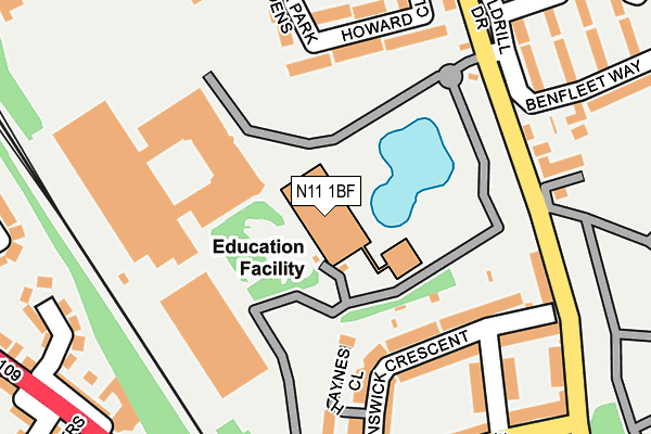
N11 1BF is located in the Brunswick Park electoral ward, within the London borough of Barnet and the English Parliamentary constituency of Chipping Barnet. The Sub Integrated Care Board (ICB) Location is NHS North Central London ICB - 93C and the police force is Metropolitan Police. This postcode has been in use since March 2014.


GetTheData
Source: OS OpenMap – Local (Ordnance Survey)
Source: OS VectorMap District (Ordnance Survey)
Licence: Open Government Licence (requires attribution)
| Easting | 528125 |
| Northing | 193430 |
| Latitude | 51.625110 |
| Longitude | -0.150463 |
GetTheData
Source: Open Postcode Geo
Licence: Open Government Licence
| Country | England |
| Postcode District | N11 |
➜ See where N11 is on a map ➜ Where is London? | |
GetTheData
Source: Land Registry Price Paid Data
Licence: Open Government Licence
Elevation or altitude of N11 1BF as distance above sea level:
| Metres | Feet | |
|---|---|---|
| Elevation | 50m | 164ft |
Elevation is measured from the approximate centre of the postcode, to the nearest point on an OS contour line from OS Terrain 50, which has contour spacing of ten vertical metres.
➜ How high above sea level am I? Find the elevation of your current position using your device's GPS.
GetTheData
Source: Open Postcode Elevation
Licence: Open Government Licence
| Ward | Brunswick Park |
| Constituency | Chipping Barnet |
GetTheData
Source: ONS Postcode Database
Licence: Open Government Licence
| Brunswick Park | Brunswick Park | 186m |
| Brunswick Park | Brunswick Park | 244m |
| Brunswick Avenue (N11) (Brunswick Park Road) | Brunswick Park | 257m |
| Brunswick Avenue (N11) (Brunswick Park Road) | Brunswick Park | 257m |
| Beaconsfield Road (N11) | Brunswick Park | 266m |
| Arnos Grove Underground Station | Arnos Grove | 1,543m |
| New Southgate Station | 1.3km |
| Oakleigh Park Station | 1.8km |
| Palmers Green Station | 2.9km |
GetTheData
Source: NaPTAN
Licence: Open Government Licence
GetTheData
Source: ONS Postcode Database
Licence: Open Government Licence


➜ Get more ratings from the Food Standards Agency
GetTheData
Source: Food Standards Agency
Licence: FSA terms & conditions
| Last Collection | |||
|---|---|---|---|
| Location | Mon-Fri | Sat | Distance |
| Brunswick Avenue/Brunswick Gro | 17:30 | 12:00 | 235m |
| Howards Close/Brunswick Pk Road | 17:30 | 12:00 | 266m |
| Oakleigh Road North Post Office | 17:30 | 12:00 | 341m |
GetTheData
Source: Dracos
Licence: Creative Commons Attribution-ShareAlike
The below table lists the International Territorial Level (ITL) codes (formerly Nomenclature of Territorial Units for Statistics (NUTS) codes) and Local Administrative Units (LAU) codes for N11 1BF:
| ITL 1 Code | Name |
|---|---|
| TLI | London |
| ITL 2 Code | Name |
| TLI7 | Outer London - West and North West |
| ITL 3 Code | Name |
| TLI71 | Barnet |
| LAU 1 Code | Name |
| E09000003 | Barnet |
GetTheData
Source: ONS Postcode Directory
Licence: Open Government Licence
The below table lists the Census Output Area (OA), Lower Layer Super Output Area (LSOA), and Middle Layer Super Output Area (MSOA) for N11 1BF:
| Code | Name | |
|---|---|---|
| OA | E00000602 | |
| LSOA | E01000123 | Barnet 010D |
| MSOA | E02000033 | Barnet 010 |
GetTheData
Source: ONS Postcode Directory
Licence: Open Government Licence
| N11 1EE | Brunswick Crescent | 138m |
| N11 1EB | Brunswick Crescent | 173m |
| N11 1EH | Howard Close | 198m |
| N11 1HH | Haynes Close | 200m |
| N11 1ED | Brunswick Grove | 208m |
| N11 1EG | Brunswick Park Road | 208m |
| N11 1EZ | Brunswick Park Road | 222m |
| N11 1HR | Brunswick Avenue | 228m |
| N11 1EJ | Brunswick Park Gardens | 246m |
| N11 1HS | Brunswick Avenue | 262m |
GetTheData
Source: Open Postcode Geo; Land Registry Price Paid Data
Licence: Open Government Licence