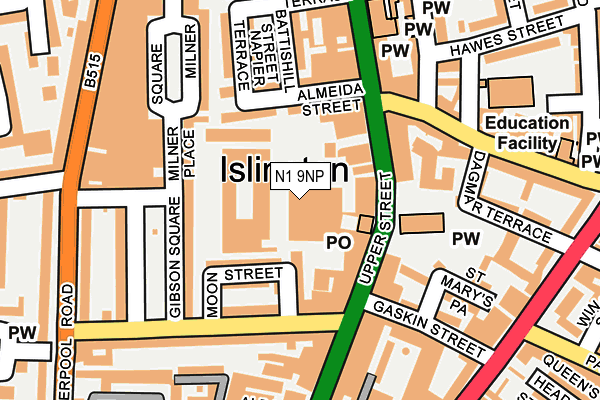
N1 9NP is located in the St Mary's & St James' electoral ward, within the London borough of Islington and the English Parliamentary constituency of Islington South and Finsbury. The Sub Integrated Care Board (ICB) Location is NHS North Central London ICB - 93C and the police force is Metropolitan Police. This postcode has been in use since March 2017.


GetTheData
Source: OS OpenMap – Local (Ordnance Survey)
Source: OS VectorMap District (Ordnance Survey)
Licence: Open Government Licence (requires attribution)
| Easting | 531622 |
| Northing | 183898 |
| Latitude | 51.538647 |
| Longitude | -0.103517 |
GetTheData
Source: Open Postcode Geo
Licence: Open Government Licence
| Country | England |
| Postcode District | N1 |
➜ See where N1 is on a map | |
GetTheData
Source: Land Registry Price Paid Data
Licence: Open Government Licence
| Ward | St Mary's & St James' |
| Constituency | Islington South And Finsbury |
GetTheData
Source: ONS Postcode Database
Licence: Open Government Licence
| St Mary's Church (N1) (Upper Street) | Islington | 96m |
| St Mary's Church (N1) (Upper Street) | Islington | 101m |
| Theberton Street Gibson Sq | Islington Green | 166m |
| Theberton Street (Upper Street) | Islington Green | 169m |
| Theberton Street Gibson Sq | Islington Green | 194m |
| Angel Underground Station | Angel | 690m |
| Highbury & Islington Underground Station | Highbury & Islington | 857m |
| Caledonian Road Underground Station | Caledonian Road | 1,510m |
| King's Cross St. Pancras Underground Station | King's Cross | 1,627m |
| Old Street Underground Station | Old Street | 1,794m |
| Essex Road Station | 0.6km |
| Highbury & Islington Station | 0.8km |
| Caledonian Road & Barnsbury Station | 1km |
GetTheData
Source: NaPTAN
Licence: Open Government Licence
GetTheData
Source: ONS Postcode Database
Licence: Open Government Licence


➜ Get more ratings from the Food Standards Agency
GetTheData
Source: Food Standards Agency
Licence: FSA terms & conditions
| Last Collection | |||
|---|---|---|---|
| Location | Mon-Fri | Sat | Distance |
| 116 Upper Street | 18:30 | 12:00 | 77m |
| Upper Street/Florence Street | 18:30 | 12:00 | 238m |
| Liverpool Rd/Theberton St | 18:30 | 12:00 | 254m |
GetTheData
Source: Dracos
Licence: Creative Commons Attribution-ShareAlike
The below table lists the International Territorial Level (ITL) codes (formerly Nomenclature of Territorial Units for Statistics (NUTS) codes) and Local Administrative Units (LAU) codes for N1 9NP:
| ITL 1 Code | Name |
|---|---|
| TLI | London |
| ITL 2 Code | Name |
| TLI4 | Inner London - East |
| ITL 3 Code | Name |
| TLI43 | Haringey and Islington |
| LAU 1 Code | Name |
| E09000019 | Islington |
GetTheData
Source: ONS Postcode Directory
Licence: Open Government Licence
The below table lists the Census Output Area (OA), Lower Layer Super Output Area (LSOA), and Middle Layer Super Output Area (MSOA) for N1 9NP:
| Code | Name | |
|---|---|---|
| OA | E00013926 | |
| LSOA | E01002794 | Islington 020B |
| MSOA | E02000573 | Islington 020 |
GetTheData
Source: ONS Postcode Directory
Licence: Open Government Licence
| N1 1ZT | Esther Anne Place | 14m |
| N1 1QP | Upper Street | 61m |
| N1 0QJ | Studd Street | 75m |
| N1 0QU | Moon Street | 86m |
| N1 1QN | Upper Street | 86m |
| N1 1TA | Almeida Street | 94m |
| N1 2TU | Upper Street | 103m |
| N1 0QX | Theberton Street | 113m |
| N1 1TN | Milner Place | 121m |
| N1 1TD | Almeida Street | 121m |
GetTheData
Source: Open Postcode Geo; Land Registry Price Paid Data
Licence: Open Government Licence