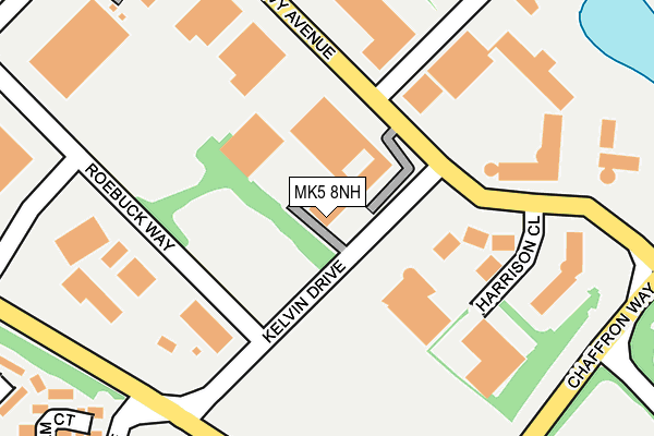
MK5 8NH is located in the Loughton & Shenley electoral ward, within the unitary authority of Milton Keynes and the English Parliamentary constituency of Milton Keynes South. The Sub Integrated Care Board (ICB) Location is NHS Bedfordshire, Luton and Milton Keynes ICB - M1J4Y and the police force is Thames Valley. This postcode has been in use since January 2006.


GetTheData
Source: OS OpenMap – Local (Ordnance Survey)
Source: OS VectorMap District (Ordnance Survey)
Licence: Open Government Licence (requires attribution)
| Easting | 484571 |
| Northing | 236667 |
| Latitude | 52.021996 |
| Longitude | -0.768895 |
GetTheData
Source: Open Postcode Geo
Licence: Open Government Licence
| Country | England |
| Postcode District | MK5 |
➜ See where MK5 is on a map ➜ Where is Milton Keynes? | |
GetTheData
Source: Land Registry Price Paid Data
Licence: Open Government Licence
Elevation or altitude of MK5 8NH as distance above sea level:
| Metres | Feet | |
|---|---|---|
| Elevation | 80m | 262ft |
Elevation is measured from the approximate centre of the postcode, to the nearest point on an OS contour line from OS Terrain 50, which has contour spacing of ten vertical metres.
➜ How high above sea level am I? Find the elevation of your current position using your device's GPS.
GetTheData
Source: Open Postcode Elevation
Licence: Open Government Licence
| Ward | Loughton & Shenley |
| Constituency | Milton Keynes South |
GetTheData
Source: ONS Postcode Database
Licence: Open Government Licence
| Kelvin Drive (Watling Street V4) | Knowlhill | 223m |
| Kelvin Drive (Watling Street V4) | Knowlhill | 241m |
| Cadman Square | Shenley Lodge | 366m |
| Cadman Square (Faraday Drive ) | Shenley Lodge | 377m |
| Cadman Square | Shenley Lodge | 391m |
| Milton Keynes Central Station | 1.4km |
| Bletchley Station | 3.7km |
| Fenny Stratford Station | 4.4km |
GetTheData
Source: NaPTAN
Licence: Open Government Licence
GetTheData
Source: ONS Postcode Database
Licence: Open Government Licence


➜ Get more ratings from the Food Standards Agency
GetTheData
Source: Food Standards Agency
Licence: FSA terms & conditions
| Last Collection | |||
|---|---|---|---|
| Location | Mon-Fri | Sat | Distance |
| Davy Avenue | 17:45 | 133m | |
| Faraday Drive | 17:30 | 12:00 | 303m |
| Northcroft | 17:30 | 12:00 | 495m |
GetTheData
Source: Dracos
Licence: Creative Commons Attribution-ShareAlike
The below table lists the International Territorial Level (ITL) codes (formerly Nomenclature of Territorial Units for Statistics (NUTS) codes) and Local Administrative Units (LAU) codes for MK5 8NH:
| ITL 1 Code | Name |
|---|---|
| TLJ | South East (England) |
| ITL 2 Code | Name |
| TLJ1 | Berkshire, Buckinghamshire and Oxfordshire |
| ITL 3 Code | Name |
| TLJ12 | Milton Keynes |
| LAU 1 Code | Name |
| E06000042 | Milton Keynes |
GetTheData
Source: ONS Postcode Directory
Licence: Open Government Licence
The below table lists the Census Output Area (OA), Lower Layer Super Output Area (LSOA), and Middle Layer Super Output Area (MSOA) for MK5 8NH:
| Code | Name | |
|---|---|---|
| OA | E00084646 | |
| LSOA | E01016775 | Milton Keynes 020B |
| MSOA | E02003478 | Milton Keynes 020 |
GetTheData
Source: ONS Postcode Directory
Licence: Open Government Licence
| MK5 7DP | Grantham Court | 316m |
| MK5 7DJ | Silicon Court | 330m |
| MK5 7DL | Silicon Court | 362m |
| MK5 7AH | Brayton Court | 377m |
| MK5 7DA | Faraday Drive | 392m |
| MK5 7BE | Northcroft | 408m |
| MK5 7DN | Cadman Square | 411m |
| MK5 7AJ | Northcroft | 421m |
| MK5 7AZ | Laser Close | 433m |
| MK5 7DG | Rutherford Gate | 447m |
GetTheData
Source: Open Postcode Geo; Land Registry Price Paid Data
Licence: Open Government Licence