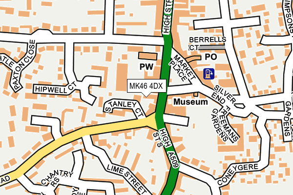
MK46 4DX is located in the Olney electoral ward, within the unitary authority of Milton Keynes and the English Parliamentary constituency of Milton Keynes North. The Sub Integrated Care Board (ICB) Location is NHS Bedfordshire, Luton and Milton Keynes ICB - M1J4Y and the police force is Thames Valley. This postcode has been in use since May 2003.


GetTheData
Source: OS OpenMap – Local (Ordnance Survey)
Source: OS VectorMap District (Ordnance Survey)
Licence: Open Government Licence (requires attribution)
| Easting | 488870 |
| Northing | 251262 |
| Latitude | 52.152509 |
| Longitude | -0.702463 |
GetTheData
Source: Open Postcode Geo
Licence: Open Government Licence
| Country | England |
| Postcode District | MK46 |
➜ See where MK46 is on a map ➜ Where is Olney? | |
GetTheData
Source: Land Registry Price Paid Data
Licence: Open Government Licence
Elevation or altitude of MK46 4DX as distance above sea level:
| Metres | Feet | |
|---|---|---|
| Elevation | 50m | 164ft |
Elevation is measured from the approximate centre of the postcode, to the nearest point on an OS contour line from OS Terrain 50, which has contour spacing of ten vertical metres.
➜ How high above sea level am I? Find the elevation of your current position using your device's GPS.
GetTheData
Source: Open Postcode Elevation
Licence: Open Government Licence
| Ward | Olney |
| Constituency | Milton Keynes North |
GetTheData
Source: ONS Postcode Database
Licence: Open Government Licence
| The Bull (High Street) | Olney | 45m |
| The Bull (High Street) | Olney | 60m |
| High Street | Olney | 356m |
| Weston Road | Olney | 394m |
| Weston Road | Olney | 468m |
GetTheData
Source: NaPTAN
Licence: Open Government Licence
GetTheData
Source: ONS Postcode Database
Licence: Open Government Licence


➜ Get more ratings from the Food Standards Agency
GetTheData
Source: Food Standards Agency
Licence: FSA terms & conditions
| Last Collection | |||
|---|---|---|---|
| Location | Mon-Fri | Sat | Distance |
| Market Place | 17:30 | 11:00 | 50m |
| Fourboys Market Place | 17:30 | 11:00 | 104m |
| Weston Road | 16:00 | 09:30 | 457m |
GetTheData
Source: Dracos
Licence: Creative Commons Attribution-ShareAlike
The below table lists the International Territorial Level (ITL) codes (formerly Nomenclature of Territorial Units for Statistics (NUTS) codes) and Local Administrative Units (LAU) codes for MK46 4DX:
| ITL 1 Code | Name |
|---|---|
| TLJ | South East (England) |
| ITL 2 Code | Name |
| TLJ1 | Berkshire, Buckinghamshire and Oxfordshire |
| ITL 3 Code | Name |
| TLJ12 | Milton Keynes |
| LAU 1 Code | Name |
| E06000042 | Milton Keynes |
GetTheData
Source: ONS Postcode Directory
Licence: Open Government Licence
The below table lists the Census Output Area (OA), Lower Layer Super Output Area (LSOA), and Middle Layer Super Output Area (MSOA) for MK46 4DX:
| Code | Name | |
|---|---|---|
| OA | E00084750 | |
| LSOA | E01016797 | Milton Keynes 001B |
| MSOA | E02003459 | Milton Keynes 001 |
GetTheData
Source: ONS Postcode Directory
Licence: Open Government Licence
| MK46 5NH | Stanley Court | 50m |
| MK46 4AJ | Market Place | 68m |
| MK46 4AA | High Street South | 70m |
| MK46 4LA | Osborns Court | 72m |
| MK46 5HS | Spring Lane | 99m |
| MK46 4BA | Market Place | 114m |
| MK46 5BD | Weston Road | 121m |
| MK46 5QB | Hipwell Court | 139m |
| MK46 5BA | Lime Street | 139m |
| MK46 4BY | Rose Court | 144m |
GetTheData
Source: Open Postcode Geo; Land Registry Price Paid Data
Licence: Open Government Licence