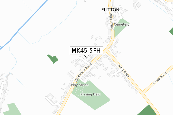
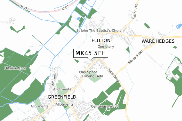
MK45 5FH is located in the Westoning, Flitton & Greenfield electoral ward, within the unitary authority of Central Bedfordshire and the English Parliamentary constituency of Mid Bedfordshire. The Sub Integrated Care Board (ICB) Location is NHS Bedfordshire, Luton and Milton Keynes ICB - M1J4Y and the police force is Bedfordshire. This postcode has been in use since April 2019.


GetTheData
Source: OS Open Zoomstack (Ordnance Survey)
Licence: Open Government Licence (requires attribution)
Attribution: Contains OS data © Crown copyright and database right 2024
Source: Open Postcode Geo
Licence: Open Government Licence (requires attribution)
Attribution: Contains OS data © Crown copyright and database right 2024; Contains Royal Mail data © Royal Mail copyright and database right 2024; Source: Office for National Statistics licensed under the Open Government Licence v.3.0
| Easting | 505814 |
| Northing | 235440 |
| Latitude | 52.007329 |
| Longitude | -0.459793 |
GetTheData
Source: Open Postcode Geo
Licence: Open Government Licence
| Country | England |
| Postcode District | MK45 |
➜ See where MK45 is on a map ➜ Where is Flitton? | |
GetTheData
Source: Land Registry Price Paid Data
Licence: Open Government Licence
| Ward | Westoning, Flitton & Greenfield |
| Constituency | Mid Bedfordshire |
GetTheData
Source: ONS Postcode Database
Licence: Open Government Licence
21, HAYFIELD CLOSE, FLITTON, BEDFORD, MK45 5FH 2021 30 SEP £1,050,000 |
17, HAYFIELD CLOSE, FLITTON, BEDFORD, MK45 5FH 2021 27 MAY £545,000 |
6, HAYFIELD CLOSE, FLITTON, BEDFORD, MK45 5FH 2021 14 MAY £1,038,000 |
4, HAYFIELD CLOSE, FLITTON, BEDFORD, MK45 5FH 2021 3 MAR £1,025,000 |
7, HAYFIELD CLOSE, FLITTON, BEDFORD, MK45 5FH 2021 8 JAN £825,000 |
18, HAYFIELD CLOSE, FLITTON, BEDFORD, MK45 5FH 2020 21 DEC £530,000 |
20, HAYFIELD CLOSE, FLITTON, BEDFORD, MK45 5FH 2020 29 OCT £1,125,000 |
19, HAYFIELD CLOSE, FLITTON, BEDFORD, MK45 5FH 2020 22 OCT £740,000 |
2, HAYFIELD CLOSE, FLITTON, BEDFORD, MK45 5FH 2020 2 OCT £725,000 |
3, HAYFIELD CLOSE, FLITTON, BEDFORD, MK45 5FH 2020 30 SEP £950,000 |
GetTheData
Source: HM Land Registry Price Paid Data
Licence: Contains HM Land Registry data © Crown copyright and database right 2024. This data is licensed under the Open Government Licence v3.0.
| Cobbett Lane (High Street) | Flitton | 297m |
| Cobbett Lane (High Street) | Flitton | 321m |
| Church (High Street) | Flitton | 414m |
| Church (High Street) | Flitton | 418m |
| Highfield Road (Wardhedges Road) | Wardhedges | 673m |
| Flitwick Station | 2.5km |
GetTheData
Source: NaPTAN
Licence: Open Government Licence
GetTheData
Source: ONS Postcode Database
Licence: Open Government Licence


➜ Get more ratings from the Food Standards Agency
GetTheData
Source: Food Standards Agency
Licence: FSA terms & conditions
| Last Collection | |||
|---|---|---|---|
| Location | Mon-Fri | Sat | Distance |
| Greenfield Road | 17:30 | 10:30 | 63m |
| Ward Hedges | 15:45 | 10:30 | 925m |
| Flitwick Turn | 16:00 | 10:30 | 1,461m |
GetTheData
Source: Dracos
Licence: Creative Commons Attribution-ShareAlike
The below table lists the International Territorial Level (ITL) codes (formerly Nomenclature of Territorial Units for Statistics (NUTS) codes) and Local Administrative Units (LAU) codes for MK45 5FH:
| ITL 1 Code | Name |
|---|---|
| TLH | East |
| ITL 2 Code | Name |
| TLH2 | Bedfordshire and Hertfordshire |
| ITL 3 Code | Name |
| TLH25 | Central Bedfordshire |
| LAU 1 Code | Name |
| E06000056 | Central Bedfordshire |
GetTheData
Source: ONS Postcode Directory
Licence: Open Government Licence
The below table lists the Census Output Area (OA), Lower Layer Super Output Area (LSOA), and Middle Layer Super Output Area (MSOA) for MK45 5FH:
| Code | Name | |
|---|---|---|
| OA | E00087866 | |
| LSOA | E01017398 | Central Bedfordshire 017A |
| MSOA | E02003615 | Central Bedfordshire 017 |
GetTheData
Source: ONS Postcode Directory
Licence: Open Government Licence
| MK45 5DR | Greenfield Road | 124m |
| MK45 5DN | Eves Field | 174m |
| MK45 5DT | Sand Road | 192m |
| MK45 5DU | High Street | 260m |
| MK45 5DQ | Moorland Close | 319m |
| MK45 5DX | Cobbett Lane | 325m |
| MK45 5DY | High Street | 457m |
| MK45 5DJ | Flitton Road | 461m |
| MK45 5EJ | Brook Lane | 478m |
| MK45 5EH | Wardhedges | 532m |
GetTheData
Source: Open Postcode Geo; Land Registry Price Paid Data
Licence: Open Government Licence