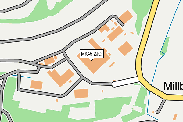
MK45 2JQ is located in the Ampthill electoral ward, within the unitary authority of Central Bedfordshire and the English Parliamentary constituency of Mid Bedfordshire. The Sub Integrated Care Board (ICB) Location is NHS Bedfordshire, Luton and Milton Keynes ICB - M1J4Y and the police force is Bedfordshire. This postcode has been in use since December 1997.


GetTheData
Source: OS OpenMap – Local (Ordnance Survey)
Source: OS VectorMap District (Ordnance Survey)
Licence: Open Government Licence (requires attribution)
| Easting | 500992 |
| Northing | 238990 |
| Latitude | 52.040132 |
| Longitude | -0.528974 |
GetTheData
Source: Open Postcode Geo
Licence: Open Government Licence
| Country | England |
| Postcode District | MK45 |
➜ See where MK45 is on a map | |
GetTheData
Source: Land Registry Price Paid Data
Licence: Open Government Licence
Elevation or altitude of MK45 2JQ as distance above sea level:
| Metres | Feet | |
|---|---|---|
| Elevation | 70m | 230ft |
Elevation is measured from the approximate centre of the postcode, to the nearest point on an OS contour line from OS Terrain 50, which has contour spacing of ten vertical metres.
➜ How high above sea level am I? Find the elevation of your current position using your device's GPS.
GetTheData
Source: Open Postcode Elevation
Licence: Open Government Licence
| Ward | Ampthill |
| Constituency | Mid Bedfordshire |
GetTheData
Source: ONS Postcode Database
Licence: Open Government Licence
| Sandhill Close (Station Lane) | Millbrook | 308m |
| Sandhill Close (Station Lane) | Millbrook | 313m |
| Millbrook Railway Station (Station Lane) | Millbrook | 1,523m |
| Valley House (Marston Road) | Lidlington | 1,576m |
| Marston Road | Lidlington | 1,581m |
| Millbrook (Beds) Station | 1.5km |
| Lidlington Station | 2.1km |
| Stewartby Station | 3.3km |
GetTheData
Source: NaPTAN
Licence: Open Government Licence
GetTheData
Source: ONS Postcode Database
Licence: Open Government Licence


➜ Get more ratings from the Food Standards Agency
GetTheData
Source: Food Standards Agency
Licence: FSA terms & conditions
| Last Collection | |||
|---|---|---|---|
| Location | Mon-Fri | Sat | Distance |
| Russell Grove | 17:15 | 09:00 | 422m |
| Station Road | 17:00 | 09:00 | 1,523m |
| Marston Valley | 16:00 | 10:45 | 1,583m |
GetTheData
Source: Dracos
Licence: Creative Commons Attribution-ShareAlike
The below table lists the International Territorial Level (ITL) codes (formerly Nomenclature of Territorial Units for Statistics (NUTS) codes) and Local Administrative Units (LAU) codes for MK45 2JQ:
| ITL 1 Code | Name |
|---|---|
| TLH | East |
| ITL 2 Code | Name |
| TLH2 | Bedfordshire and Hertfordshire |
| ITL 3 Code | Name |
| TLH25 | Central Bedfordshire |
| LAU 1 Code | Name |
| E06000056 | Central Bedfordshire |
GetTheData
Source: ONS Postcode Directory
Licence: Open Government Licence
The below table lists the Census Output Area (OA), Lower Layer Super Output Area (LSOA), and Middle Layer Super Output Area (MSOA) for MK45 2JQ:
| Code | Name | |
|---|---|---|
| OA | E00087757 | |
| LSOA | E01017373 | Central Bedfordshire 012C |
| MSOA | E02003610 | Central Bedfordshire 012 |
GetTheData
Source: ONS Postcode Directory
Licence: Open Government Licence
| MK45 2JD | Sandhill Close | 420m |
| MK45 2JB | 485m | |
| MK45 2JE | Russell Grove | 561m |
| MK45 2JA | Sandhill Close | 799m |
| MK45 2HY | Woburn Street | 995m |
| MK45 2HF | Hazelwood Lane | 1371m |
| MK45 2JJ | Pillinge Cottages | 1475m |
| MK45 2JH | Station Lane | 1547m |
| MK43 0PP | Marston Road | 1553m |
| MK43 0UP | The Lane | 1719m |
GetTheData
Source: Open Postcode Geo; Land Registry Price Paid Data
Licence: Open Government Licence