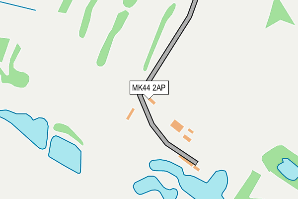
MK44 2AP is located in the Wyboston electoral ward, within the unitary authority of Bedford and the English Parliamentary constituency of North East Bedfordshire. The Sub Integrated Care Board (ICB) Location is NHS Bedfordshire, Luton and Milton Keynes ICB - M1J4Y and the police force is Bedfordshire. This postcode has been in use since February 2007.


GetTheData
Source: OS OpenMap – Local (Ordnance Survey)
Source: OS VectorMap District (Ordnance Survey)
Licence: Open Government Licence (requires attribution)
| Easting | 509594 |
| Northing | 257117 |
| Latitude | 52.201398 |
| Longitude | -0.397803 |
GetTheData
Source: Open Postcode Geo
Licence: Open Government Licence
| Country | England |
| Postcode District | MK44 |
➜ See where MK44 is on a map | |
GetTheData
Source: Land Registry Price Paid Data
Licence: Open Government Licence
Elevation or altitude of MK44 2AP as distance above sea level:
| Metres | Feet | |
|---|---|---|
| Elevation | 70m | 230ft |
Elevation is measured from the approximate centre of the postcode, to the nearest point on an OS contour line from OS Terrain 50, which has contour spacing of ten vertical metres.
➜ How high above sea level am I? Find the elevation of your current position using your device's GPS.
GetTheData
Source: Open Postcode Elevation
Licence: Open Government Licence
| Ward | Wyboston |
| Constituency | North East Bedfordshire |
GetTheData
Source: ONS Postcode Database
Licence: Open Government Licence
| Wilden Road | Rootham's Green | 575m |
| Wilden Road | Rootham's Green | 585m |
| Chapel End (Church Road) | Colmworth | 1,164m |
| Chapel End (Church Road) | Colmworth | 1,165m |
| School Farm (Church Road) | Colmworth | 1,448m |
GetTheData
Source: NaPTAN
Licence: Open Government Licence
GetTheData
Source: ONS Postcode Database
Licence: Open Government Licence


➜ Get more ratings from the Food Standards Agency
GetTheData
Source: Food Standards Agency
Licence: FSA terms & conditions
| Last Collection | |||
|---|---|---|---|
| Location | Mon-Fri | Sat | Distance |
| Roothams Green | 17:15 | 11:15 | 776m |
| Shrubbery Lane | 14:30 | 09:00 | 1,745m |
| Channels End | 17:15 | 08:00 | 1,800m |
GetTheData
Source: Dracos
Licence: Creative Commons Attribution-ShareAlike
The below table lists the International Territorial Level (ITL) codes (formerly Nomenclature of Territorial Units for Statistics (NUTS) codes) and Local Administrative Units (LAU) codes for MK44 2AP:
| ITL 1 Code | Name |
|---|---|
| TLH | East |
| ITL 2 Code | Name |
| TLH2 | Bedfordshire and Hertfordshire |
| ITL 3 Code | Name |
| TLH24 | Bedford |
| LAU 1 Code | Name |
| E06000055 | Bedford |
GetTheData
Source: ONS Postcode Directory
Licence: Open Government Licence
The below table lists the Census Output Area (OA), Lower Layer Super Output Area (LSOA), and Middle Layer Super Output Area (MSOA) for MK44 2AP:
| Code | Name | |
|---|---|---|
| OA | E00088553 | |
| LSOA | E01017543 | Bedford 004E |
| MSOA | E02003619 | Bedford 004 |
GetTheData
Source: ONS Postcode Directory
Licence: Open Government Licence
| MK44 2NJ | Wilden Road | 445m |
| MK44 2NH | Roothams Green | 695m |
| MK44 2EY | Kimbolton Road | 1039m |
| MK44 2PP | Kimbolton Road | 1121m |
| MK44 2QH | Chequers Hill | 1137m |
| MK44 2JY | Chapel Lane | 1315m |
| MK44 2JX | Church Road | 1323m |
| MK44 2NS | Channels End Road | 1534m |
| MK44 2QW | Ducks Cross | 1673m |
| MK44 2EX | Kimbolton Road | 1699m |
GetTheData
Source: Open Postcode Geo; Land Registry Price Paid Data
Licence: Open Government Licence