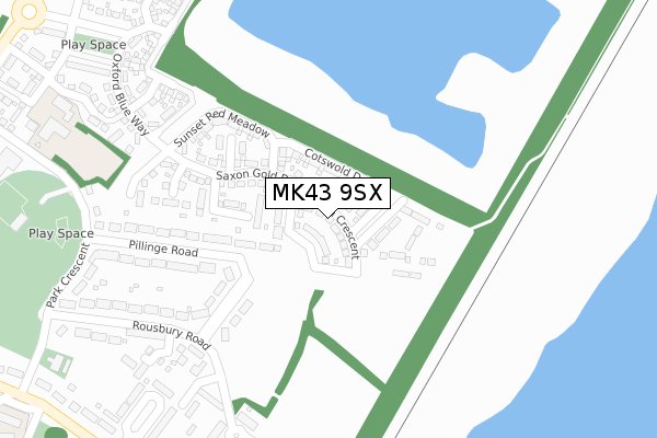
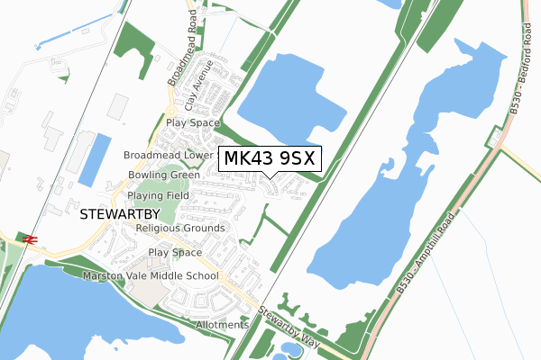
MK43 9SX is located in the Houghton Conquest & Haynes electoral ward, within the unitary authority of Central Bedfordshire and the English Parliamentary constituency of Mid Bedfordshire. The Sub Integrated Care Board (ICB) Location is NHS Bedfordshire, Luton and Milton Keynes ICB - M1J4Y and the police force is Bedfordshire. This postcode has been in use since December 2019.


GetTheData
Source: OS Open Zoomstack (Ordnance Survey)
Licence: Open Government Licence (requires attribution)
Attribution: Contains OS data © Crown copyright and database right 2025
Source: Open Postcode Geo
Licence: Open Government Licence (requires attribution)
Attribution: Contains OS data © Crown copyright and database right 2025; Contains Royal Mail data © Royal Mail copyright and database right 2025; Source: Office for National Statistics licensed under the Open Government Licence v.3.0
| Easting | 502645 |
| Northing | 242451 |
| Latitude | 52.070936 |
| Longitude | -0.503844 |
GetTheData
Source: Open Postcode Geo
Licence: Open Government Licence
| Country | England |
| Postcode District | MK43 |
➜ See where MK43 is on a map ➜ Where is Stewartby? | |
GetTheData
Source: Land Registry Price Paid Data
Licence: Open Government Licence
| Ward | Houghton Conquest & Haynes |
| Constituency | Mid Bedfordshire |
GetTheData
Source: ONS Postcode Database
Licence: Open Government Licence
7, MILTON CRESCENT, STEWARTBY, BEDFORD, MK43 9SX 2022 14 JAN £491,000 |
1, MILTON CRESCENT, STEWARTBY, BEDFORD, MK43 9SX 2021 26 NOV £493,000 |
5, MILTON CRESCENT, STEWARTBY, BEDFORD, MK43 9SX 2021 5 NOV £433,000 |
3, MILTON CRESCENT, STEWARTBY, BEDFORD, MK43 9SX 2021 29 OCT £433,000 |
40, MILTON CRESCENT, STEWARTBY, BEDFORD, MK43 9SX 2021 26 FEB £306,000 |
36, MILTON CRESCENT, STEWARTBY, BEDFORD, MK43 9SX 2021 29 JAN £315,000 |
38, MILTON CRESCENT, STEWARTBY, BEDFORD, MK43 9SX 2020 12 JUN £312,000 |
25, MILTON CRESCENT, STEWARTBY, BEDFORD, MK43 9SX 2020 30 MAR £316,000 |
45, MILTON CRESCENT, STEWARTBY, BEDFORD, MK43 9SX 2019 29 NOV £312,995 |
GetTheData
Source: HM Land Registry Price Paid Data
Licence: Contains HM Land Registry data © Crown copyright and database right 2025. This data is licensed under the Open Government Licence v3.0.
| Montgomery Close (Stewartby Way) | Stewartby | 437m |
| Marston Vale Middle School (The Crescent) | Stewartby | 591m |
| The Post Office (Stewartby Way) | Stewartby | 693m |
| The Post Ofice (Stewartby Way) | Stewartby | 701m |
| Brickworks (Broadmead Road) | Stewartby | 741m |
| Stewartby Station | 1.2km |
| Kempston Hardwick Station | 2.4km |
| Millbrook (Beds) Station | 2.7km |
GetTheData
Source: NaPTAN
Licence: Open Government Licence
GetTheData
Source: ONS Postcode Database
Licence: Open Government Licence


➜ Get more ratings from the Food Standards Agency
GetTheData
Source: Food Standards Agency
Licence: FSA terms & conditions
| Last Collection | |||
|---|---|---|---|
| Location | Mon-Fri | Sat | Distance |
| Rousbury Road | 16:40 | 10:15 | 291m |
| Post Office Stewartby Way | 16:40 | 11:15 | 697m |
| How End | 16:10 | 07:00 | 1,645m |
GetTheData
Source: Dracos
Licence: Creative Commons Attribution-ShareAlike
The below table lists the International Territorial Level (ITL) codes (formerly Nomenclature of Territorial Units for Statistics (NUTS) codes) and Local Administrative Units (LAU) codes for MK43 9SX:
| ITL 1 Code | Name |
|---|---|
| TLH | East |
| ITL 2 Code | Name |
| TLH2 | Bedfordshire and Hertfordshire |
| ITL 3 Code | Name |
| TLH25 | Central Bedfordshire |
| LAU 1 Code | Name |
| E06000056 | Central Bedfordshire |
GetTheData
Source: ONS Postcode Directory
Licence: Open Government Licence
The below table lists the Census Output Area (OA), Lower Layer Super Output Area (LSOA), and Middle Layer Super Output Area (MSOA) for MK43 9SX:
| Code | Name | |
|---|---|---|
| OA | E00087928 | |
| LSOA | E01017411 | Central Bedfordshire 008B |
| MSOA | E02003606 | Central Bedfordshire 008 |
GetTheData
Source: ONS Postcode Directory
Licence: Open Government Licence
| MK43 9NP | Magpie Avenue | 205m |
| MK43 9NW | Pillinge Road | 243m |
| MK43 9NA | Rousbury Road | 269m |
| MK43 9PE | The Meadows | 282m |
| MK43 9NZ | The Pastures | 291m |
| MK43 9PF | The Meadows | 316m |
| MK43 9PN | Kitchener Place | 332m |
| MK43 9NJ | Rousbury Road | 352m |
| MK43 9LP | Montgomery Close | 356m |
| MK43 9NY | The Pastures | 363m |
GetTheData
Source: Open Postcode Geo; Land Registry Price Paid Data
Licence: Open Government Licence