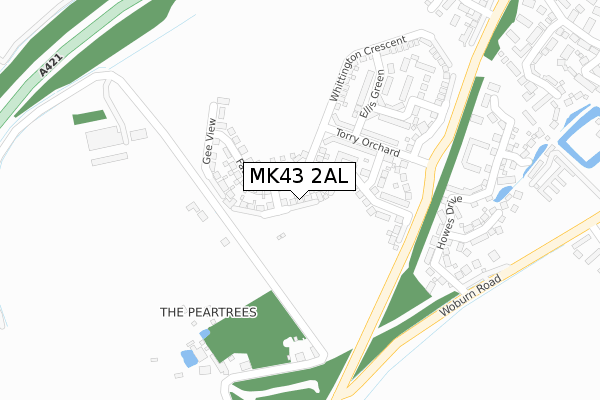
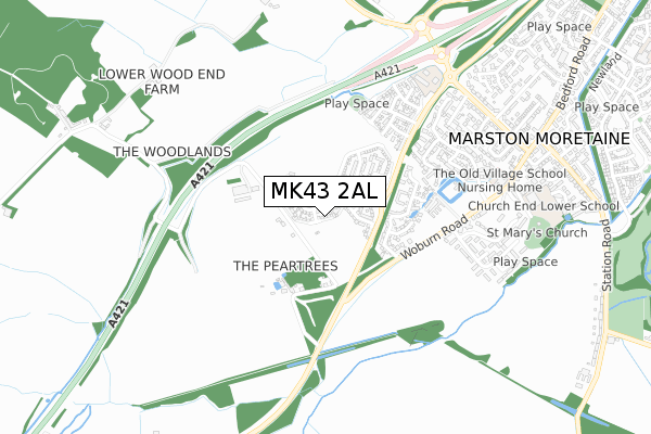
MK43 2AL is located in the Cranfield & Marston Moretaine electoral ward, within the unitary authority of Central Bedfordshire and the English Parliamentary constituency of Mid Bedfordshire. The Sub Integrated Care Board (ICB) Location is NHS Bedfordshire, Luton and Milton Keynes ICB - M1J4Y and the police force is Bedfordshire. This postcode has been in use since November 2019.


GetTheData
Source: OS Open Zoomstack (Ordnance Survey)
Licence: Open Government Licence (requires attribution)
Attribution: Contains OS data © Crown copyright and database right 2025
Source: Open Postcode Geo
Licence: Open Government Licence (requires attribution)
Attribution: Contains OS data © Crown copyright and database right 2025; Contains Royal Mail data © Royal Mail copyright and database right 2025; Source: Office for National Statistics licensed under the Open Government Licence v.3.0
| Easting | 498752 |
| Northing | 241198 |
| Latitude | 52.060381 |
| Longitude | -0.560985 |
GetTheData
Source: Open Postcode Geo
Licence: Open Government Licence
| Country | England |
| Postcode District | MK43 |
➜ See where MK43 is on a map ➜ Where is Marston Moretaine? | |
GetTheData
Source: Land Registry Price Paid Data
Licence: Open Government Licence
| Ward | Cranfield & Marston Moretaine |
| Constituency | Mid Bedfordshire |
GetTheData
Source: ONS Postcode Database
Licence: Open Government Licence
4, COPPERWHEAT BANK, MARSTON MORETAINE, BEDFORD, MK43 2AL 2021 2 JUN £671,495 |
2, COPPERWHEAT BANK, MARSTON MORETAINE, BEDFORD, MK43 2AL 2020 10 DEC £599,999 |
6, COPPERWHEAT BANK, MARSTON MORETAINE, BEDFORD, MK43 2AL 2020 4 DEC £454,495 |
8, COPPERWHEAT BANK, MARSTON MORETAINE, BEDFORD, MK43 2AL 2020 16 OCT £439,995 |
1, COPPERWHEAT BANK, MARSTON MORETAINE, BEDFORD, MK43 2AL 2020 28 AUG £419,995 |
10, COPPERWHEAT BANK, MARSTON MORETAINE, BEDFORD, MK43 2AL 2020 27 AUG £544,995 |
3, COPPERWHEAT BANK, MARSTON MORETAINE, BEDFORD, MK43 2AL 2020 18 MAR £459,995 |
5, COPPERWHEAT BANK, MARSTON MORETAINE, BEDFORD, MK43 2AL 2020 17 JAN £459,995 |
9, COPPERWHEAT BANK, MARSTON MORETAINE, BEDFORD, MK43 2AL 2019 29 NOV £539,995 |
7, COPPERWHEAT BANK, MARSTON MORETAINE, BEDFORD, MK43 2AL 2019 22 NOV £664,995 |
➜ Marston Moretaine house prices
GetTheData
Source: HM Land Registry Price Paid Data
Licence: Contains HM Land Registry data © Crown copyright and database right 2025. This data is licensed under the Open Government Licence v3.0.
| Howes Drive (Woburn Road) | Marston Moretaine | 351m |
| Manor Road (Woburn Road) | Marston Moretaine | 554m |
| Chandlers Close (Beancroft Road) | Marston Moretaine | 768m |
| Chandlers Close (Beancroft Road) | Marston Moretaine | 771m |
| Moreteyne Road (Beancroft Road) | Marston Moretaine | 795m |
| Millbrook (Beds) Station | 2.1km |
| Lidlington Station | 2.1km |
| Stewartby Station | 2.9km |
GetTheData
Source: NaPTAN
Licence: Open Government Licence
GetTheData
Source: ONS Postcode Database
Licence: Open Government Licence


➜ Get more ratings from the Food Standards Agency
GetTheData
Source: Food Standards Agency
Licence: FSA terms & conditions
| Last Collection | |||
|---|---|---|---|
| Location | Mon-Fri | Sat | Distance |
| Manor Road | 16:10 | 10:55 | 547m |
| Post Office Bedford Road | 16:15 | 11:00 | 927m |
| Station Road | 17:10 | 10:50 | 1,201m |
GetTheData
Source: Dracos
Licence: Creative Commons Attribution-ShareAlike
The below table lists the International Territorial Level (ITL) codes (formerly Nomenclature of Territorial Units for Statistics (NUTS) codes) and Local Administrative Units (LAU) codes for MK43 2AL:
| ITL 1 Code | Name |
|---|---|
| TLH | East |
| ITL 2 Code | Name |
| TLH2 | Bedfordshire and Hertfordshire |
| ITL 3 Code | Name |
| TLH25 | Central Bedfordshire |
| LAU 1 Code | Name |
| E06000056 | Central Bedfordshire |
GetTheData
Source: ONS Postcode Directory
Licence: Open Government Licence
The below table lists the Census Output Area (OA), Lower Layer Super Output Area (LSOA), and Middle Layer Super Output Area (MSOA) for MK43 2AL:
| Code | Name | |
|---|---|---|
| OA | E00087954 | |
| LSOA | E01017417 | Central Bedfordshire 009B |
| MSOA | E02003607 | Central Bedfordshire 009 |
GetTheData
Source: ONS Postcode Directory
Licence: Open Government Licence
| MK43 0NY | Wood End | 257m |
| MK43 0NJ | Woburn Road | 268m |
| MK43 0FD | Howes Drive | 317m |
| MK43 0FL | Ashcraft Close | 361m |
| MK43 0FG | Howes Drive | 364m |
| MK43 0FJ | Ashcraft Close | 370m |
| MK43 0FH | Drapers End | 429m |
| MK43 0PE | Moat Farm Barns | 478m |
| MK43 0AE | Moat Farm Close | 492m |
| MK43 0UR | Primrose Close | 572m |
GetTheData
Source: Open Postcode Geo; Land Registry Price Paid Data
Licence: Open Government Licence