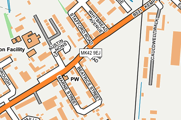
MK42 9EJ is located in the Kempston Central & East electoral ward, within the unitary authority of Bedford and the English Parliamentary constituency of Bedford. The Sub Integrated Care Board (ICB) Location is NHS Bedfordshire, Luton and Milton Keynes ICB - M1J4Y and the police force is Bedfordshire. This postcode has been in use since April 2017.


GetTheData
Source: OS OpenMap – Local (Ordnance Survey)
Source: OS VectorMap District (Ordnance Survey)
Licence: Open Government Licence (requires attribution)
| Easting | 504162 |
| Northing | 248581 |
| Latitude | 52.125746 |
| Longitude | -0.479850 |
GetTheData
Source: Open Postcode Geo
Licence: Open Government Licence
| Country | England |
| Postcode District | MK42 |
➜ See where MK42 is on a map ➜ Where is Bedford? | |
GetTheData
Source: Land Registry Price Paid Data
Licence: Open Government Licence
| Ward | Kempston Central & East |
| Constituency | Bedford |
GetTheData
Source: ONS Postcode Database
Licence: Open Government Licence
| Whitbread Avenue (Bedford Road) | Kempston | 67m |
| Whitbread Avenue (Kempston Road) | Kempston | 73m |
| The Keep (Bedford Road) | Kempston | 165m |
| Savannah Close (Walcourt Road) | Kempston | 310m |
| Savannah Close (Walcourt Road) | Kempston | 335m |
| Bedford St Johns Station | 0.9km |
| Bedford Station | 1.2km |
| Kempston Hardwick Station | 4.1km |
GetTheData
Source: NaPTAN
Licence: Open Government Licence
GetTheData
Source: ONS Postcode Database
Licence: Open Government Licence


➜ Get more ratings from the Food Standards Agency
GetTheData
Source: Food Standards Agency
Licence: FSA terms & conditions
| Last Collection | |||
|---|---|---|---|
| Location | Mon-Fri | Sat | Distance |
| Endsleigh Road | 18:25 | 11:15 | 472m |
| Ashdale Avenue | 18:20 | 11:20 | 607m |
| Ampthill Road | 18:30 | 12:30 | 607m |
GetTheData
Source: Dracos
Licence: Creative Commons Attribution-ShareAlike
The below table lists the International Territorial Level (ITL) codes (formerly Nomenclature of Territorial Units for Statistics (NUTS) codes) and Local Administrative Units (LAU) codes for MK42 9EJ:
| ITL 1 Code | Name |
|---|---|
| TLH | East |
| ITL 2 Code | Name |
| TLH2 | Bedfordshire and Hertfordshire |
| ITL 3 Code | Name |
| TLH24 | Bedford |
| LAU 1 Code | Name |
| E06000055 | Bedford |
GetTheData
Source: ONS Postcode Directory
Licence: Open Government Licence
The below table lists the Census Output Area (OA), Lower Layer Super Output Area (LSOA), and Middle Layer Super Output Area (MSOA) for MK42 9EJ:
| Code | Name | |
|---|---|---|
| OA | E00088393 | |
| LSOA | E01017506 | Bedford 017B |
| MSOA | E02003632 | Bedford 017 |
GetTheData
Source: ONS Postcode Directory
Licence: Open Government Licence
| MK42 8AD | Bedford Road | 72m |
| MK42 9DX | Kempston Road | 85m |
| MK42 8AE | Beatrice Street | 99m |
| MK42 8AF | Beatrice Street | 102m |
| MK42 9EA | Stafford Road | 123m |
| MK42 8AS | Austin Canons | 126m |
| MK42 9DU | Kempston Road | 128m |
| MK42 8AG | Marne Street | 132m |
| MK42 8AB | Bedford Road | 139m |
| MK42 9DY | Whitbread Avenue | 155m |
GetTheData
Source: Open Postcode Geo; Land Registry Price Paid Data
Licence: Open Government Licence