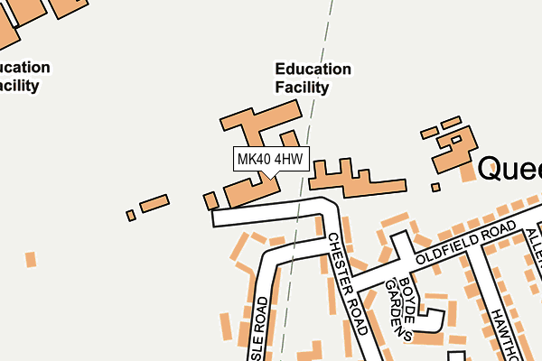
MK40 4HW is located in the Queens Park electoral ward, within the unitary authority of Bedford and the English Parliamentary constituency of Bedford. The Sub Integrated Care Board (ICB) Location is NHS Bedfordshire, Luton and Milton Keynes ICB - M1J4Y and the police force is Bedfordshire. This postcode has been in use since January 1980.


GetTheData
Source: OS OpenMap – Local (Ordnance Survey)
Source: OS VectorMap District (Ordnance Survey)
Licence: Open Government Licence (requires attribution)
| Easting | 503245 |
| Northing | 249580 |
| Latitude | 52.134885 |
| Longitude | -0.492958 |
GetTheData
Source: Open Postcode Geo
Licence: Open Government Licence
| Country | England |
| Postcode District | MK40 |
➜ See where MK40 is on a map ➜ Where is Bedford? | |
GetTheData
Source: Land Registry Price Paid Data
Licence: Open Government Licence
Elevation or altitude of MK40 4HW as distance above sea level:
| Metres | Feet | |
|---|---|---|
| Elevation | 30m | 98ft |
Elevation is measured from the approximate centre of the postcode, to the nearest point on an OS contour line from OS Terrain 50, which has contour spacing of ten vertical metres.
➜ How high above sea level am I? Find the elevation of your current position using your device's GPS.
GetTheData
Source: Open Postcode Elevation
Licence: Open Government Licence
| Ward | Queens Park |
| Constituency | Bedford |
GetTheData
Source: ONS Postcode Database
Licence: Open Government Licence
| Oldfield Road | Queens Park | 145m |
| Allen Close (Oldfield Road) | Queens Park | 283m |
| Ormesby Way (Old Ford End Road) | Queens Park | 298m |
| Chester Road | Queens Park | 305m |
| Ormesby Way (Old Ford End Road) | Queens Park | 323m |
| Bedford Station | 0.9km |
| Bedford St Johns Station | 1.8km |
| Kempston Hardwick Station | 4.8km |
GetTheData
Source: NaPTAN
Licence: Open Government Licence
GetTheData
Source: ONS Postcode Database
Licence: Open Government Licence


➜ Get more ratings from the Food Standards Agency
GetTheData
Source: Food Standards Agency
Licence: FSA terms & conditions
| Last Collection | |||
|---|---|---|---|
| Location | Mon-Fri | Sat | Distance |
| Old Ford End Road | 18:00 | 12:30 | 345m |
| Bromham Road | 17:55 | 12:05 | 553m |
| Biddenham Turn | 17:30 | 10:45 | 555m |
GetTheData
Source: Dracos
Licence: Creative Commons Attribution-ShareAlike
The below table lists the International Territorial Level (ITL) codes (formerly Nomenclature of Territorial Units for Statistics (NUTS) codes) and Local Administrative Units (LAU) codes for MK40 4HW:
| ITL 1 Code | Name |
|---|---|
| TLH | East |
| ITL 2 Code | Name |
| TLH2 | Bedfordshire and Hertfordshire |
| ITL 3 Code | Name |
| TLH24 | Bedford |
| LAU 1 Code | Name |
| E06000055 | Bedford |
GetTheData
Source: ONS Postcode Directory
Licence: Open Government Licence
The below table lists the Census Output Area (OA), Lower Layer Super Output Area (LSOA), and Middle Layer Super Output Area (MSOA) for MK40 4HW:
| Code | Name | |
|---|---|---|
| OA | E00088528 | |
| LSOA | E01017537 | Bedford 013C |
| MSOA | E02003628 | Bedford 013 |
GetTheData
Source: ONS Postcode Directory
Licence: Open Government Licence
| MK40 4HL | Chester Road | 76m |
| MK40 4HU | Carlisle Road | 183m |
| MK40 4HR | Carlisle Road | 193m |
| MK40 4HD | Oldfield Road | 216m |
| MK40 4HP | Chester Road | 226m |
| MK40 4HE | Oldfield Road | 285m |
| MK40 4LY | Old Ford End Road | 303m |
| MK40 4HJ | Hawthorne Avenue | 303m |
| MK40 4HG | Allen Close | 311m |
| MK40 4PS | Saunders Gardens | 341m |
GetTheData
Source: Open Postcode Geo; Land Registry Price Paid Data
Licence: Open Government Licence